Day 5 - Streymoy II

The following morning, we clean our room and load our packs into the car for a hour-long drive under the ocean to Streymoy, to the village of Saksun in its northwestern corner. Heading past the mountain road to Tórshavn, the highway passes a roundabout and then hugs the eastern coast of the island, proceeding along Kollafjørður and then Sundini (“The Sound”), the narrow strait that separates the main islands of Streymoy and Eysturoy. We pass Hvalvík (“Whale Bay”), so named because it is ideally situated - and has a long history of involvement in - the Faroese tradition of pilot whale hunts (grindadráp).

These hunts, which date back centuries and were vital to the survival of the ocean-bound Faroese villages, were initiated by fishermen who noticed a pod of whales close to shore. Using maritime flags, they would raise a signal to those onshore - a call that spread like wildfire up and down the coast and through the valleys, carried by word of mouth and fleet-footed messengers. Within hours, hundred of small craft, sometimes from far-flung parts of the archipelago, would race to join the hunt, their mission being to corral the flighty cetaceans toward land and to beach them in a suitable place (grindaplas) - usually a bay or cove easily reachable by the villagers but difficult to escape by sea. The leaders of the hunt would need tremendous sailing prowess, organizational skill, and an intimate knowledge of the coastal landscape in order to contain the mighty creatures and successfully bring their catch to shore. Once grounded in shallow water, the whales are taken; the entire affair, bloody as it may be, is a joyous occasion for the Faroese - a symbol of the sea’s benevolence and bounty. The yield of meat and blubber from a single grindadráp, apportioned out systemically to the participants and leaders of the hunt, kept many Faroese communities alive through what would have otherwise been insurmountable winters.

Today, the grindadráp is threatened by climate change, bioaccumulation of oceanic pollutants, and misguided environmentalists alike - the latter of whom, in their protests against the killing of the great fish, have drawn considerable attention and energy away from the forces that threaten both the animals they claim to protect, and the islanders who have lived sustainably beside them for centuries - and built monuments, dedicated museums, and named villages and bodies of water for these magnificent, savior creatures. Surely, a more profound respect for their sacrifice than we first-world cosmopolites display for our factory-raised, machine-killed hordes of livestock.

Passing Hvalvík, we leave the highway and turn onto a single-lane country road that winds through a long green valley. The sun is out, and the pastures sparkles with morning dew. More than once, we stop to allow a roadside crossing of sheep, imperturbable and unhurried. A few miles down this road takes us through the island’s interior, to the little crofting community of Saksun, which is comprised of a church, a farm, and a collection of turf houses overlooking a tidal lagoon near the northwest coast. We leave the car in a small parking lot and set off on foot to explore the area.

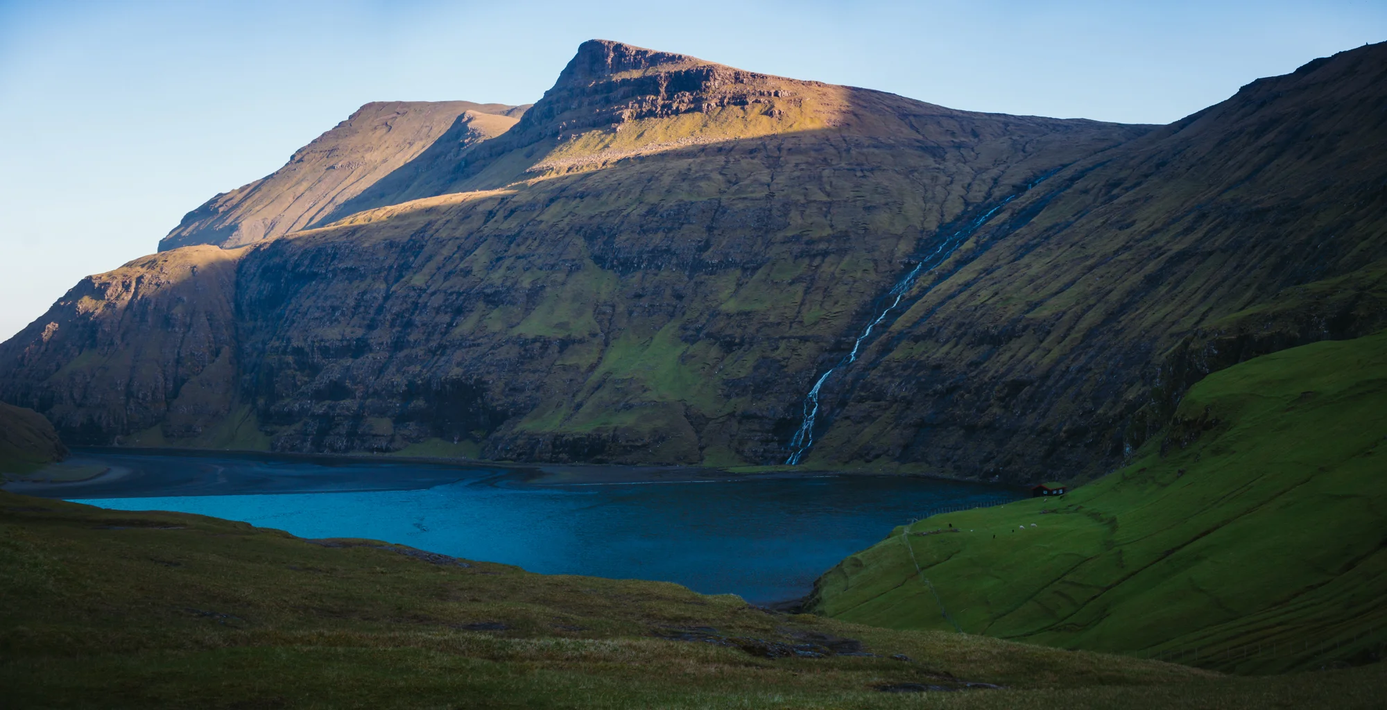
The wind is howling as we approach the small, peat-roof church on the hilltop.  Saksun is located in what was formerly an inlet of the sea, before a powerful winter storm and subsequent landslide in in the late 1600s blocked the path to the ocean and turned the harbor into a sheltered tidal lagoon. Now, the lagoon is only accessible to small boats at high tide, while at low tide, a dark volcanic beach becomes exposed. The mountains form a bowl around the valley, funneling gusts of harsh oceanic air into the village. Jane pulls a scarf over her face as I take some quick pictures of the scene across the valley - the sheep grazing placidly along the grassy hills, the cataract rolling down the face of the opposing mountain, and the brackish water of the lagoon, whipped into little waves. After admiring a pair of horses in front of the nearby farmhouse, we move across the village and descend down a gravel walking track along the southern side of the valley. Following a herd of goats along a pleasantly burbling stream, we reach the lagoon at low tide. Jane proceeds along the cliff path toward the ocean, while I take photos of the lake and the waterfall. Afterward, we return to the car and resume the main highway along the eastern coast of Streymoy.

Passing the road bridge to Eysturoy, we continue north toward the village of Tjørnuvík. In about three miles, just by the roadside, we catch our first glimpse of Fossa (“The Falls”), formed by a river from the mountainous interior of Streymoy. Plunging into the ocean in two tiers over a total of 140 meters, Fossa is technically the highest waterfall in the country - though we were seeing it in a fairly unimpressive, dry condition. We leave the car at a small turnoff and climb down the basalt stone to the base of the lower falls, where I take some photos of Jane from the foot of the stream. Then, turning up the hillside, we clamber up a grassy slope and navigate a thin sheep trail up to the second basalt rim, where we see the multiple veils of the upper falls. As we descend from the cliffside, we’re treated to a a picturesque but vertigo-inducing view of the strait between Streymoy and Eysturoy - the road stretching away beyond the horizon on both coasts.

Back in the car, we return south and cross the water to Eysturoy (“Eastern Island”), stopping at the little gas station on the other side - near the settlement of Norðskáli - for pastries, drinks, and a toilet break. As we breakfast on danishes and sliced cheese in the back seat of the car, we watch a lone female hiker up the road try, unsuccessfully, to flag a ride for several minutes - and so we pull out of the gas station parking lot on a mission. I roll down the windows as we come to stop beside her. “We’re headed to Ei-di. Where are you headed?” I say in perfect American. “Oh! Ei-yeh?” she says, teaching us how to actually pronounce the Faroese glide consonant. “That would be perfect. I’m headed to Slættaratindur.” She hops into the backseat, and we take off up the western coast of the island. Our passenger is a German exchange student, here in the Faroes for a summer semester, studying tourism and hospitality in Tórshavn. She spent her Sunday morning hitchhiking here from the capital, and she plans to continue to the foot of the islands’ tallest mountain, complete the two-hour summit hike, and catch a ride back to the city by nightfall. “I almost slept in. I was thinking, anyways, I have the whole summer,” she tells us. “But when I woke and saw how blue the skies were, I knew it was a perfect chance to climb the mountain.” We entertain her with stories of Baltimore, and of getting nearly trapped in Munich and Düsseldorf, and she laughs at the English voice on our GPS. We leave her where the highway forks above Eiði, with one road descending to the coastal village, and the other road hair-pinning up the mountainside toward the high peaks of northern Eysturoy. Jane and I plan to explore Eiði’s beach and climb to the top of its seaside mount (Eiðiskollur), so Slættaratindur will have to wait. “From up there, you can see me if I’m still walking in a few hours,” says our German friend cheerily as she climbs out of the car. “Hopefully not!” we say as we bid her farewell. She proceeds up the hill, thumb out to the road, as we enter the village.

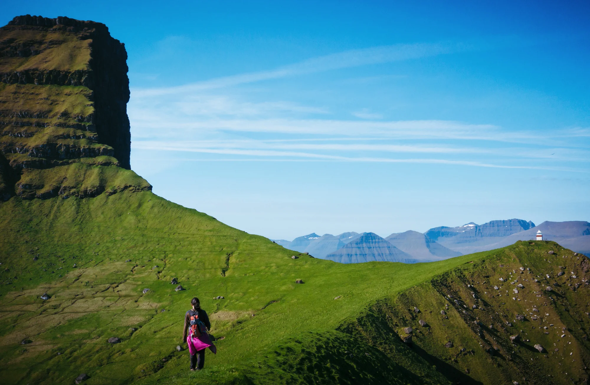
Shimmering like a rainbow under the mid-day sun, Eiði (“Isthmus”) is a seaside town out of a postcard. True to its name, it is located at the northwest corner of Eysturoy, its colorful houses laid into a hillside that overlooks the strait to the south and the Atlantic Ocean to the north. It is sheltered from the open ocean by a small lagoon and cove, while the imposing sea cliff of Eiðiskollur (“Eiði’s Headland”) rises precipitously to the west. To the east, the lake Eiðisvatn is set in the foothills of Eysturoy’s high peaks, and a stream from the lake flows into a hydroelectric dam that powers the village. We drive through the village’s narrow lanes, past the white-steepled church which, as one of the settlement’s oldest extant buildings, dates back to the 17th century. Winding our way past the lagoon at the outskirts of town, we park near the town’s soccer field (doubling as an RV park for weekend vacationers from the capital) and spend time exploring a rocky cove that opens up to Eysturoy’s northern coast. Jane hops on down to the water, while I search in and around the tide pools for interesting compositions. With the pounding of the surf, the cries of the guillemots and gulls circling overhead, and the howl of the wind sweeping down from the mountains, the Faroese shoreline is ever a noisy place.

After replacing my batteries in the car, we drive back to the highest point in town and park at the end of a residential street, where a sheep gate leads us to a walking path northward along the headland. Following a series of stone cairns, we climb the hillside to the top of the cliff, passing through a section of boggy grass and up the spine of the sea mount, using a staircase of dirt steps kicked into the mountainside. I follow closely behind Jane, but the wind gusts drown out all audible conversation. At the top where the slope levels off, we pass under the mast of an old radar tower - a holdover from the days of the Faroes’ military occupation during the Second World War. Near the summit, we stop for a break (and shelter from the wind) in an concrete bunker whose window offers a stunning view toward the tops of Slættaratindur and Gráfelli - the Faroes’ two highest mountains. We try in vain to spot our friend the German hitchhiker, who has hopefully made it to the trailhead beneath the mountain by this point in the early afternoon.

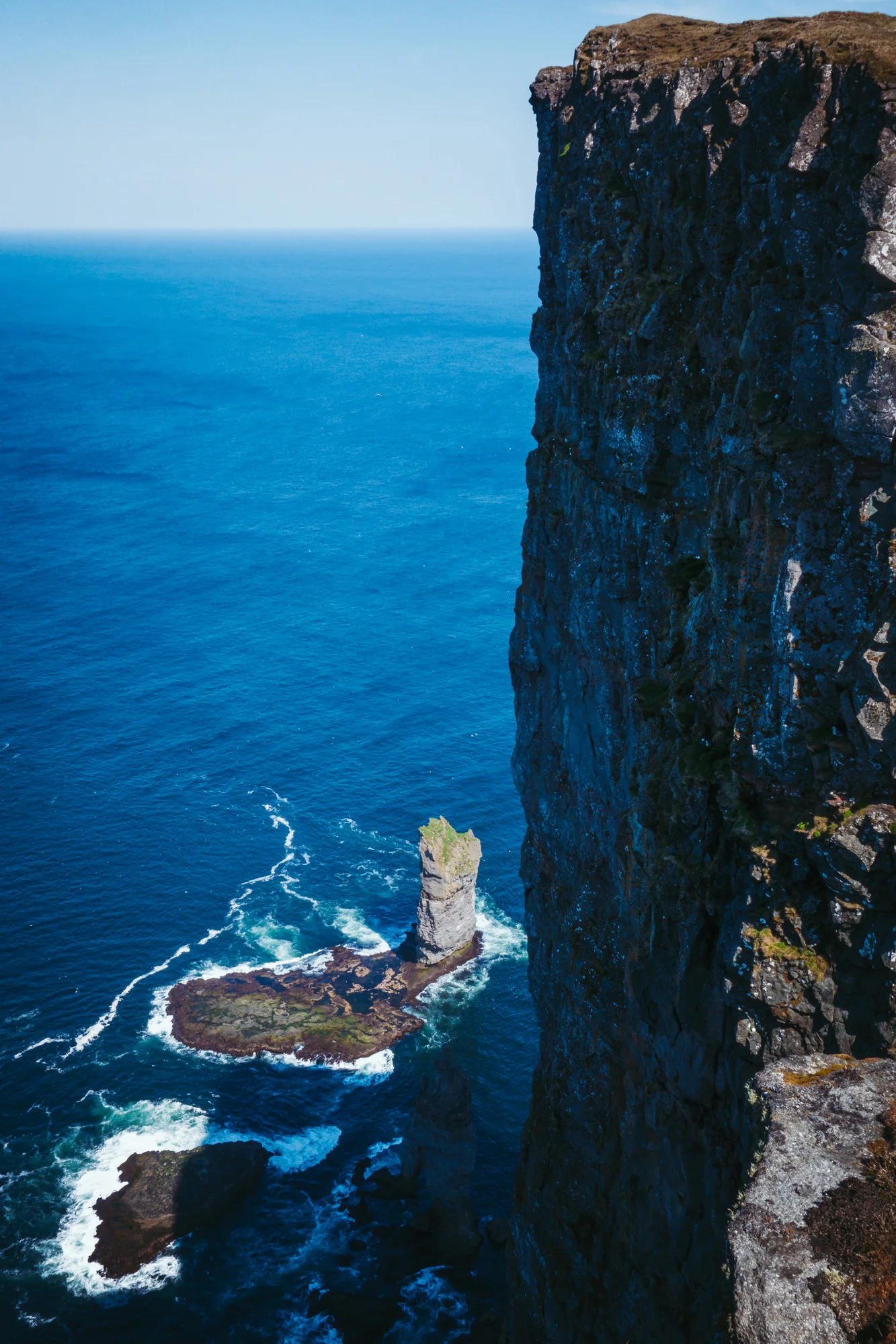
At the end of the trail, our walk dead-ends into a 1000-foot drop into the ocean below. To our west, the village of Tjørnuvík on Streymoy is a mass of colorful dots nestled against the ocean, and the sheer cliffs of Streymoy and Vágar beyond look enormous in comparison. We sit on the grass and crawl as close to the edge of the mountain as we dare. Under us, the guano-peppered rock wall, the seabirds whirling about hundreds of feets below, and the points of sunlight glimmering on the ocean - impossibly fake and far-appearing - make for an incredibly vertiginous experience. Down at the base of the mount, we see the sea stacks of Risin og Kellingin (“The Giant and the Hag”) rising out of the ocean - each several hundred feet tall themselves, but laughably small from our vantage point. According to Faroese mythology, the Giants of Iceland were envious of the Faroes’ beauty, so sent the Giant and his wife to steal the islands and bring them back. One night, the pair of them swam across the North Atlantic, and the Giant waited in the sea off the coast of Eysturoy while his wife climbed Eiðiskollur to begin lashing the mountains together with a heavy rope. However, though they pushed and pulled with all their might, the Giant and his wife could not budge the massive islands, and when the first light of dawn broke upon them, the two turned to stone - the Giant looming imposingly in the water, and his wife, mid-stride, in a vain attempt to leap from the mountain and reunite with her husband before they met their fate. There they have stood for centuries - and will stand until the wind, waves, and winter storms carry them off in the coming centuries. Such are the lovely legends that animate the Faroese landscape.

After we descend the mount (Jane going quickly, and I going much more slowly with a painful right knee after crab-stepping my way along the steep slopes to Drangarnir), we leave town and take the mountain pass that cuts across the island from Eiði to Funningur. Along the way, we stop for photos next to a roadside shepherd’s hut looking over Eiðisvatn, and pass under the shadow of Slættaratindur. Jane falls asleep as we descend from the mountains and proceed along the western shore of Funningsfjørður, past another fishing village of the same name, at the fjord’s head. Proceeding south, we rejoin the highway from Streymoy and continue along another long tendril of water - Skálafjørður, the Faroes’ largest fjord which cuts a gaping swath through Eysturoy’s southern end. Halfway along the fjord, we turn beneath the peak of Støðlafjall and sweep up and down another mountain pass, descending into the municipality of Gøta - named after the legendary heathen Viking chief Tróndur í Gøtu, who hailed from this settlement in the 10th century A.D, and whose opposition to the spread of Christianity through the Faroes made him the villain of the Færeyinga Saga.

Gøta itself is split into a series of settlements that dot the lower eastern coast of Eysturoy - including Gøtugjógv and Syðrugøta, and Norðragøta. We stop at the northern village; our home for the next 5 nights is the ground floor of a wooden house near the edge of Norðragøta, just down the road from its gas station. It is the last stop before highway proceeds to Leirvík and the Faroes’ second undersea tunnel, which connects to the Northern Islands of the archipelago. Norðragøta itself is a pleasant settlement at the foot of a broad valley flanked by mountains on two sides and ocean on another. Like every other Faroese town and village, it has an old wooden church, a football pitch, a museum housing local curiosities and bits of history, and a small co-op and grocery store. It being Sunday, the grocer has limited evening hours for the Sabbath, so after we stop by the house (and find it completely unlocked as is typical, but with no hosts at home to welcome us), we stroll down to the gas station to buy iced coffee drinks, ice cream bars, and pair of freshly baked ciabatta buns topped with ham, cheese, and pepperoni.

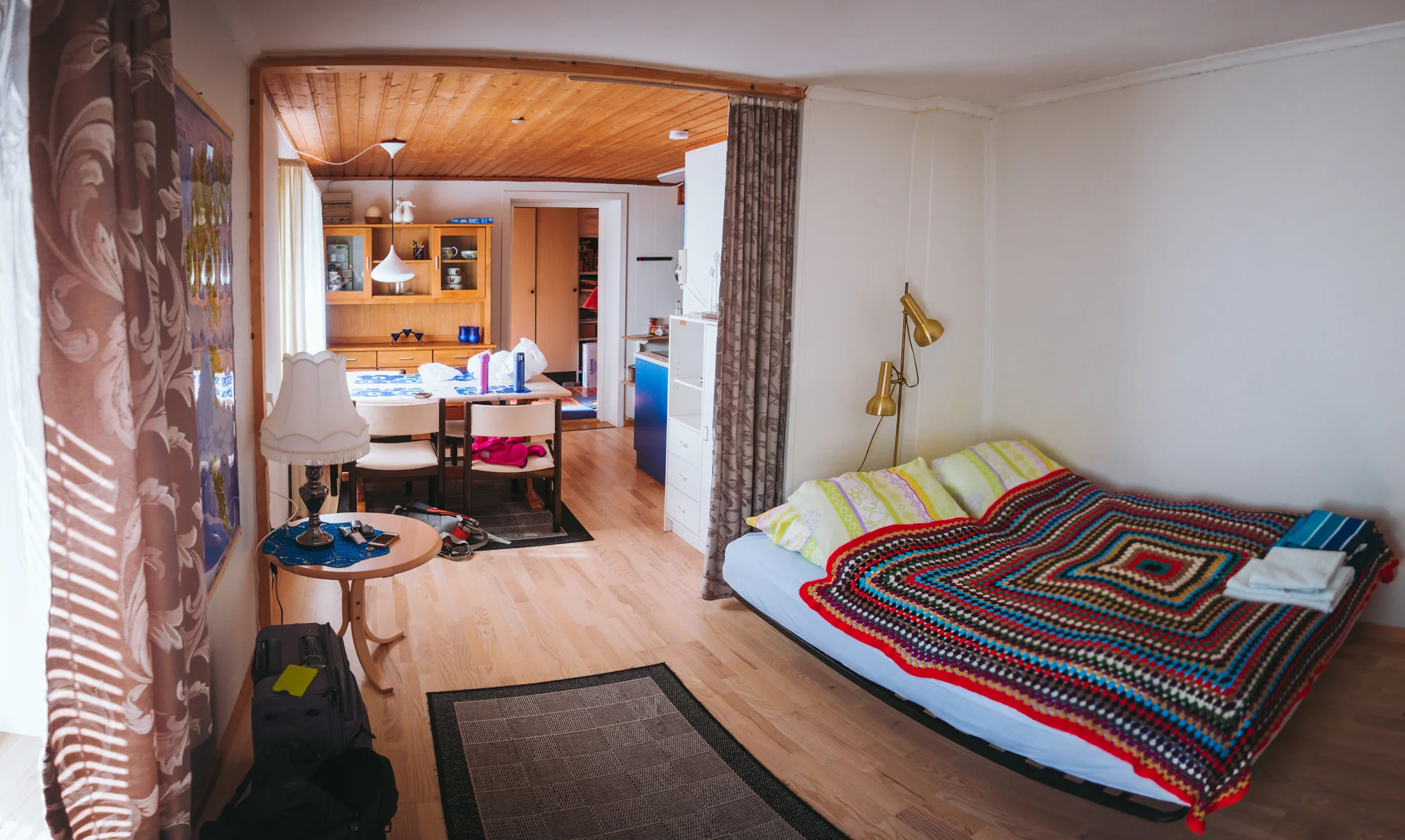
After a short time and a snack in the backseat, we see our host Jón walking down the road in a football jersey, on his way down to the stadium to cheer on the local team in their playoff game in the Faroe Premier League. Jón’s parents, Sunneva and Flóvin, occupy the top floor of the house. Jón apologizes for the wait and shows us into our spacious apartment, which comes equipped with a refrigerator, a full kitchen with induction stovetops, a cozy bed, and broad double-paned windows that look out into the valley, and into his parents’ vegetable garden. After stashing our food in the fridge and charging our electronics, Jane and I settle in for an afternoon nap.

In the early evening, Jane and I stroll down the village lane to the grocery store, where we re-stock our sandwich supplies (a new bottle of remoulade) and buy fish cakes to grill and frozen vegetables to sauté with butter on the stovetop. Fish cake, evidently, is quite popular among the protein-hungry Faroese, and it tastes quite like the Japanese and Korean products that Jane and I are used to tossing in our soups and stir-frys - a little taste of home from far, far away. We assemble and devour a good dinner spread before heading out again for sunset. A few minutes away, we stop on a nearby hilltop just below Støðlafjall, at a dirt road turn-off that leads down into the village and offers beautiful views out to sea, to the eastern edge of Eysturoy, and beyond it to the neighboring island of Borðoy. The outfield here, as in much of the Faroes, is dotted by sheep and glacial erratics, and I have a fun time photographing them while my primary camera runs a timelapse of the view across the road - the pyramidal peak of Ritafjall basked in the golden, red, and mauve shades of sunset radiating through the valley. As the light wanes, we see a trio of Faroese teenagers descending from the ridge of Støðlafjall, their presence announced by what I can only assume is Faroese rap playing on a shoulder-mounted boombox. They nod at us before heading downhill into the village - teenagers like teenagers everywhere, out for a casual stroll up and down a mountain on a Sunday afternoon. Jane and I head back to the house as dusk falls, and go to bed in preparation for another island sunrise.

Day 6 - Eysturoy

We, our culture, and our language - our way of understanding and describing the world around us - are all products of place. We are intimately connected to the landscapes we move through, and the nature we inhabit. So just as the Sami people of northern Finland and Sweden, it is said, have over 20 different ways to describe snow in all its forms, the Faroese language has three different words for fog: mjørki, the dense, marine fog that lies in the valleys like a shroud (sarcastically called “Faroese sunshine” during the war by British sailors, who knew a thing or two about grey weather); skadda, the orographic nimbi that accumulate like cotton candy wrapped around the peaks of mountains; and pollamjørki, the thin ribbons of mist that lace the hillsides even on clear days, beautiful and beloved by islanders and visitors alike.

It is this lovely, latter type of velvet fog that clings to the valley walls when we awaken the next morning and peer out of the broad windows of our ground-floor apartment in Norðragøta. The mist is rolling in like a wave from the ocean to the south, while the first light of dawn begins to appear above the eastern ridge behind the house. After a breakfast of hard-boiled eggs, sliced ham, and orange cream yogurt with muesli, we get in the car and retrace our previous day’s drive along the fjords of Eysturoy. At the north end of Funningsfjørður, at a roadside overlook above the village of Funningur, we greet the sun as it appears over the shapely peaks of Kalsoy - tomorrow’s destination. We drive down into Funningur, where not a soul is stirring, and park beside the turf-roofed church at the water’s edge. Beside the church, a burbling stream flows past clumps of dandelions and flowering cat’s ears, and empties into the sound. Jane explores the village and finds a yard of domesticated ducks and geese, while I shoot a timelapse of sunrise framed by the church, the fjord, and the distant mountains.

An hour later, we return to the highway and take the steep mountain road that runs between Funningur and Gjógv, passing under the shadow of the Faroes’ tallest mountains. After hairpinning our way to the top of the mountain pass, we park at a dirt turnoff above the valley and set off on foot up the rockstrewn slope toward the summit of Middagsfjall (“Midday Peak”). The climb is relentlessly steep, and in between gasps for air, we shield our faces from the blasts of arctic wind reverberating down the mountainside. At the top of the ridge, we are rewarded with a stunning view along the length of Funningsfjørður and out to sea beyond Kalsoy and the other Northern Islands. Far below us, the villages of northern Eysturoy are dwarfed by the surrounding topography, and the fish cages at the mouth of the fjord appear like tiny bubbles on a pond surface. Jane climbs to the top of the rocky ridgeline before we retrace our steps, descending toward our car parked beneath the broad, hulking mass of Slættaratindur and the sleek, arrowhead summit of Gráfelli.

We proceed along the road to the village of Gjógv (“Gorge”), at the northern tip of the island. Above the village, we stop for photos; Jane takes pictures of me standing on the grassy hummock beside the road, while I frame some shots of the village outfield - a curling stream cutting through neatly sectioned sheep pastures, which are dotted with glacial debris. Continuing on, we park beside the large guesthouse on the outskirts of the village, and walk down along the village lane. We pass a house with a yard festooned with all manners of decorations: Greco-Roman sculptures, a garden gnome, a standing flamingo. A decorative beehive and a cluster of birdhouses. We pass by an elderly Faroese gentleman, wearing a tweed cap and a knit wool sweater, who is painting his picket fence one fence-post at a time; his wife waves good morning to us from the front porch. Weaving in and out of alleyways between the brightly colored houses, we follow the stream as it runs through the village to a rocky boat launch at the shore. Descending a long flight of steps, we come to the massive cleft in the hillside that gives the village its name. Here, water drips down the moss-covered rocks in little rivulets, and even on this calm, sunny morning, water is sloshing around in the gorge as if it were an agitated bathtub. As protected as it is from the open ocean, one imagines it must be terrifying to land at this dock in rough weather. Indeed, the graveyard behind the village church has a memorial by the famed Faroese sculptor Janus Kamban, of a woman and two children looking out to sea; its inscription bears the names of over forty sailors - nearly every able-bodied man in the village - who died in a single horrific night during a winter storm in the early 1900s.

After exploring the gorge, we walk back up the hill to our car, and drive back southward along Funningsfjørður. We stop briefly at the head of the fjord (at the docks of the village which bears its name) to photograph a roadside waterfall beneath the mountain Múlatindur. The towering peak makes quite an impression, but unfortunately the falls are quite dry and difficult to compose with, given the proximity of the road, with its street lamps and powerlines. We resolve to return here later, to photograph the boathouses at the head of the fjord in the evening light. Returning to the south, we stop to pump gas at the Effo petrol station in Skálabotn before returning home to make our lunch sandwiches and take a long afternoon nap.

In the evening, we drive back to Funningsfjørður at park at the large gravel turnoff near the boat docks. I set up an abortive timelapse of the waterfall (cut short by the shadow rising up the mountainside as the sun sets beneath the west side of the fjord) but eventually settle on a timelapse of the clouds moving in over the boats in the fjord. Jane, for her part, mostly sits in the passenger seat of the car, playing games on her phone. We end the day with the same beautiful wisps of oceanic mist that started it. As the light disappears, the mist develops into shades of lavender and azure blue as it rolls down the mountainside, settling like a blanket over the valley as it drifts toward sleep for the night.

Day 7 - The Northern Islands

To the east of Eysturoy are a cluster of six islands, arranged like parallel fingers running north-south amidst saltwater fjords. Their narrow landmass is lined by steep and magnificent ridges, while the villages sit in the bowls and troughs between mountain peaks, or in the rare coves and harbors that lie sheltered from the swell of the open Atlantic. These islands, the farthest from the capital and the most northeastern of the archipelago, are what the Faroese call the Northern Islands (Norðoy) - and even in this strange land, they seem to be a world unto themselves. Gone are the idyllic pastures and limnic valleys of Vágar, the rolling hillsides of Streymoy, or the broad highlands of Eysturoy. On these narrow isles, the topography is profound, and excepting the major port town of Klaksvík, the human settlements are small and seem to all but cling to steep cliff faces above the sea, on which their livelihoods utterly depend.

The Northern Islands are not as isolated as they were in olden times, when they could only be reached after a long journey by boat, or a series of overland and inter-island ferries from the capital. The highway now tunnels beneath the sound between Eysturoy and the neighboring island of Borðoy, such that we can leave our apartment in Norðragøta and be in Klaksvík within fifteen minutes; the Faroes’ two largest cities are just over an hour and a half apart by car. Jane and I sleep in until 7 AM (missing sunrise by three whole hours) so that we can spend the day away from home, exploring the two islands of Borðoy and Kalsoy.

After a short drive through the town of Leirvík, with its car dealership, pizza parlour, and bowling alley, we enter a 4-mile undersea tunnel, lined by a colorful light display, that delivers us to the hillside above Klaksvík. Klaksvík is the major population hub of the Northern Islands, and a center for fishing and commerce second only to the capital. It is situated in concentric rings overlooking a broad, semicircular bay on the north side of Borðoy: the port district in the middle, followed by downtown shops, markets, banks, and football stadium, which are then surrounded by apartment buildings and residential suburbs on the hillside terraces. These are all flanked by refineries, quarries, and packing houses on the city’s outskirts. Facing north from anywhere in Klaksvík, the seaward view is dominated by the mountain ridges of Kalsoy to the northwest, which bisects the sound and obscures all view of Eysturoy, and the mammoth peak of Suður á Nakki, which looms over the city as if it were a smouldering volcano on an tropical island in the Pacific Rim. We drive to the docks, where we are first in line for the morning ferry run to Kalsoy. At promptly 8:30 AM, the mail boat Sam takes us onboard along with half a dozen other cars, and we hang around the deck for the breezy, 15-minute ride across the water.

On the other side, we disembark at Syðradalur (“Southern Dale”), a tiny cluster of houses at the southeastern tip of Kalsoy. From here, a single-lane asphalt road winds along the eastern coast of Kalsoy, passing through four mountain tunnels and connecting the island’s four small settlements. The skies are brilliantly blue and warm, and our passage north is accompanied by a flock of arctic terns riding the ocean breeze, their distinct snow-white plumage and deep forked tails glimmering under the mid-morning sun. At the north end of the island, after the long mountain tunnel beneath the bowels of Nestindar, we reach a bowl-shaped valley overlooking craggy sea cliffs, on top of which the village of Trøllanes clings with its cluster of houses, two small farms, a smithy, a derelict church and one-room schoolhouse. The village, for all its remoteness, is one of the oldest continuously inhabited places in the Faroes - the farms are listed are far back as the 1500s in the islands’ landholding records, and the settlement itself probably dates back centuries farther. Its name (“Troll Peninsula”) derives from olden legends, which state that the valley was once haunted by trolls from the surrounding mountains, who would regularly descend into the village and terrorize the locals. One such night, the elderwoman of the village, being infirm and unable to flee, hid beneath her living room table as pandemonium unfolded around her. She prayed aloud for Christ the Savior to protect her, upon which the monsters abruptly dispersed and returned into the hills, never to be seen again.

We park our car beside the small schoolhouse and trudge north, past a sheep gate and up a muddy embankment, onto a peninsula of steep green slopes - the land of the trolls. The rolling hillsides take us toward the lighthouse on the headland of Kallur, at the northern tip of Kalsoy. The walking path, which essentially follows sheep tracks, takes us past old stone foundations where shielings or shepherd's huts once stood, overlooking the ocean and the outlying islands looming like massive ships in the distance. On the way, we pass flocks of sheep sunning lazily in the dung-spotted grass, and the odd glacial erratic, much too large and too far downslope to have been cast down from the towering cliffs above us. At the end of the peninsula, we climb one last series of dirt steps up to the small beacon, which stands atop a triangular ridge that drops away to the sea in three directions. Beyond the lighthouse, Jane and I navigate a narrow dirt ridge that descends then climbs to the very tip of the island - again, not for the faint of heart. Here at the edge of land, we can see for miles around us - to the Northern Islands, to Eysturoy and the familiar figures of Risin and Kellingin, and to the north shore of Streymoy far beyond. After we pose for photos, I take pictures of Jane as she scrambles back to the lighthouse, her figure dwarfed by the precipitous seaward slopes and the titanic mountain face of Borgarin, which lords over the landscape.

After a short rest on the shoulder of the headland, we make the hour-long walk back to Trøllanes. We visit the schoolhouse turned community center for a bathroom break, then stroll into the village, following posted signs to the “Kiosk at the End of the World” - a little trailer shed selling snacks, drinks, frozen treats, and locally cured and dried lamb and lamb sausages. Upon our arrival, a woman from the house next door, busy gardening in only a bra and a pair of blue jeans, puts on a shirt and comes to tend to the cash register. “Hello!” she says cheerfully. “Beautiful weather today!” We say good morning and each pick out an ice cream bar from the freezer. Treats in hand, we sit at the top of the cliffs, above a series of stone steps leading down to a rocky landing, and watch as the surf pounds on the concrete below.

Back in the car, we return through the mountain tunnel, to the next valley to the south and the village of Mikladalur (“Great Dale”), the largest of Kalsoy’s four settlements. Before the road tunnel linked the two villages in the 1980s, a traveler between Trøllanes and Mikladalur would have to make the dangerous traverse over Nestindar - the island’s highest peak. The mountain trail would be all but impassable in the winter, and any inclement weather would roil the strait, making travel by boat a life-threatening affair at either of the villages’ cliffside landings. Such as it was, these neighboring villages spent centuries separated from one another through vast stretches of the year, their inhabitants eking out a lonely subsistence from the temperamental sea and the small pockets of arable land beneath the mountains. Today, a public bus runs up and down the length of the island several times a day, delivering commuters who ride the ferry to and from work in Klaksvík. Life has changed significantly here in the outer reaches of the Faroes - for the better, I suspect most of the Faroese would say.

Mikladalur, too, is surrounded by several farms with outfields stretching to the foot of the mountains, including a small pine plantation (the first trees we have seen during the entire trip), which we drive past as we come down the hill into the valley. We park at a small turnoff just above the village and walk down among the turf-roofed houses, along narrow gravel lanes. We pass by several hjallur - ventilated wooden shacks, which function both for storing tools and for wind-curing lamb and mutton (skerpikjøt). Their door handles are fashioned from rams’ horns - an intriguing ornamental touch. Where the village houses meet the open ocean, a stream cascades over the edge of the cliff and into the ocean below. Beside the waterfall, we descend a series of stairs that lead to Mikladalur’s boat landing, little more than a battered basalt terrace exposed at low tide. There, on a prominent rock beside the sea, stands a bronze statue of the Kópakonan (“Seal Woman”), patina-stained after years of inundation by salt water. Many seagoing northern cultures, especially those of Scandinavia and the Atlantic isles, have tales about the sealfolk, mythological creatures capable of transforming from seal form into human form, said to be inhabited by the souls of drowned mariners. Perhaps it was the grey seal’s mournful, all-too-human bellowing at the water’s edge, or its long, silvery, hair-like fur, that was the inspiration for this shared body of folklore, which spans Scotland’s sylkies, Ireland’s merrows, Iceland’s marmennlar, and most famous of all, Denmark’s Little Mermaid. The Kópakonan is the Faroes’ analogue, and subject of one of the islands’ best known legends, which goes something like this:

In olden times, it was believed that seals were formerly humans who had died at sea - or perhaps voluntarily sought death in the vastness of the North Atlantic. Once a year, on the Twelfth Night, they were allowed to shed their sealskins and become human for a night, enabling them to leave the confines of the ocean, to frolic on land with reckless abandon. One year, a young farmer from the village of Mikladalur went down to the cliffside to watch the seals as they came ashore and danced on the rocks. There, he saw a beautiful woman with flowing dark hair, dancing with the other sealfolk beside the ocean. In an instant, he fell madly in love with this her, and knew that he must have her as his bride. Under cover of darkness, he crept down the rocks and stole her sealskin, hiding it away. At the end of the night, as sunrise began to light the rocky cliffs of Kalsoy, the other seals donned their skins and returned to the sea - but the woman could not find her skin, and thus could not complete the transformation. With no choice or recourse, she entered the village of Mikladalur, and was taken in by the young farmer, who she eventually married. They lived together for years and years, and had several children together. But no matter how much time passed, she would always find her thoughts returning to the sea - to memories of her native home, and to longing for her friends and family who dwelled in the watery depths.

All this time, the farmer kept the sealskin hidden in a chest beside the hearth, locked by a key that he kept on his person at all times. One day, the call for grindadráp (whale hunt) was raised off-shore, and a great commotion erupted in the village as every able-bodied man took to the boats to join the pursuit. In his haste, the farmer left the key at home. Realizing his mistake, he rowed with all his might back toward shore, sprinted up the stone steps to the village, and hurried back to his dwelling - but it was too late. The sealskin was gone, along with his wife. The rest of the house was nicely tidied, the children safely tucked in bed, and the hearthfire put out.

Some time later, the men of Mikladalur planned to make an expedition into one of the deep sea caverns along the island’s coast, to hunt the seals that lived there. The night before the hunt, the Kópakonan appeared before the young farmer in a dream, and pleaded with him not to kill the great bull seal residing in the depths of the cave, nor the two seal pups accompanying him, for those were her true husband and children. In a fit of selfishness, and with no love lost for his former wife, the farmer did not heed her message. He joined the other men the next morning, and they killed every seal that they could find in the cave. Upon returning home from a successful hunt, the men divided the spoils; the bull seal, and the flippers of the two young pups, went to the farmer himself. Later that evening, as the head of the large seal and the limbs of the small ones were stewing over the fire, there was a crash as the seal woman burst through the threshold in the form of a monstrous creature. Seeing her own flesh and blood stewing in the pot, she screamed out: “Here is  the head of my husband with his broad nostrils, the hand of Hárek, and the foot of Fredrik! Now there shall be revenge, revenge on the men of Mikladalur! Some will perish at sea, and others plummet from the mountaintops; and so many shall die that the dead shall link hands to encircle the shores of Kalsoy!”

After she pronounced this curse, she vanished with a peal of thunder and was never seen again. But ever since that day, and even to this day, they say that men from the village of Mikladalur have met unusual fates at sea, their boats capsized by rogue waves or sudden squalls that emerge even out of calm blue skies. And likewise, the village shepherds, even climbing under clear weather, have suffered terrible and mysterious falls from the high peaks as they tried to gather their flock. So it is that the vengeful spirit of the Kópakonan continues to haunt Mikladalur to the present day - her statue at the water’s edge a somber reminder to every villager: not yet enough have died to encircle the long isle of Kalsoy.

It’s the noon hour when we return to the car. We sit in the back seat, enjoying our packed lunches (homemade sandwiches, fruit, and milk boxes) and watching the powerful northern winds ripple across the turf roofs of the village houses. Afterward, we drive back to the ferry landing at Syðradalur and take a short nap while awaiting our ride back to Borðoy. We return to Klaksvík in the mid-afternoon. Leaving the car in a parking lot by the docks, we walk around the city center, finding mostly shops for pricey wool products and tourist memorabilia. For an early dinner, we stop in at the Café Fríða, a hip little establishment with a patio overlooking the water, where we order an iced green tea and a platter of “Faroese tapas” - including a variety of delectable seafood snacks and local lamb. The fish salad with trout roe (below) is my personal favorite; the sandwiches of sliced fish and small shrimps, ordered by other patrons, also look delicious.

After our meal, we climb back in the car and drive to the outskirts of town. Ascending the slopes that form the western rim above Klaksvík, we turn up the long gravel drive nicknamed Ástarbreytin (“Lovers’ Lane”), a steep road that leads toward the peak of Klakkur - evidently a popular place for romantic sunsets and first dates. Our tiny Kia struggles as it climbs the rocky, uneven gradient, but we soon make it to a dirt lot beside the flat alpine meadow and pond of Hálsur. With our heavy jackets on, we pass through the sheep gate and make the short, 1-mile climb to the summit. At the top of Klakkur, we are treated to a full panorama of the islands below - Eysturoy beyond the mountains to our west, Kalsoy and Kunoy to the northwest and northeast, and the bulk of Borðoy to our east. The winds at the summit are sharp and powerful. Banks of marine fog and mist go hurtling by, briefly obscuring all view of the terrifying and dizzying heights below us. Jane helps me set up a timelapse of the clouds encircling Suður á Nakki like a crown, using the strait as a leading line into the horizon. After a half hour atop the mountain, wind-blasted and chilled to the bone, we make our descent back to the car, with the summits of Halgafelli and Háfjall rising before us to the south. The sun is beginning its gradual downward arc as we drive down the mountain, and the mountains cast a growing shadow over the port town. We return to Eysturoy through the undersea tunnel, and spend the evening relaxing and preparing for our last day of travel in the Faroes.