Day 4: Northern Flow

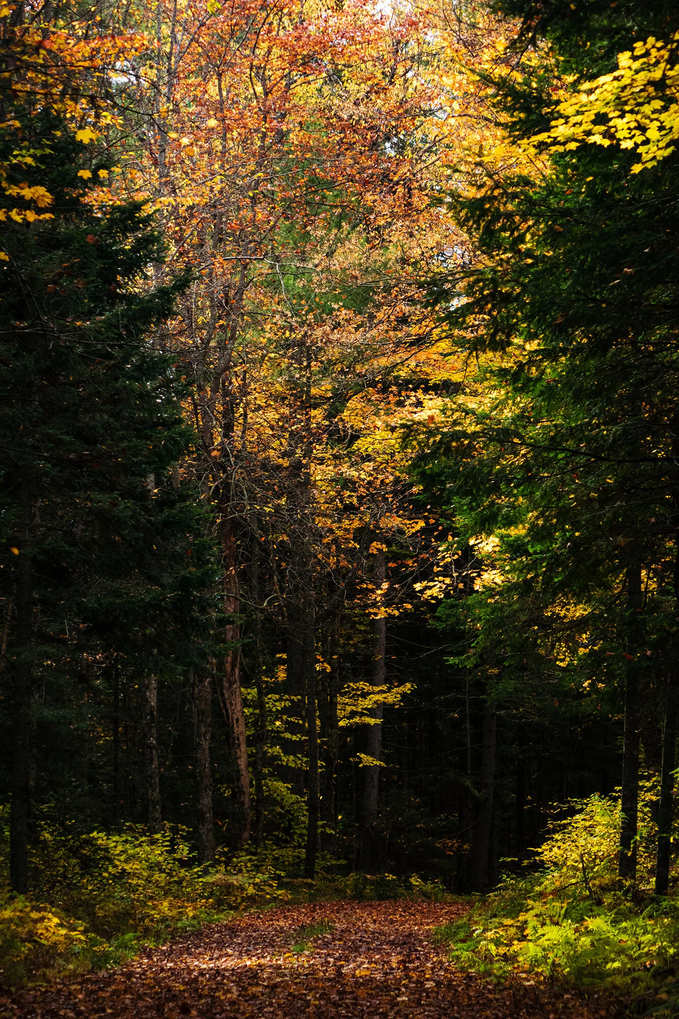
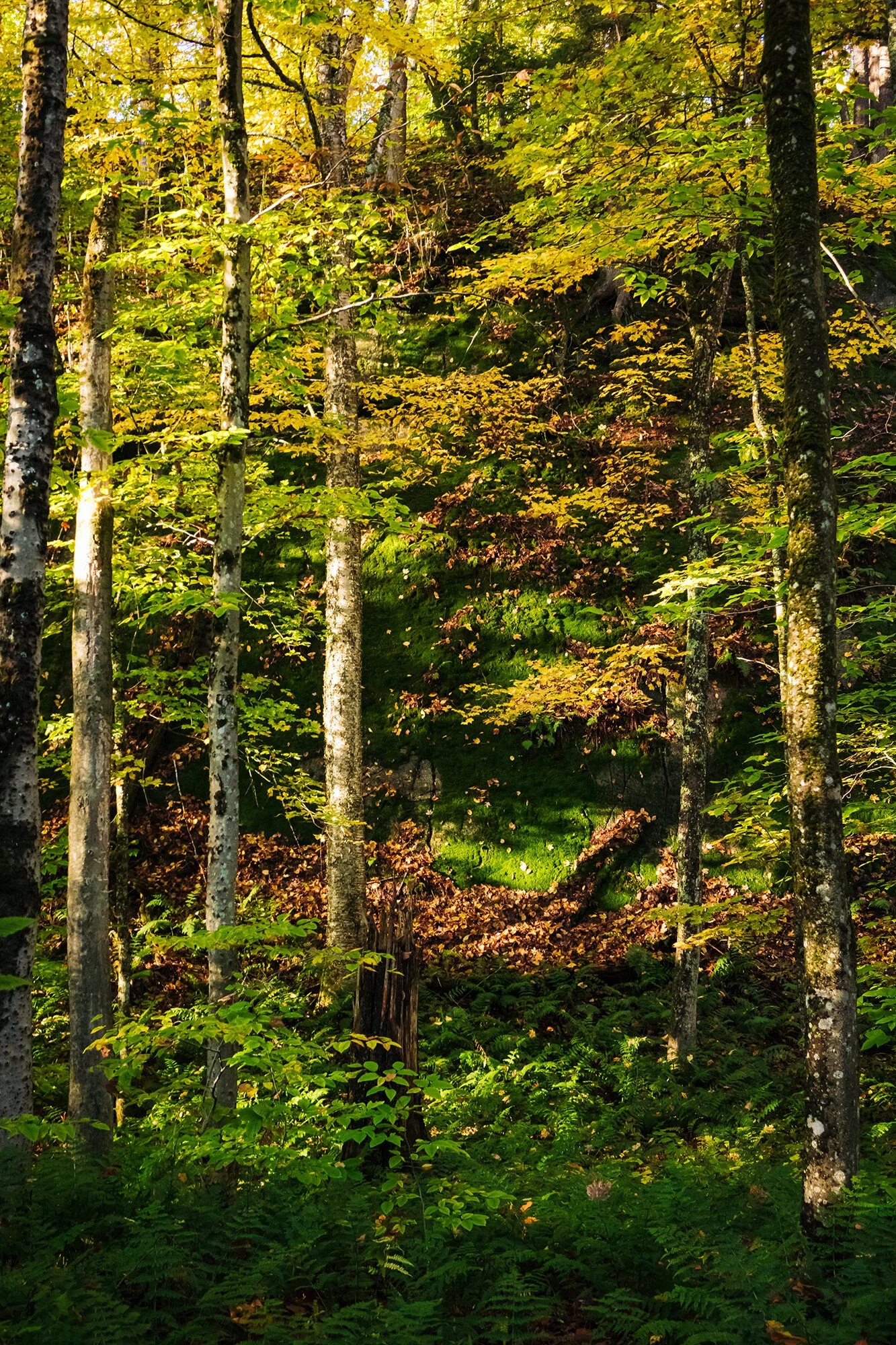
The next morning, we drive west out of Lake Placid, passing through the sleepy Main Street of Saranac Lake before turning north. To the east, beyond green pastures and miles of rolling forests, the sun is cresting the summits of the McKenzie Mountain Wilderness. We mark a turnoff along the highway for tomorrow’s sunrise, before continuing to Church Pond, a quiet lake just outside the hamlet of Paul Smiths. We leave our car on a narrow dirt road, beside the little church house for which the pond is named. The morning air is calm but cold - the dense sort of cold that settles around you and chills you to your bone. Jane and I wander to the water’s edge, where I set my camera up to photograph first light on the opposite shore. Here, working with a palette of rainbow foliage and mist-cloaked water, I am in my comfort zone. I fire off a short timelapse series with the RX-100 while using my longer lens to highlight the birches and maples, which in the morning light stand out nicely from the soft background of firs and black spruce.

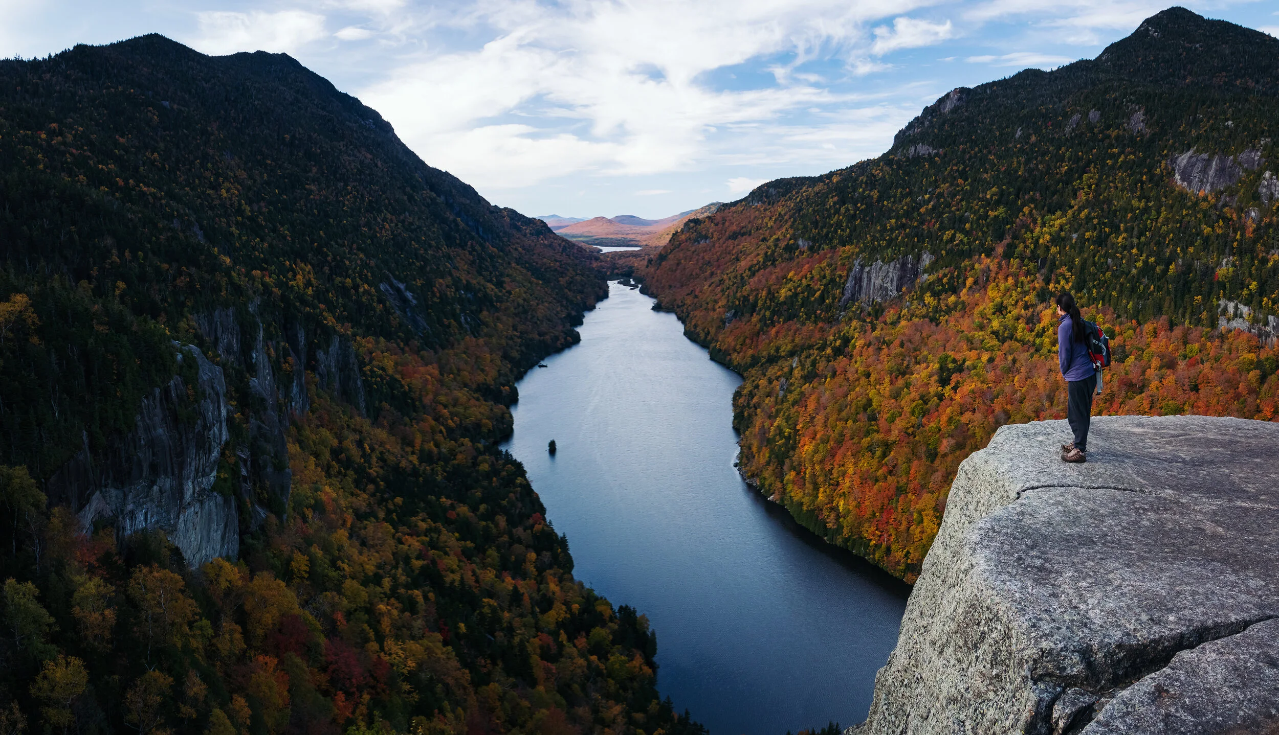
After half an hour at Church Pond, we drive a few miles west of the village, to the trailhead of our main walk for the day - a 7-mile round trip to the summit of St. Regis Mountain. The walk begins as a pleasant, undulating stroll through the woodlands surrounding the St. Regis Canoe Area. The forest, all aglow with golden aspen leaves, is quite lovely in the morning light, and we pass our time on the trail mostly in peaceful silence (it is a Tuesday morning in October, and we see only one hiker with his golden retriever on our way up the mountain). Past the two-mile mark, after treading through the forest, across boardwalks and footbridges, and up and down leaf-littered slopes, we reach the main ascent, a series of rockfalls turned into waterfalls by the previous day’s rain. Feeling grateful for my new boots, I lead carefully up the stone steps, avoiding puddles and deeper portions of the rivulet. The going is hard, but we’re drawn upward by the thinning canopy - the beckon and call of the soaring, beautiful blue sky. At the top of the climb, a short scramble over boulders breaks us free of the treeline, and we find ourselves standing on the rocky summit of St. Regis Mountain, with a breathtaking panorama before us.

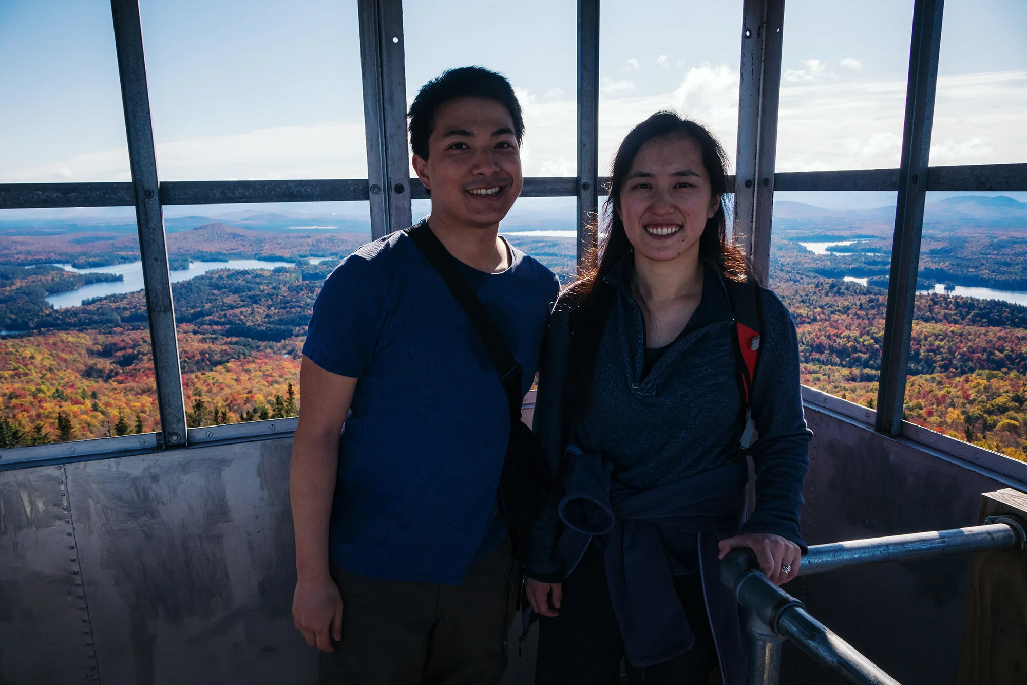
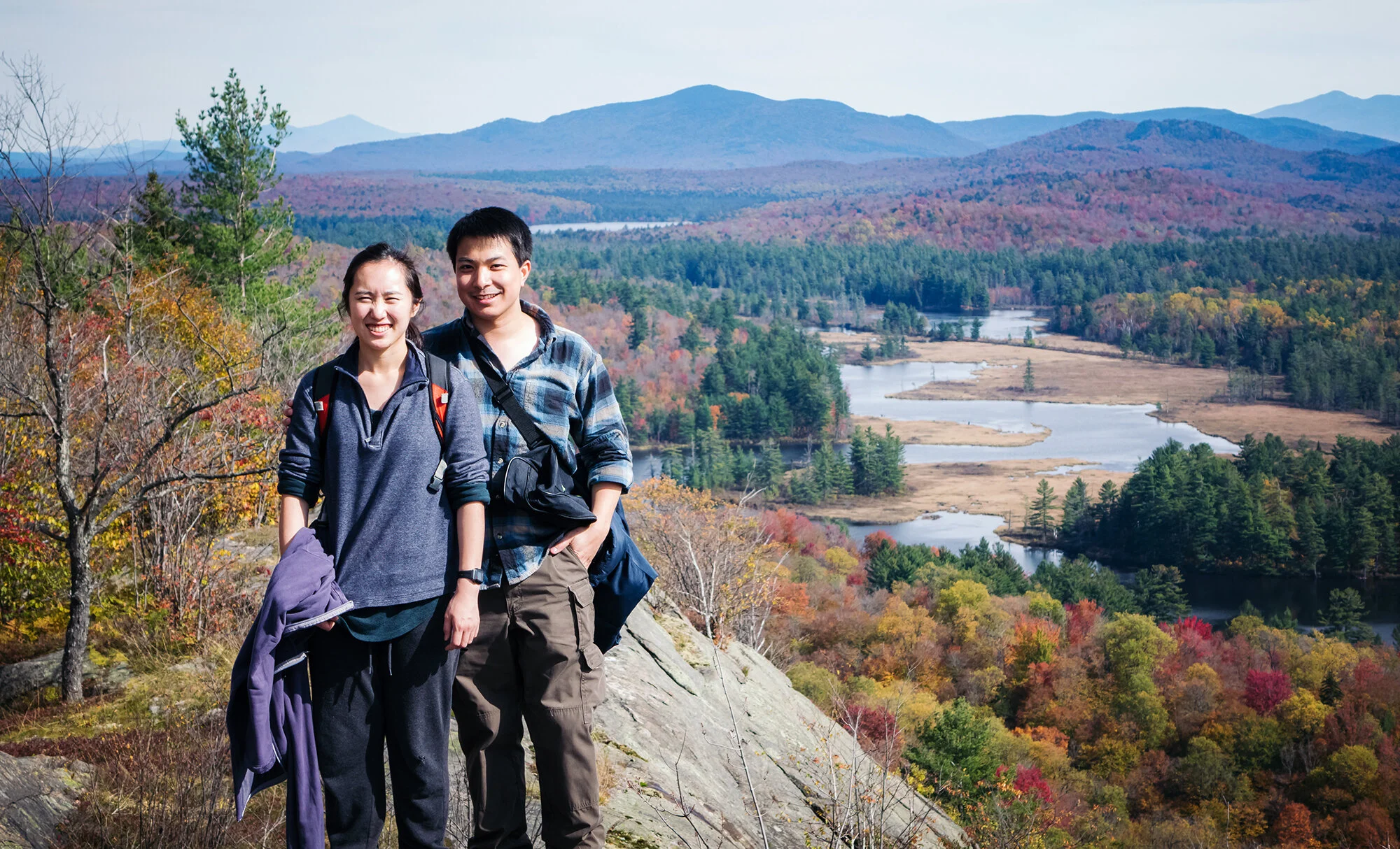
Climbing over the granite, Jane and I ascend the steel steps of the fire tower. From the top, we have unobstructed views for miles in every direction. To the east, across a sea of foliage, are the St. Regis Lakes and the McKenzie Mountain Wilderness. To the south and southeast, the ponds of the Floodwood and Saranac are shining under the midday sun, like a string of pearls on an emerald necklace. Behind them rise the High Peaks, a towering mass of earth in the far blue distance. To the west and north, clear past the Canadian border, lie ponds and woodlands as far as the eye can see, the fiery colors of deciduous autumn transitioning gradually into a dark and endless boreal forest. Alone at the summit, Jane and I take in these marvelous vistas before descending from the tower. I shoot a mix of panoramas and far landscapes while Jane relaxes below. After awhile, we are joined by another hiker and her dog, who seems completely unfazed by the 3-mile climb and runs circles around us, lapping up our attention. We leave them at the summit and begin our long descent and walk back toward the trailhead.

After a seemingly interminable walk back through the forest, we reach our car and backtrack past Paul Smith’s College and Church Pond. In Saranac, we trudge into the McDonald’s with our sweat-laced brows, disheveled gear, and muddy boots. I order a mango smoothie and a 20-piece box of chicken nuggets, and Jane gets a double quarter-pounder with fries. We eat like pair of vengeful ghosts. A short drive and half an hour later, we are back at our basement apartment in Lake Placid, showered and relaxed. Jane takes a long afternoon nap, while I recharge my batteries and flip through television channels by the fireplace.

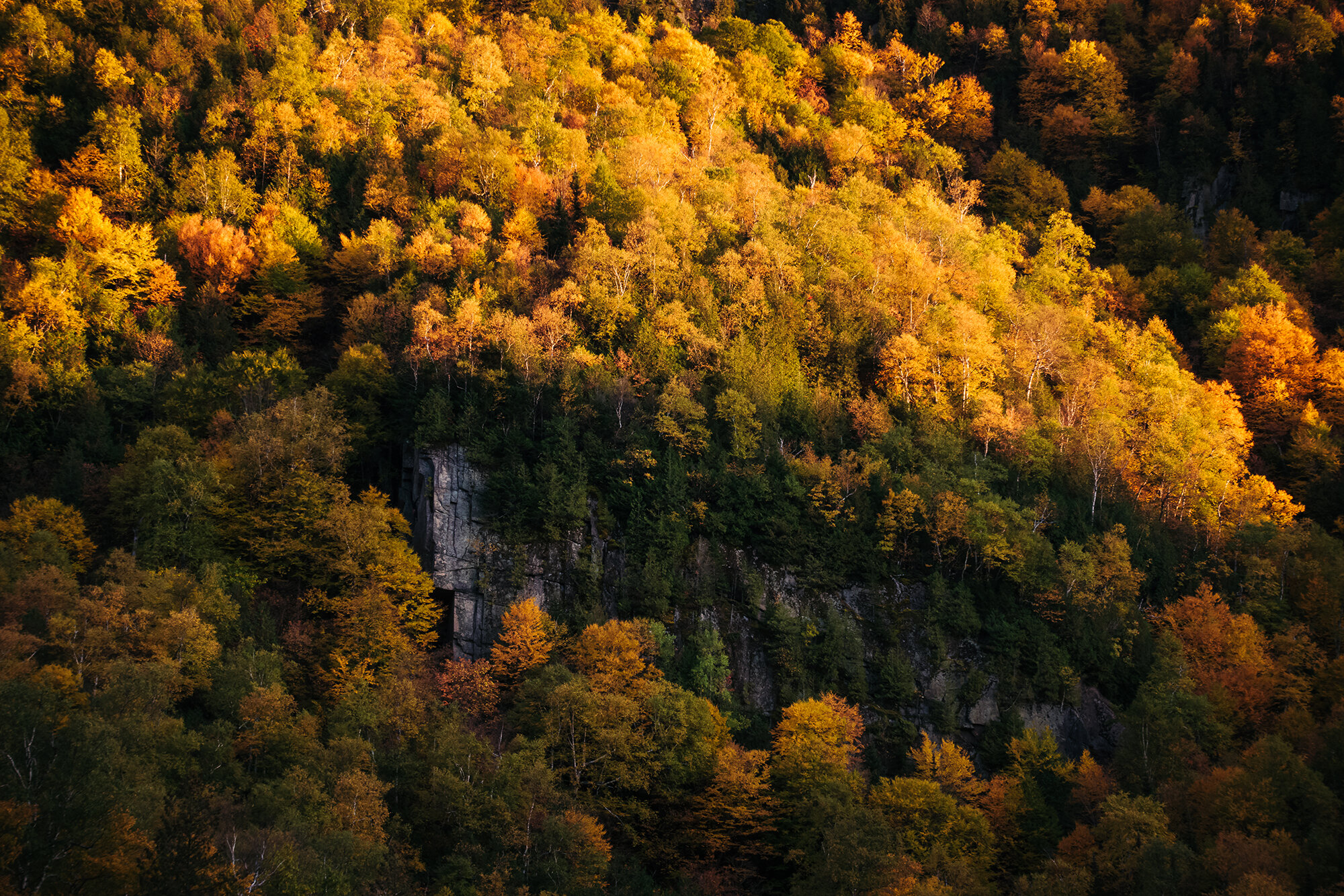
In the late afternoon, we re-lace our boots and set off to capture the golden hour just a few miles outside of town, at the Cascade Lakes. Pulling into the small dirt lot between the lakes, I can tell that we are in for truly special conditions. To our southwest across Upper Cascade Lake, the light of the setting sun is beginning to fall, obliquely, on the shoulder of Cascade Mountain, bathing the treetops in a warm, golden glow. The air is tranquil, and the lake surface forms a perfect mirror, transformed into an amphitheatre of light and color. After capturing a quick panorama and setting up a half-hour timelapse of the fading light, I use the reach on my new camera to isolate the most compelling portions of the landscape: an exposed rock face on the nearby ridge, half-caught in shadow; intriguing sections of shoreline, reflected in the water; and individual or stands of trees, perfectly catching the sunset’s dream light. In the next minute, I take my favorite photograph of the entire trip - a simple portrait composition of birch trees standing at the water’s edge.

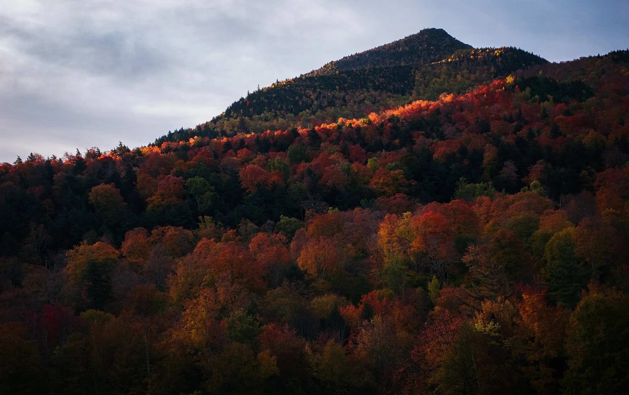
As the light wanes, we pack up our gear and head back toward Placid. Along the way, we stop on the corner of Adirondack Loj Road, beside the so-called Plains of Abraham, a rolling expanse of fields originally settled by hardscrabble New England farmers in the early 19th century. Beyond the fields, twilight is falling on the High Peaks, and the sky moves through shades of vermilion and burgundy. I fire off another timelapse while we admire this scene - the silence broken only by the rush of the passing cars, their headlights fading down a country road.

Day 5: Western Flow

The next day, we’re off again before sunrise, driving in the dark through the quiet outskirts of Saranac Lake, past motels and winter sporting stores and outdoor barbecue joints. Mist is rolling off the surface of Lake Flower as we enter the village proper, again turning north toward the settlement of Harrietstown. We stop the car at the spot we identified the day before - a dirt turnoff just over half a mile north of the junction with Route 186, where the highway rises onto a broad ridge, with unobstructed views to the east across miles of farmland and woodland. Behind the mountain range in the far distance, the sun is beginning to rise, and the banks of high cirrus clouds seem to all but catch fire. I set a longer timelapse here with the RX-100 while Jane eats breakfast in the car; with the RX-10, I experiment with light leak using the warm, golden rays of the early morning sun. Halfway through my first full trip with the new camera, I’m finding the 200mm reach of its lens to be creatively liberating, if not outright exhilarating, as it enables me to fill the camera sensor with smaller, more intimate sections of the landscape, emphasizing the depth and distance between the receding layers of trees, hills, and mountains.

Back on the road, we make a U-turn and return to Route 186, which we follow to the west past the local airport, along the shores of Lake Clear, and then through the spruce and pine forest of the Floodwood region. We will be returning to explore this area by boat in two days; for now, we follow the road as it threads its way between the lakes, passing over bridges shrouded in morning mist. Further south, after leaving Upper Saranac Lake, we rejoin the thoroughfare between Saranac and Tupper Lake, following that road west as it passes over the Raquette River. At Tupper Lake, we find a grungier, industrial version of the Adirondack village, a old lumber mill-town and railyard settlement, abandoned by the current century, unadorned by the ski chalets and cafés of Lake Placid, or the museums and boathouses of Saranac. In the silence of the early morning, with a thick fog rolling in off the nearby lake, the deserted village looks eerie, almost supernaturally so. We hurry out of town, past dollar stores, hardware stores, and empty gas stations.

To the northwest, over Piercefield Flow, we turn onto Conifer Road, a small back-road cutting westward toward the Cranberry Lake and Five Ponds Wilderness, in the northwest corner of the Adirondack Park. After a short drive, we reach the parking area for Mt. Arab, a fire tower peak overlooking the Tupper Lake region. Like the day before, the mid-week trailhead is all but abandoned, except for a family of local hikers with the family dog. We set off up the mountain shortly behind them, enjoying the brief, brisk climb through the trees, aided in places by wooden steps and stone staircases. Jane picks up a pair of sturdy oak branches from the forest floor and re-purposes them as walking sticks. About a mile in, the trail levels out and branches into several divergent paths as it reaches the rocky shoulder just beneath the summit. We circle to the right (southward), reaching a wooden bench with lovely, open views toward Mt. Arab Lake and Eagle Crag Lake, which remain shrouded by a blanket of morning mist. At the summit, we join the hiking family on top of the fire tower, while their retriever waits anxiously at ground level and whimpers. From the top, we’re greeting by a staggering panorama of the northwest Adirondacks: rolling hills, forests, lakes, and mountains as far as the eye can see, interrupted only by the billows of fog rising from Tupper Lake and the many surrounding ponds. As we watch over minutes, this cover is lifted by the warmth of the morning sun, and the turquoise-blue surface of Mt. Arab Lake reveals itself beneath the mist. Our friends in the fire tower point toward Eagle Crag Lake, where they own a lakefront cabin, and reminisce about long summer nights spent drinking and watching Independence Day fireworks from the water’s edge.

Climbing down from the tower, we spend some time exploring the summit, basking in the views and the clear, calm morning air. After taking my panoramas and landscape shots, I try to craft close composition with the bright-red berries of a nearby ash tree and the dark-violet elderberries growing beneath them, but give up after a few minutes. We descend the mountain to the car, and retrace our route back to the Tupper Lake. In town, I stop for gas while Jane goes inside the station to buy a cup of coffee. We head south now, following the eastern shore of Tupper Lake. We break into the bag of snacks we purchased at the Lake Placid Hannaford the day before - cheese sticks, bread rolls, and a bag of dried fruit and trail mix (Jane feeds me while I drive and try to guess the fruit). Along the way, we stop for photos on the road bridge between Tupper Lake and Simon Pond, and on the roadside at Rock Island Bay, where a painter is setting up her oils and canvas. Continuing on, we leave Route 30 just south of Tupper Lake, taking the backcountry road toward Horseshoe Lake and the Bog River Flow.

A few miles past the Bog River Falls, where the Bog River empties into Tupper Lake, the smooth asphalt gives way to a well-graded, dirt road. We continue past the campsites and campervans on the shore of Horseshoe Lake, driving several more miles through the forest to a Y-intersection with a gated fire road. There, we park our car to the side of the leaf-littered road. After a quick lunch in the car (bread, cheese, oranges, and chocolate milk), we set off on a long walk (7 miles round-trip) to Hitchens Pond and to the top of nearby Low’s Ridge - named for Abbot Augustus Low, a lumbar baron from Brooklyn who owned forty-thousand acres of the surrounding woodlands in the early 20th century. The fire road makes for a mostly flat, easy stroll, which takes us through stands of mixed hardwood forest, and past open stretches of bog spruces and tamaracks. The rapid transitions between plant communities, and the lovely autumn colors draped over all of them, make for compelling photographic subjects even in the midday light under largely cloudless skies. We pass the time by chatting and admiring the scenery.

Over two miles in, we emerge from the forest at the concrete dam between Low’s Lake and Hitchens Pond, where a group of canoeists is finishing a portage. Missing the trailhead sign for the Hitchens Pond Overlook, we initially continue along the fire road toward the Sabattis Scout Camp for several minutes before realizing our mistake. We backtrack along the lake shore and find the turnoff to the northwest, tucked behind the ruined foundations of Low’s old manor house. Setting off on this trail, we begin a roughly 1-mile climb to the top of Low’s Ridge, along narrow forest paths that skirt and switchback their way along the edge of the mountain. Near the top, after a bit of scrambling over flat granite blocks, we reach the rocky ridgeline and are rewarded with impressive vistas to the south and east.

From the ridge, we scan from the south, toward Lake Lila and the undulating hills of the William Whitney Wilderness, to the east, where the Bog River flows out of Hitchens Pond in a sinuous, meandering curve. Behind the river stands the imposing figure of Goodman Mountain, surrounded by the rounded peaks of the Long Lake region, and beyond them, the broad, rising massif of the central Adirondacks. Jane walks to the northeastern end of the ridge and plants herself on the granite, while I take my landscape shots, utilizing the leading curve of the river. We also set the tripod for a couples’ portrait before turning to make our way downhill. During the descent, we catch up with a hiking group of older women, one of whom has fallen and suffered a gash in her lip. We lend them a bandage and antiseptic ointment from our first aid kit before continuing down to the dam. From there, we make the long walk back along the fire road to our parked car.

After driving out to the main highway, we turn north, headed back toward Tupper Lake. During the planning phase, I’d originally wanted to turn south here, making a full circuit into the central Adirondacks in order to explore Long Lake and the watershed of the Boreas River. However, time considerations and a distaste for accommodation-hopping won out, and we opted for a more streamlined trip, focusing on photography in the areas around Placid, Saranac, and Tupper. So we backtrack toward Saranac Lake, attempting to first stop at the Bartlett Carry (a historic portage trail) between Upper and Middle Saranac Lakes for golden hour photography. We find that the carry road leads to private, waterfront property, so we turn our car around and move on.

A few miles east, we enter the Saranac Lake Islands Campground, where I’ve identified some lovely lakeside views across Second Pond. We park our car in the campground parking lot and walk out on the wooden boat dock; unsatisfied with the angle, we walk out of the campground and carefully pick our way through the brush along the edge of the nearby road bridge, which offers a higher perspective across the water and toward the High Peaks. Although I initially meant to reserve this southeast-facing view for sunrise, it’s become clear that I have too many sunrise locations, and too few days left to accomplish them. Footsore and tired from over ten miles of hiking and climbing, we decide to settle for a somewhat average session of late afternoon photography, skipping what indeed turns out to be an unspectacular sunset with high cloud cover.

Day 6: The Reserve

On Thursday morning, we’re up before sunrise, with a plan to spend the day hiking and exploring in the Adirondack Mountain Reserve, a privately owned acreage that lies between the High Peaks region and the Dix Mountain Wilderness. Owned and administered by the Ausable Club at St. Huberts, the AMR is a beautiful place, filled with rugged mountains, winding valleys, and pristine lakes and woodlands surrounding the East Branch of the Ausable River. After a breakfast of chocolate croissants with yogurt and juice, we head east in the car, passing by the Plains of Abraham and the Cascade Lakes in the pre-dawn darkness. We continue south, over the Ausable River and through the sleepy towns of Keene and Keene Valley. At St. Huberts, we turn into the private driveway of the Ausable Club, which has a small public lot with a limited spots for hikers. The lot fills by 7 AM on most days, and is jam-packed every weekend during the warmer months. Later arrivals are forced to park several miles down the road, which leads to dangerous traffic issues on the highway, for drivers as well as pedestrians coming back uphill (the Ausable Club, the New York Department of Environmental Conservation, and local communities are working on solutions, but over-visitation remains a difficult and sensitive subject for many in the Adirondacks). Fortunately, we are plenty early, and park our car beside two others in the dirt lot before setting off up the driveway toward the Ausable Club

After a long walk along Ausable Road, past golf greens and clusters of quaint vacation cottages, we turn left onto Lake Road just reaching before the clubhouse, with its grand porch and luxurious trappings. After leaving our names on a trailhead register, we head through the gate to the Reserve. To our south, the slopes and treetops of Noonmark Mountain are beginning to catch the light of the morning sun, which comes up over the Giant Mountain Wilderness.  We continue our walk to the southwest, along a fire road which follows the East Branch of the Ausable River to its source at Lower Ausable. Along the way, I stop frequently to take photos of the trail, the foliage, and the little tributary brooks and pebbly rills that flow into the river.

Three miles into the reserve, we are in sight of Lower Ausable Lake, a placid blue sheet of water that sits in a narrow valley between two mountain chains . Here, Lake Road begins to curve downhill toward the concrete dam at the outlet of the lake; we first turn to the left here, heading off on a forest trail that climbs steeply uphill toward the rocky outcrop of Indian Head. On our way up the mountain, we briefly lose the trail, which makes a sharp left turn and becomes a narrow dirt path that winds and switchbacks its way along the slope; we end up scrambling up a steep section of fallen rocks of logs, a more adventurous route than intended. Before continuing uphill, we briefly pause at the Gothics Window, a opening in the treeline affording lovely views of the opposing mountain with its trademark, gash-like rockslides. The trail becomes an enjoyable, light scramble over tree roots, boulders, and rock shelves before rising to the ridgeline of Indian Head, where we find a 3-way intersection with the Gill Brook Trail (which heads north and back to Lake Road) and the trail to the Fish Hawk Cliffs (the rocky prominence just south of Indian Head). We take the small path that heads out of the forest to the summit of Indian Head, where we are greeted by an iconic vista over Lower Ausable Lake.

From the cliff top, the lake forms a sinuous curve that runs in from our right, and stretches away to the southwest. It is flanked by Gothics and Sawteeth on one side and Mount Colvin and Nippletop on the other, whose steep mountain walls cast a shadow upon the lake surface until the late afternoon. Beyond the water, in the far distance, we can see Upper Ausable Lake and the rounded hills surrounding Boreas Pond. It is an utterly stunning American landscape, especially when clad in the glorious golds, oranges, and auburns of early October. While I set up my camera gear, Jane clambers down further along the granite cliff. I take a picture of her standing in the distance before joining her on the lower ledge, which offers a more sweeping view of the lake. We grab a few selfies before sitting down to rest, rehydrate, and consume another trail lunch of bread, cheese, and dried fruit.

After descending Indian Head the same way we climbed it, we rejoin Lake Road and proceed downhill, toward the northern end of Lower Ausable Lake. Here, the lake pours over a steep concrete dam with a series of fish ladders, flowing into a beautifully clear stretch of the Ausable River. As evidenced by the nearby gear, tackle, and parked pick-up trucks, this is a favorite local spot for fly-fishing. As we cross the river over a wooden footbridge, we watch a novice fisherman get coaching on his technique; a few minutes later, he successfully lands a sizeable brown trout, much to Jane’s excitement. I stop to take what turns out to be one of my favorite photos of the trip - a long-exposure composition of the opposite riverbank, with its rippled water and colorful blend of maple, birch, and beech trees.

Continuing onward past the lake, we head up the Weld Trail toward Sawteeth and Gothics. A short way into the forest, the path branches off toward the head of a side canyon. We follow the creek here upstream for about half a mile, as a roar of falling water continues to build and build. Rounding a bend, we abruptly find ourselves stepping into a cathedral of towering stone walls, backlit by the glow of the early afternoon sun, which illuminates a canopy of leaves as vibrant and detailed as any stained-glass window. At the center of this sacred room, Rainbow Falls plunges from the mountain above into a crystal wading pool, from which the creek emerges. A stone staircase, like steps to an altar, lead to a ledge in front of the waterfall. Jane and I scramble up over the wet boulders, and she climbs the staircase while I photograph from a distance. Notwithstanding all of the beautiful waterfalls and watery palaces we have visited throughout the world, this is a special one - one of those truly rare places where nature seems to overflow with abundance, and one’s thoughts cannot help but turn to the eternal. We sit here alone for some time, silently enjoying this momentary space in our lives, before gathering our gear and returning the way we came.

The walk back along Lake Road is a long one, but Jane and I reach the gate of the Reserve, round the bend near the clubhouse, and walk back down to our car by the mid-afternoon. The parking lot, true to expectation, is completely full; we leave our spot for a lucky latecomer and make the short drive back to Lake Placid. That evening, exhausted from another long day on foot (11 miles), we grace ourselves with another absence from sunset photography. We spend the time instead in ourcozy apartment, perfectly content to enjoy our cup noodles, drink hot cocoa, and watch TV by the fireplace late into the night.