Day 1: Welcome to the Kingdom

Many well-laid plans have fallen apart this year. We aspirationally booked a weeklong Japan trip for spring 2022, but due to ongoing pandemic restrictions cancelled this and went exploring in the Four Corners region instead. In May, a trip to British Columbia was dropped last minute after our new adoptee Phoebe (a cat with behavioral history and a sensitive disposition) went to town on my leg. And in September, we had planned a hiking trip to the Canadian Rockies, but swapped this to a more tame weekend getaway in midcoast Maine after finding out we were expecting. Thus, for the second year in a row, we stuck to New England during peak autumn, taking a four-day foliage trip in Vermont spanning the holiday weekend. We visited Vermont exactly a year prior, but hadn’t spent enough time to truly explore the state’s northern corner, a beautiful region of forest, lakes, and pastoral villages known as the Northeast Kingdom. Since our brief morning in Peacham last fall, I’ve been dreaming of re-visiting this place, and have spent many hours scouting Google Earth and reading guides to get a sense of the region’s photographic opportunities. This trip, our final vacation as a travelling, childless couple, became one of the most memorable fall shoots I’ve ever had - a restful and much-needed creative boost to close out the year.

We leave Boston on Friday afternoon before the October holiday weekend; traffic is absolutely atrocious - essentially bumper-to-bumper from our home in the Longwood Medical Area, onto Storrow Drive, and all the way north to the New Hampshire state line. It’s already pushing 7 PM by the time we leave Massachusetts, and what was supposed to be a three hour jaunt to the Northeast Kingdom of Vermont has been drawn out to a five-hour drive from hell. Passing through the White Mountains of Franconia Notch in the rain, we enter Vermont and leave the highway at the gateway town of Lyndonville. We drive along the shores of Lake Willoughby in the dark, reaching our accommodations (a cozy cabin on a hillside in Westmore) after 9 PM. For us, it’s a fancy instant ramen dinner (replete with vegetables and canned fish) before settling in for the night.

In the morning, we pack our breakfasts and head to the south shore of Lake Willoughby. It’s a cloudy, blustery morning; the wind comes whistling across the water, funnelled down the glacial trough between Mount Hor to the west, and Mount Pisgah to the east. Although the sunrise is muted, I shoot two timelapses on the beach here, using a group of boulders are the near shore as a foreground. Afterward, Jane and I drive up to nearby Long Pond, where the morning mist is beginning to dissipate. We shoot another timelapse here, along with several other lovely long shots - the mist clearing along the treeline; Bald Hill looming in the distance; and a pair of northern loons on the water, their signature clarion call a signal that we have come to the northern woods.

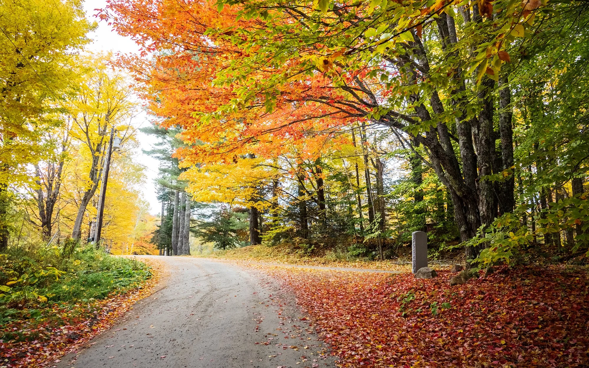
After our time beside Long Pond, we explore a nearby trailhead in the woods, admiring the beautiful colors carpeting the forest floor. Back on the road after a breakfast in the car (bread rolls, milk, chocolate, and dried fruit), we head southward toward Burke to explore a number of scenic viewpoints on the crest of Darling Hill. It is mid-morning now, and the sun is shining.

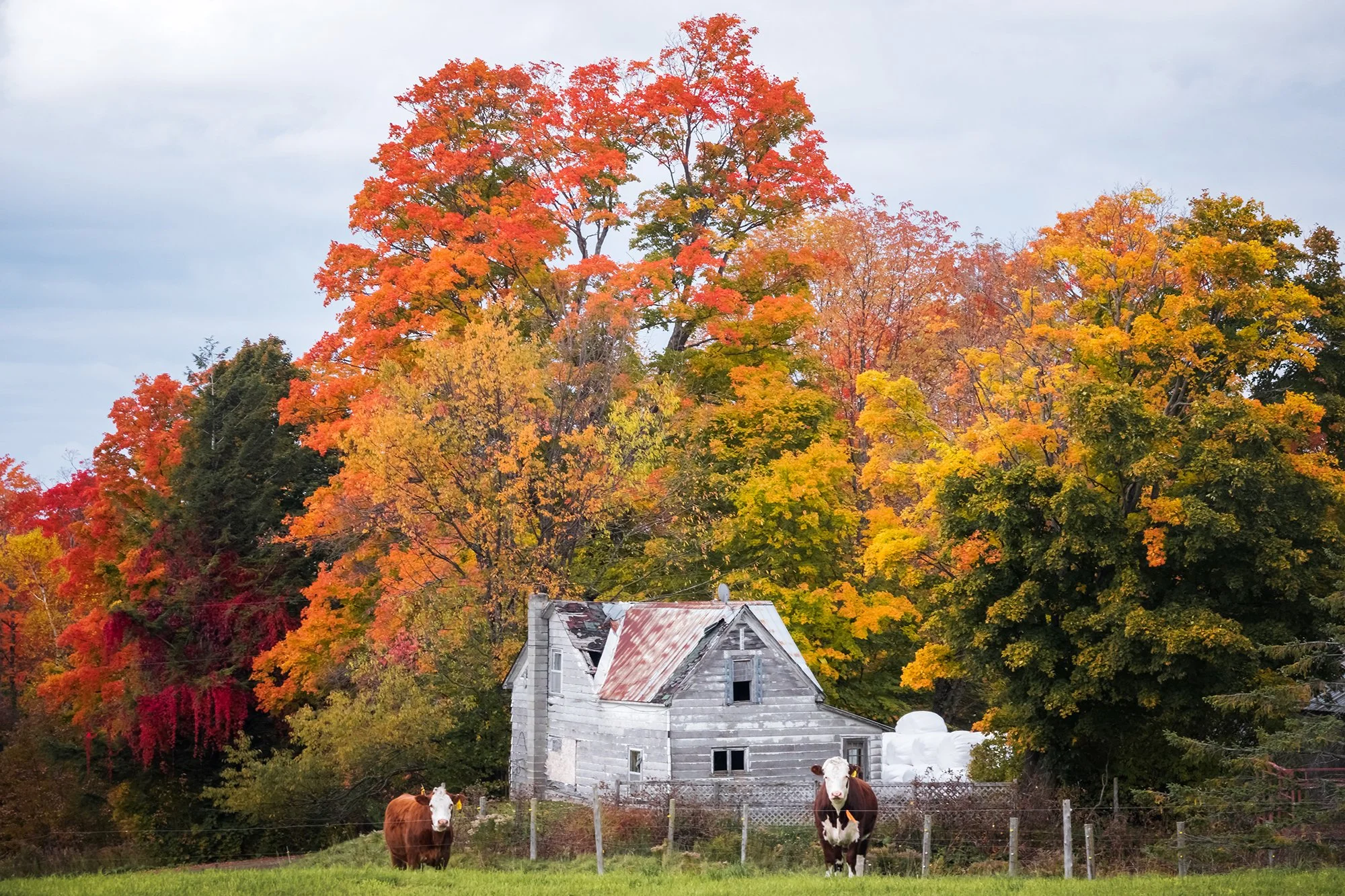
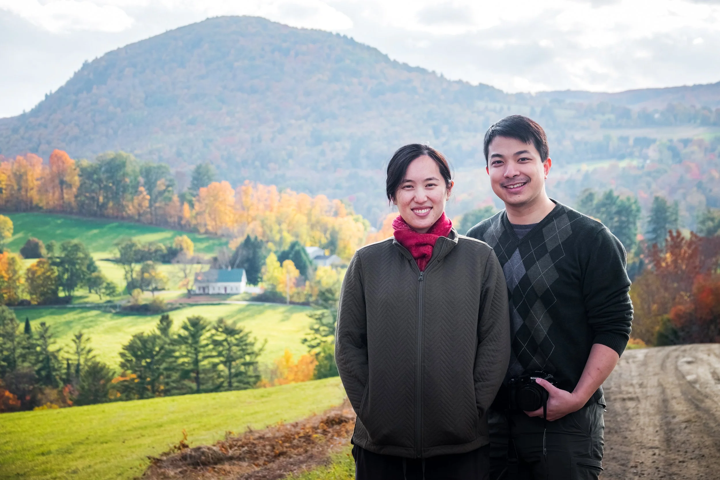
We meander along Darling Hill Road, stopping the car along the way to photograph the lofty valley views to either side. Dappled light is dancing across the ski slopes of Burke Mountain to our east, while to the west, the landscape rolls away clear toward the Green Mountains in the distance. Before Lyndonville, we swing back north and turn off onto Lost Nation Road, a well-maintained dirt road that climbs into the hills near East Haven. The autumn colors are at peak here, the hillside a glowing sea of red maples, birches, and oaks; we get out of the car to take a selfie at a particularly colorful overlook. Afterward, while Jane waits for me on the road, I descend the nearby stream to capture a few long exposures along Jack Brook. Afterward, we continue northward to the town of Island Pond for a refueling stop and a lunch break. We eat at the nearby Kingdom Grille (a burger and fries for me; a French dip sandwich with au jus dip for Jane), and I photograph a loon on the pond surface before we return south to Jobs Pond, a beautiful pond tucked beneath wooded slopes and granite cliffsides.

Here, during a routine battery change, disaster strikes: the battery mislatches and swells inside of my RX-10, becoming instantly stuck inside of the non-functioning camera. We quickly drive back to Ace Hardware in Island Pond, where the store employees kindly give us access to anything we need in the store to pry out the stuck battery. Jane and I hop around the aisles, trying unsuccessfully to McGyver a lever system using superglue, a fishhook, and a pair of kitchen knives. Finally, the cashier calls over a friend working in the construction department. Thanks to Grant and his “redneck ingenuity,” the battery is quickly dislodged. We offer to pay for the tools used, but the friendly folks at the store refuse to take a payment for anything except the super glue (thanks, Ace Hardware in Island Pond!). Having had enough excitement for one afternoon, we head west over the hills, back to our home in Westmore.

In the late afternoon, after a snack and a long nap, Jane and I drive to a hillside a few minutes up the road from our cabin to watch the sunset. We walk out a little distance across an open meadow, where the view faces downhill, opening up across miles of rolling hills and woodlands, westward toward Lake Willoughby and the setting sun. I set up the tripod for a sunset timelapse here, which Jane dutifully watches over as I walk around the meadow, shooting close-ups of the nearby trees and burning-bushes aglow in the golden-hour light. Afterward, we return home, enjoying a peaceful TV night with our snacks and our typical ramen dinner.

Day 2: Mist and Light

The next morning, we head west past the north shore of Lake Willoughby and toward the village of Barton. We arrive at May Pond just as day breaks; it’s another misty, overcast morning, and aside from a momentary bloom of violet clouds, sunrise is muted yet again. I focus on shooting the far shore’s foliage with my long lens, along with some peaceful intimates near the pond’s outlet. There is a fine drizzle in the air as we leave the pond and pass through Barton. Driving south, we follow the highway past Crystal Lake to Wheeler Mountain Road, a fine dirt road that winds up through the forest to the marshy edge of Wheeler Pond. We take a selfie here, and I attach my CPL to dampen the reflected light glinting off the surface of the pond’s lily pads and other vegetation. On our way down the mountain, we stop in a dirt turnoff so that I can shoot into one of the most beautiful woodland scenes I can ever remember seeing, the canopy glowing brightly with a full pallette of golden-orange maple, elm, and birch leaves.

Further east, we make a brief stop on the shore of Bean Pond before continuing down the highway toward Lyndonville. We decide to take a detour south to the village of Sutton. Winding along the backroads and dairy farms on Pudding Hill, we catch fanstatic scenes of cows at pasture, distant hillsides in the mist, and dirt roads lined by majestic golden trees. We reach Lyndonville in the mid-morning; the local bookstore is, unfortunately for me, closed, but we stop at the Freighthouse Market and Cafe to eat brunch (bagel breakfast sandwiches, coffee, and smoothie) and browse the candle store upstairs. I shoot the colorful maple tree in the yard outside the farmhouse before we return to the car, driving the short distance back to Lake Willoughby and our cabin in Westmore. With rain clouds blowing in from the west, we spend the mid-day relaxing at home; Jane takes a nap while I take a timelapse of Mount Hor over Lake Willoughby, and walk a ways down to road to spend some time with the local dairy cows.

After a restful early afternoon, we head back out to shoot golden hour on the shores of Lake Willoughby and Long Pond. We initially stop by the Willoughby Lake Store hoping to find a maple cremee (unfortunately, we find, these ubiquitous frozen Vermont treats are only available during the summer). On Long Pond Road, we take a brief walk into the golden forest at the Mt. Pisgah trailhead before proceeding back to the Long Pond boat launch. I shoot a series of timelapses here as the storm clouds blow across the hills to the south. Eventually, rain drops begin to speckle the surface of pond. This peaceful scene transforms into a downpour a few minutes later; we beat a hasty retreat back down to Lake Willoughby, where sunset is in full swing. We shoot the dramatic, cloud-strewn skies from the lake’s boat access, before returning to the cabin for our final night in Westmore. In the evening, we spend don our outer layers and do some constellation-watching in the backyard. Unable to sleep that night, I watch the cloud inversion flowing down and over Lake Willoughby under the light of full autumn moon, grateful to have more waking hours in this beautiful place.

Day 3: The Road to Peacham

After sleeping in past sunrise, we clean up the house, load up the car, and depart from Westmore in the early morning. It’s another cloud-strewn day - this time, banks of middle clouds are rolling in from the valleys to the west, making for excellent fall foliage shooting conditions. Past the village of Barton, we head west along Barton Hill Road toward Irasburg, stopping the car every few hundred yards to gawk at the colors, the landscape spangled by shadow and sunlight, and the morning mist rolling over the treetops. I take a number of favourite shots along this road: a tunnel of golden oaks lining the path, and a distant shot of a working farm, with valley fog and looming mountains beyond, to the west.

In Irasburg, Jane looks in vain for a public restroom (third-trimester bladder is no joke) while I shoot the village’s congregational church from the nearby green. We turn south now on the road to Peacham and Caledonia County, stopping at a gas station for Jane before continuing toward Craftsbury Common. Before Craftsbury, we turn off on a side road, stopping along the way to photograph distant hills and farmlands, admiring majestic maples, oaks, and elms emblazoned with color. The opportunities for creativity and composition are endless after leaving the main road; meandering along farm roads and through less-frequented hamlets, you catch a sense of the slower, more intentional life that the pastoral landscape almost seems to encourage no matter where you turn. It is this sort of beautiful autumn morning that makes the Northeast Kingdom so special - even, one gathers, for the local Vermonters.

At Craftsbury Common, we take a brief break and photograph the beautiful trees behind the village’s public library before continuing southward, past Hardwick and along a vanishingly narrow dirt road to a trailhead just past Nichols Pond. Here, we take a brief, slightly steep climb (Jane climbing carefully and steadily, at 30 weeks) through the autumn forest to Nichols Ledge, which looks out over an impressive westward vista across Nichols Pond and East Long Pond, the lakes tucked admist a sea of fall foliage at its peak. I take two timelapses here while Jane rests and munches on some snacks. It’s past noon now; a light drizzle moves in as we climb back down the mountainside and through the forest.

Back on the road, we head east toward Cabot and finally rejoin our route from last year (when we visited the Foster Covered Bridge and bought apple cider donuts at Burt’s Orchard before heading into Groton State Forest). Jane takes another bathroom break in the Cabot General Store, while I walk around the village green but find little to photograph. Further south, we pass through the town of Marshfield, turning off onto an old railroad bed-turned dirt road toward Turtlehead Pond. The western end of the pond has impressive near, medium, and far views of the foliage in the Marshfield Town Forest, tucked beneath granite cliffs; after scouting for a bit, we resolve to return early the next morning for sunrise. Back on the road, we head east to Groton State Forest, stopping first at Peacham Pond. The pond itself has fairly standard views as far as lakeside scenery goes, but we stop to photograph our trusty Corolla beneath the panoply of colorful trees that line the access road.

Heading further south, we pass through Groton State Forest and onward to our next pondside stop. After we mistakenly try the entrance to the Ricker Pond Campground, the campsite attendant directs us another mile or so south to a parking lot where we can access the old railroad bed (now walking/biking trail) at the pond’s southern end. We scout around here a bit, walking out onto a tiny peninsula that juts out into the pond (where we’ll come back tomorrow for a mini-maternity shoot of sorts), and also photographing the foliage and small falls at the pond’s nearby outlet. Back in the car, we head south to Rt 302 and turn north along Minard Hill Road, which will finally lead us to our long-awaited reunion with the village of Peacham.

We enter the Peacham-Barnet area in the mid-afternoon. A morning of enticing light and changeable weather has only looked more and more promising as the day has worn on. By the time we find our first shooting location (a cemetery near West Barnet), I could not possibly ask for better conditions for shooting autumn scenery: the clouds provide just enough coverto act as a soft lightbox for the colorful landscapes, but are moving swiftly enough to produce beautiful, active light rays that highlight different features of the land. After setting up another timelapse here, I walk along the cemetery and up and down the dirt road, shooting in just about every direction. Next, we turn the car back down the hill toward Peacham, and turn off along the hills to the north to explore a trio of shooting locations I’ve scouted around the vicinity of East Peacham. My homework has proven fruitful; from this height of land, we’re able to see down the valley and toward the rolling farmlands and hillsides that surround Peacham; to our south, I can see the white steepletop of Peacham’s iconic church. I file these locations away for sunrise on our final day, before proceeding back to the old fire station above the church, where Jane and I first stopped one year ago (nearly to the day). We walk along the nearby hill behind the fire station, stopping to photograph the church and farm from under the boughs of an apple tree.

It is nearly the golden hour now; as a touring photography group moves in to shoot the church, we leave and head across the street to Peacham’s beautiful cemetery, where we are alone until the sunset. Here, I revisit a beautiful, massive maple tree towering above the headstones - quite possibly the most beautiful maple tree I have ever photographed in my life (but not the most beautiful tree - that honor goes to the Great Beech standing above the Susquehanna River in Maryland). Behind the cemetery, the hillside opens up to an impressive southward vista, taking in hamlets and hillsides, trees coated in the honeyglow of the setting sun. I set up the day’s final timelapse here - a long one - while we sit on the grass among the gravestones, observing and photographing the changing light. Perhaps it’s the setting, but Jane and I get a little nostalgic here, talking about our childhoods, our travels, the meaning of our work, the meaning of our traveling to and being in a place as beautiful as this one, and how all of it will change (yet again, but perhaps more than ever before) in the space of the next few months. As the sun sets behind the hills in the forest to our west, we walk back through the cemetery to our car. We make the short drive north along the Peacham-Danville Road, and after a very long day of driving, exploring, and shooting, we settle in for the night in a guesthouse along Joe’s Brook, just south of Danville.