As part of our deal in undertaking this trip together, Lindsey agreed to accompany me for at least one sunrise in exchange for coffee and brunch afterward. I believe my exact words were, “Nothing too intense.” I lied. What I did not tell my very forgiving and tolerant friend was that I hoped to be on or near the summit of Mt. Major, overlooking the lower reaches and islands of Lake Winnipesaukee during or shortly after the sunrise on Wednesday morning. What’s the saying that comes to mind here — “the devil’s in the details”? Or is it “God is in the details”? “The proof is in the pudding”? “Stupid is as stupid does”? Yes, that last one. That’s the one I’m looking for. Lindsey being an amazing, kind, and caring soul (also one who humors more than her deserved share of stupidity), she allows me to set a 6 AM alarm time, which she cheerlessly points out is earlier than both of our usual on-service workweek alarm times (“And on vacatiooooon,” she groans. “Thank youuuuuu,” I reply chirpily). She is neither impressed nor reassured (is, in fact, horrified) when I point out that the fall sunrise is fairly late in comparison to my 10 PM sunset / 3 AM sunrise alarm times on the Faroe Islands in 2018.
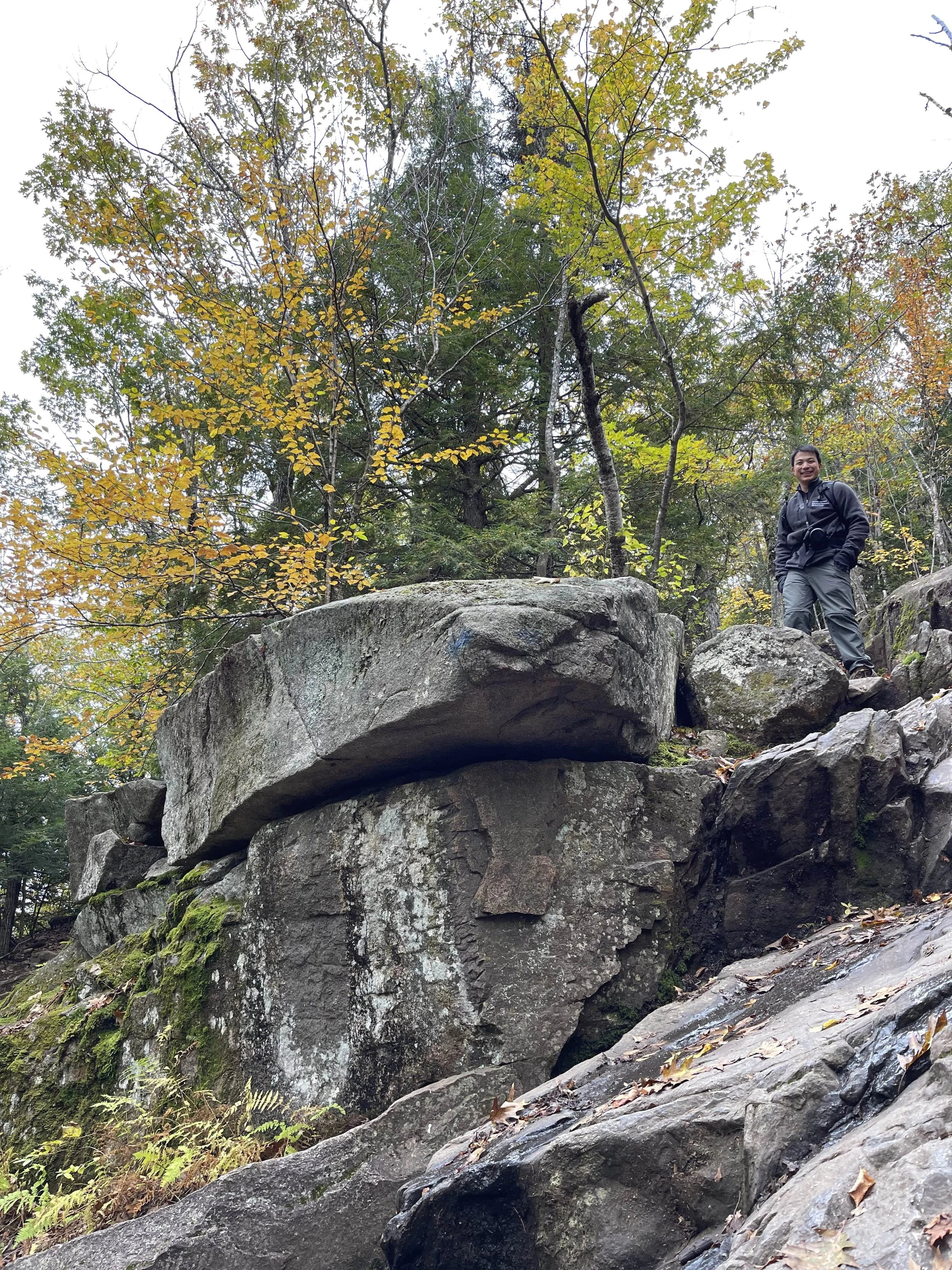
Stupid being what stupid does, we head out from our Weirs Beach condo around 6:30 AM, arriving at the Mt. Major trailhead as the sky is beginning to lighten. Obviously we are not going to be anywhere near the summit at daybreak (in fact, we are treated to a landscape photography classic - a glorious sunrise spectacle from the parking lot, just as we are about the embark up the mountain), but as additional evidence of my dumbness, 1) the sky remains completely blanketed in high clouds this morning, and the light looks to be as flat as it gets, and 2) we soon discover that the Mt. Major main trail is a real hell of a trail. Nothing like the previous day’s athleisurely jaunt up Lockes Hill, Mt. Major is a true eastern seaboard climb. After a deceptive stretch northbound along pleasant forest paths, the trail curves westward up the north flank of the mountain, proceeding straight up boulderfall and then eventually across granite faces. Despite being well-marked with blazes, there are a good few sections that require handholds, careful step placement, and occasionally scouting for routes around dicey wet ledges. I quickly shed my outer layers and fingerless gloves (stupid), then my sweat-soaked cotton flannel (really stupid), until I am eventually going up the mountain in just my base tights (pinnacle of stupidity). Lindsey can’t help but poke a bit of fun at me for my idea of sunrise, though honestly she is very good-natured about the entire thing (“Thank youuuuuu,” I keep chirping anyways - when I can catch my breath). We snap photos of each other going up the rockfall, though the pictures don’t do the verticality justice. On our way up the granite ledges, we pass by a descending couple who did manage to catch sunrise at the top, though it’s hard to imagine how much sketchier the route must have been in the dark.
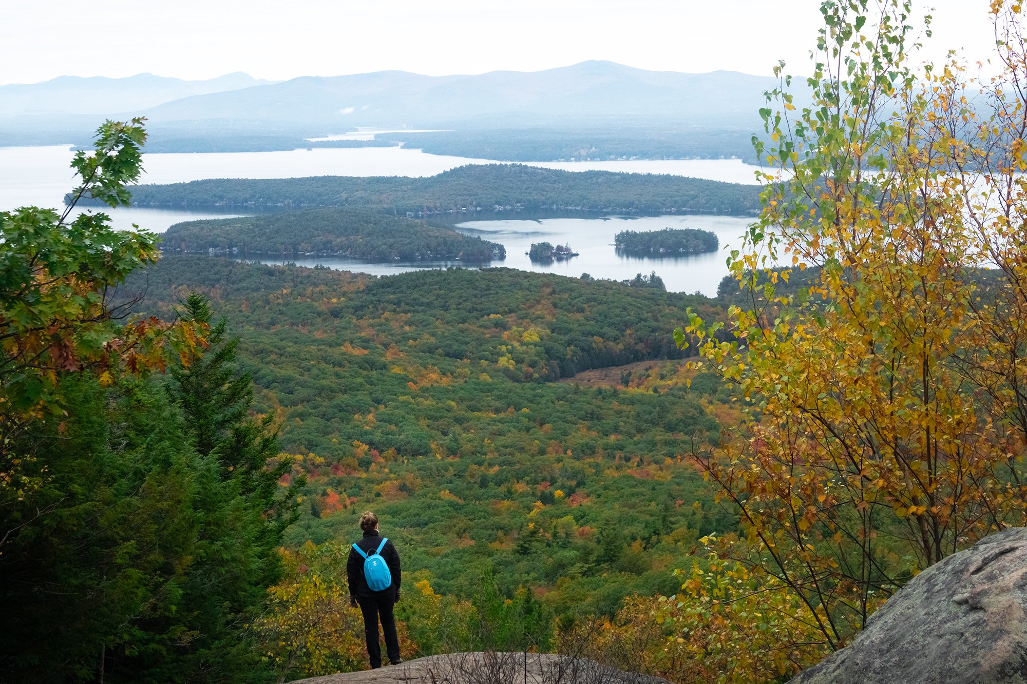
After a good hour-plus of climbing and scrambling (i.e. well after sunrise), we arrive at the summit, where we have marvelous 360-degree panoramic views all to ourselves (again not what I expected during foliage season - though again, it is a Wednesday). I set up the pod and we shoot a few portraits on the summit with foliage, lakes, and mountain ranges in the distance. After a brief snack break, we descend the same way we came up (namely, carefully), stopping for photos in the forest below.


Back at the car, Lindsey cheerfully announces that according to her fitness app, she has exceeded 350% of her daily workout goal before 9 AM. Keeping my end of the bargain, we drive back north to the town of Meredith to make up the entire caloric deficit with a glorious post-hike meal at George’s Diner, an old-fashioned small-town diner serving up breakfast staples and hot coffee. We grapple with different menu options for a few minutes before deciding to just order everything, including an omelette with “the works” (I am literally too brain-dead to pick specific fillings), a breakfast burrito for Lindsey, and a pile of French toast to share, with extras like fresh fruit and real maple syrup (Lindsey insists) instead of the high fructose corn stuff on the countertop. The waitress gives us the slightest smirk as she brings the food out, but this only fills us with greater confidence and determination. We utterly demolish the meal without pausing. A six-egg omelette, massive burrito, and five massive pieces of butter- and syrup-drenched toast later, we lumber back to the car and mutually agree to head back to the condo to get out of our dirty hiking clothes and take a mid-day break. It may not be our first time traveling together, but Lindsey is doing remarkably well hewing to the photographer’s schedule (i.e. sunrise, food, die).
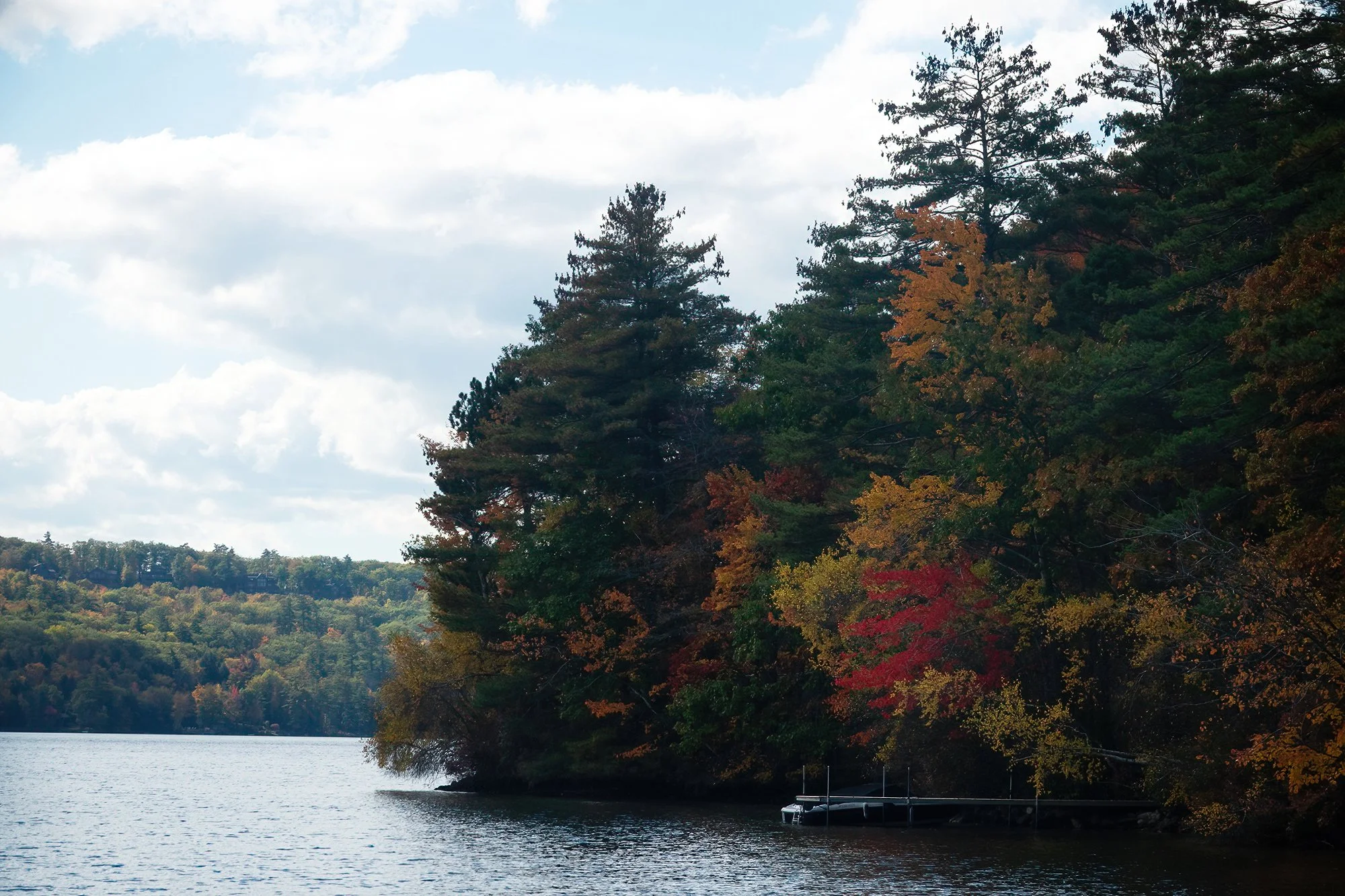
An hour later in the early afternoon (passed out on the couch in a food coma after showering and getting back into PJs), we step out again to spend the afternoon casually poking around (as Lindsey describes it) the periphery of Lake Winnipesaukee. I had marked out various other spots and walks, but it is clear that neither of us is in the mood for much exertion beyond exploring and seeing pretty places from the roadside. We make quick stops at the waterfront in Meredith and further northeast at the Center Harbor Beach, where I photograph a variety of lakeside trees turning brilliant colors. Our next stop is a totally spontaneous one - a promising spot that I saw and dropped a pin on while browsing the map in our condo. It turns out to be one of our loveliest photographic stops of the trip. We park the car at Long Island Beach (thank goodness for free parking and completely deserted shorelines after Labor Day), on a narrow strip of land connecting Moultonborough Neck and Long Island. From here, a small dirt path runs through the nearby trees and out onto a peninsula. I photograph Lindsey as she walks ahead of me through the golden foliage, and we take a few (spontaneous and gorgeous) portraits of her framed by pines and maples. We also walk back out along the road bridge to see across the water to our east and west; I photograph a bird on the lake which Lindsey tries to gaslight me into believing is not a loon (but does in fact turn out to be a northern loon with juvenile plumage). Back in the car, Lindsey navigates us as we continue poking around to the ends of Long Island and Moultonborough Neck, turning around when we reach signs for private lakefront resorts and yacht clubs. We see a lovely pine plantation (and beautiful water views) on Long Island, and muse about what it would feel like to live in such a peaceful and isolated place during the winter months.


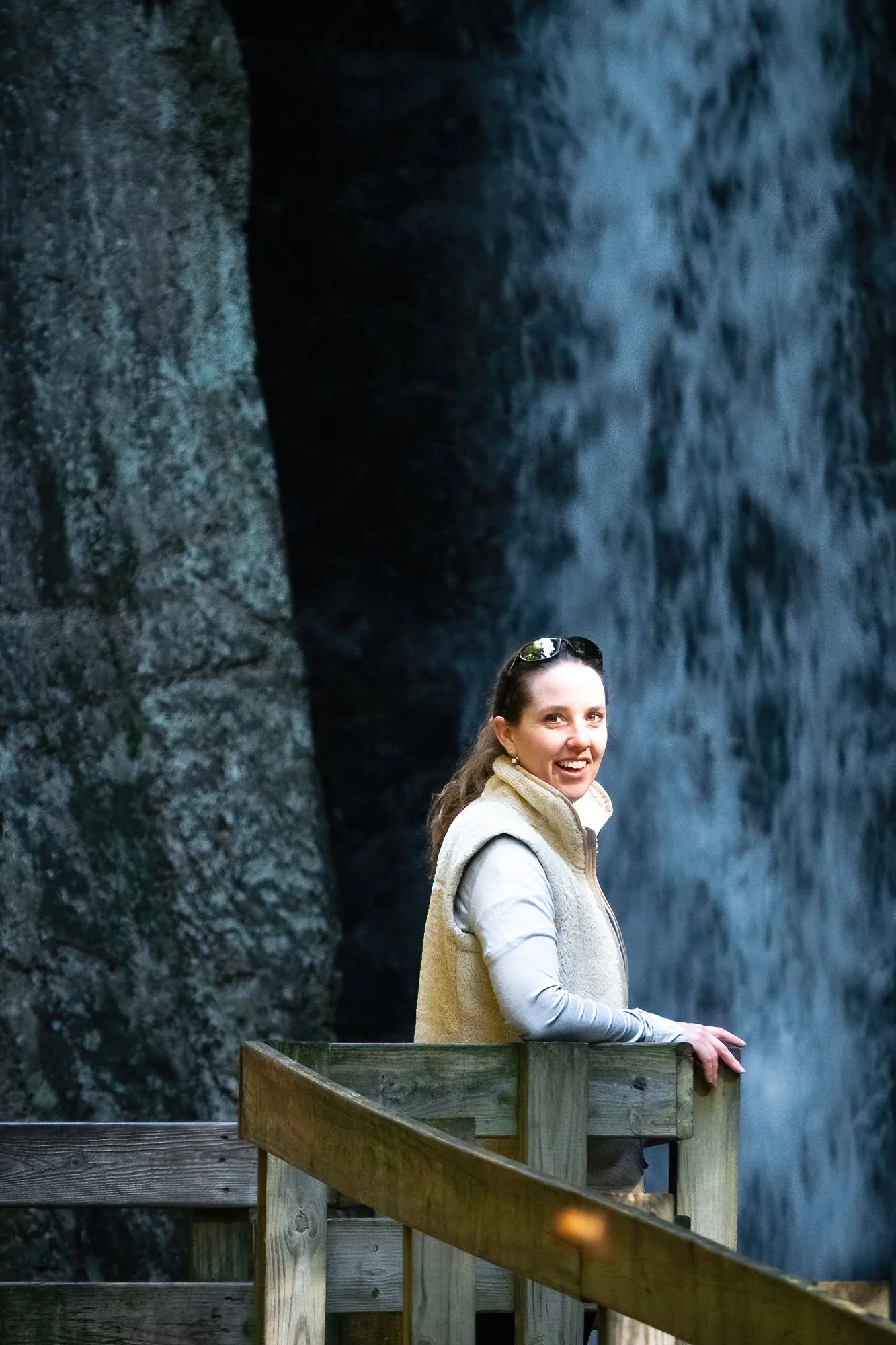
There is a light drizzle falling as we retrace our route and continue north into Moultonborough, but the rain swiftly passes, portending lovely shooting conditions and dramatic skies for the rest of the afternoon. Lindsey continues to point me toward potentially scenic places by the water as we circle the north shore of Winnipesaukee, planning to conclude the driving loop in Alton Bay for sunset. We first visit the town boat launch in Melvin Village, where we take a selfie together and catch a glimpse of clearing storm clouds to the north and the west. We next stop on a whim at 19-Mile Bay near Mirror Lake, after a scene catches my eye from the road: more dramatic clouds and golden afternoon sunbeams, coming down across an inlet between the mainland and Farm Island, an anchored boat in the bay backlit by this beautiful light. After perusing the scene and taking some telephoto shots, I decide to break out the reflector and tripod adapter to set up some (much less spontaneous but still really pretty) portraits of Lindsey, who again is remarkably good-humored and tolerant about the whole situation - namely, I am still not a portrait photographer and still have no idea what I’m doing when my subject isn’t a landform or wildlife (overheard at the scene: “Do something with your hands. Yeah, perfect.” “Just going to take one more. One, and one, and one, and one….” “You can relax, this one’s just a test shot. And this one. And this one...” “It’s not you, it’s definitely me.”). Lindsey returns the favor with a candid shot of me looking like a very happy, very dumb person carrying my reflector kit on the beach.
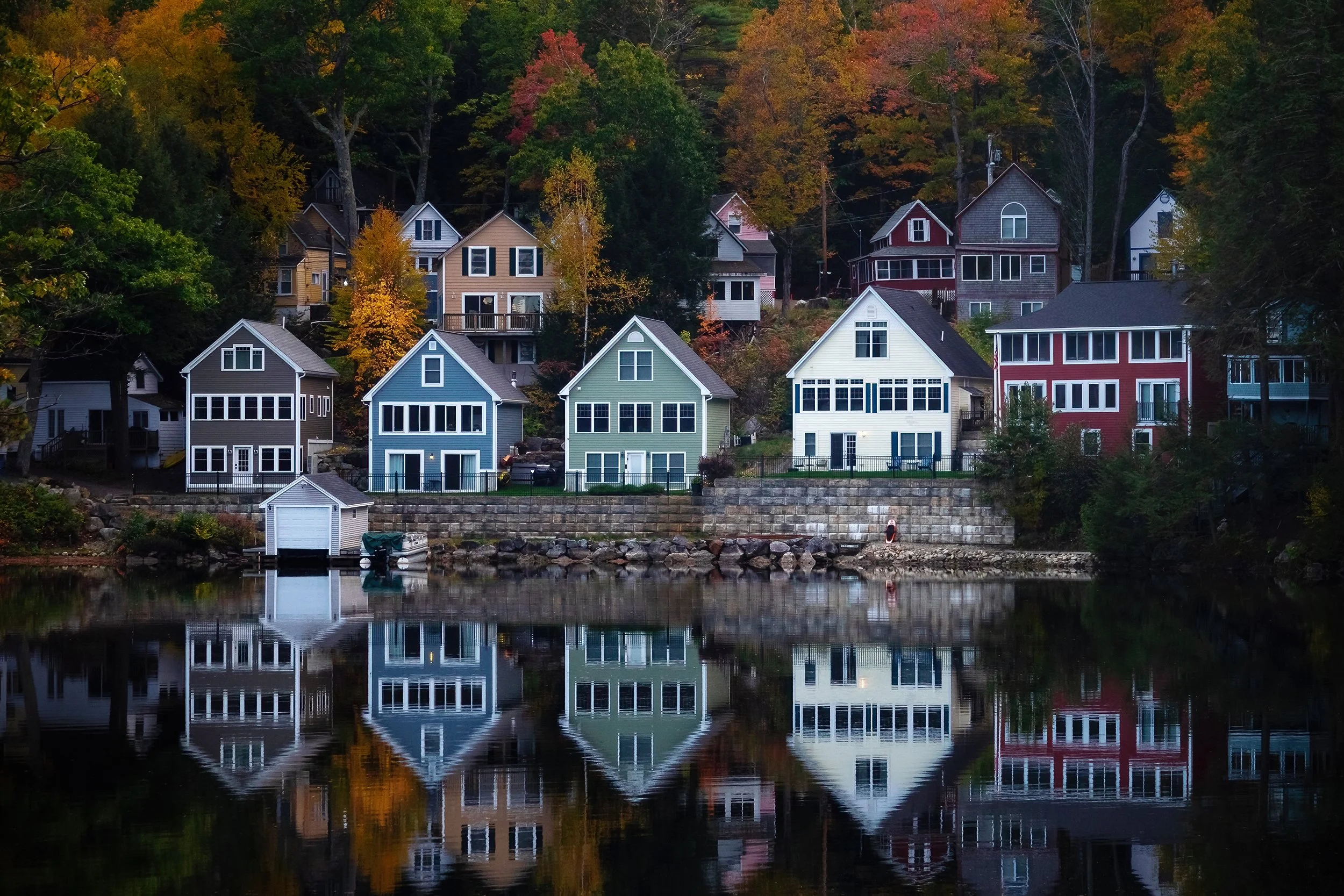
Further along the road, we take a few more foliage shots at Carry Beach in Wolfeboro before proceeding into town proper and stopping briefly to visit a souvenir shop (trip magnet acquired) and walk down the dock. Finally, several miles to the south, located at the head of a long cove of the lake, we reach Alton Bay close to sunset. Here, I leave Lindsey for a few minutes and jog up the road to a very traditional landscape composition (i.e. one that I spotted while browsing maps weeks before this trip, and knew instantly I would go through hell or high water or any degree of ridiculousness to grab): a row of colorful lakefront houses surrounded by foliage and backlit by the light of dusk. Regrouping with Lindsey back at the car, we head north along the highway to Mt. Major, completing a full loop around Lake Winnipesaukee. We close the day at a roadside overlook, where we are treated not only to colorful clouds, but also to a magnificent double rainbow generated by the setting sun against the clearing rain over Alton Bay. Afterward, we drive back to Laconia for dinner. My first pick is a total bust (a rustic but very outdoors and totally-not-weather-appropriate tapas bar at the edge of a farm field), so we backtrack into town and find a great meal of risotto and grilled pear salad at Laconia Local Eatery. After returning to the condo, we settle in for a movie and an early, restful night of sleep.