Death Valley and Owens River Valley

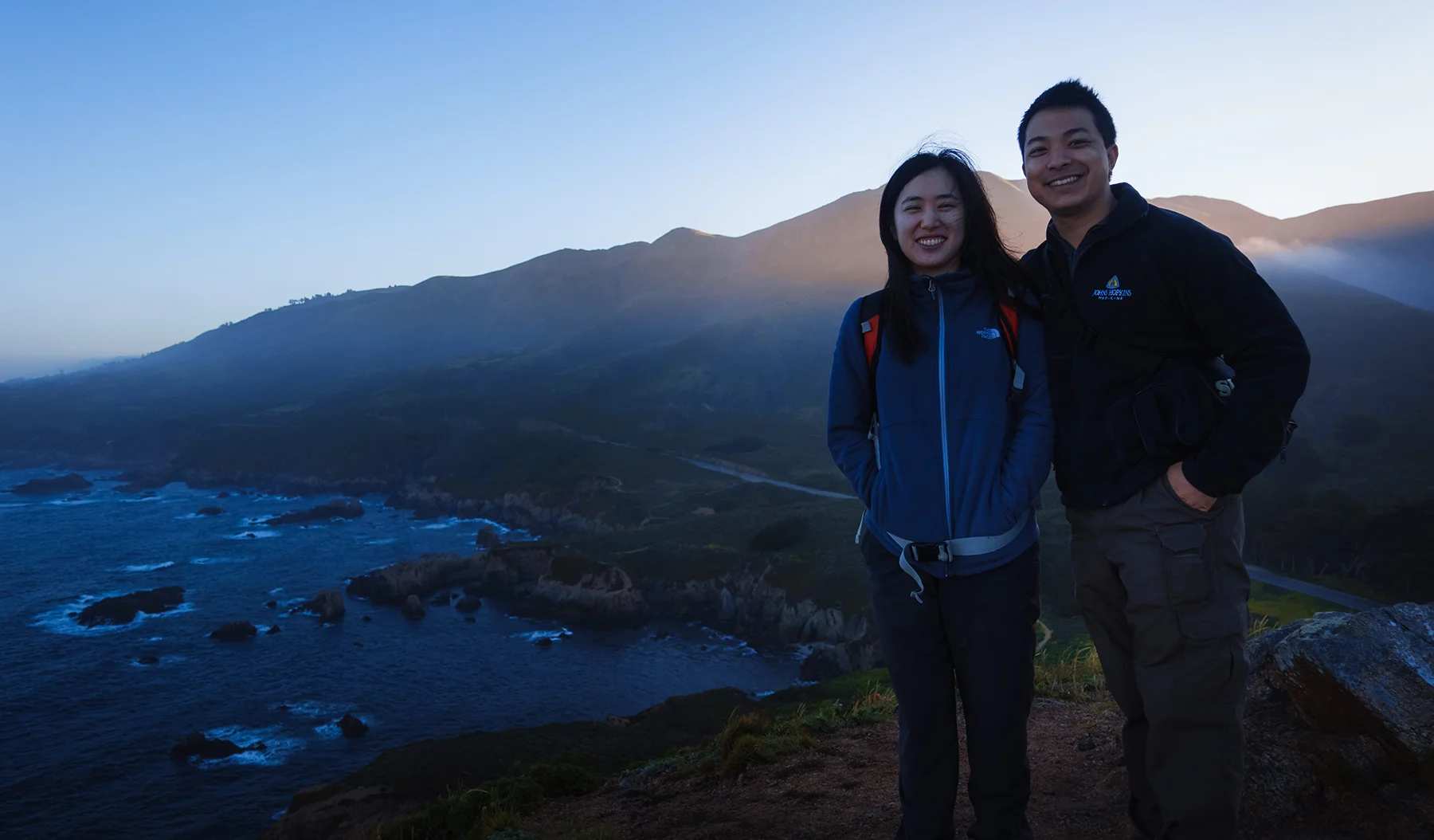
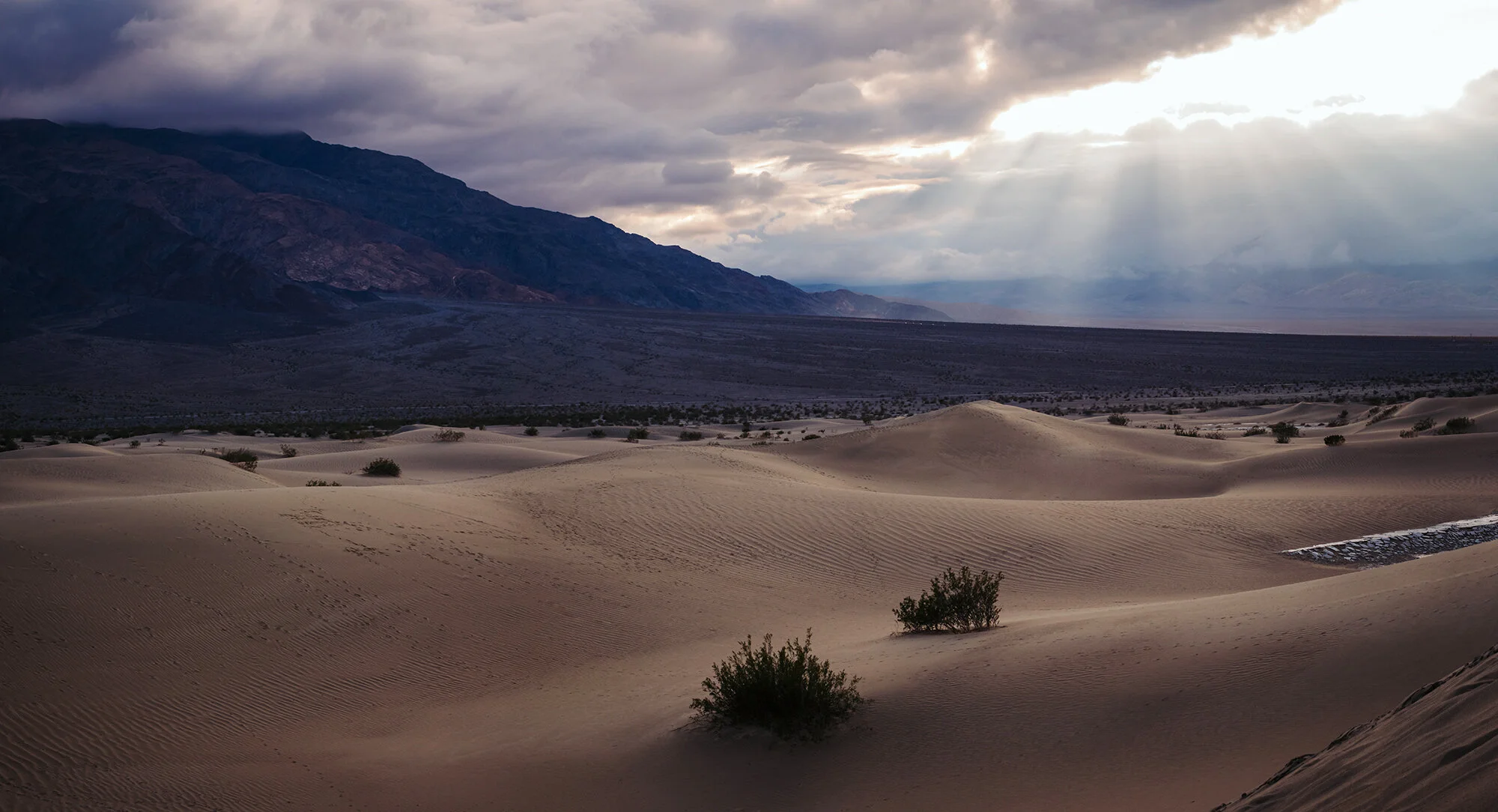
On a trip home over the winter holidays, Jane and I took my mom and my sister on a 3-night trip to explore Death Valley National Park and the Owens River Valley. On the first day, we drive out of East Los Angeles in the morning, having lunch at the Arby’s in Baker in the late morning before turning north along the Amargosa Mountain Range. Evelyn drives us through the desert into the national park, where we stop at the visitor center to buy a fridge magnet and an American the Beautiful annual pass (for our upcoming trip to the Four Corners region in May 2020). We head northwest to Stovepipe Wells, and spend the late afternoon climbing up and down the sand dunes at Mesquite Flat. Despite the heavily trafficked, footstep-laden dunes, we get some great light along the alluvial fans to the west and southwest during the golden hour. We drive back to our little hotel room at Furnace Creek, and begin to work on our shipping box full of instant noodles, canned foods, and snacks.

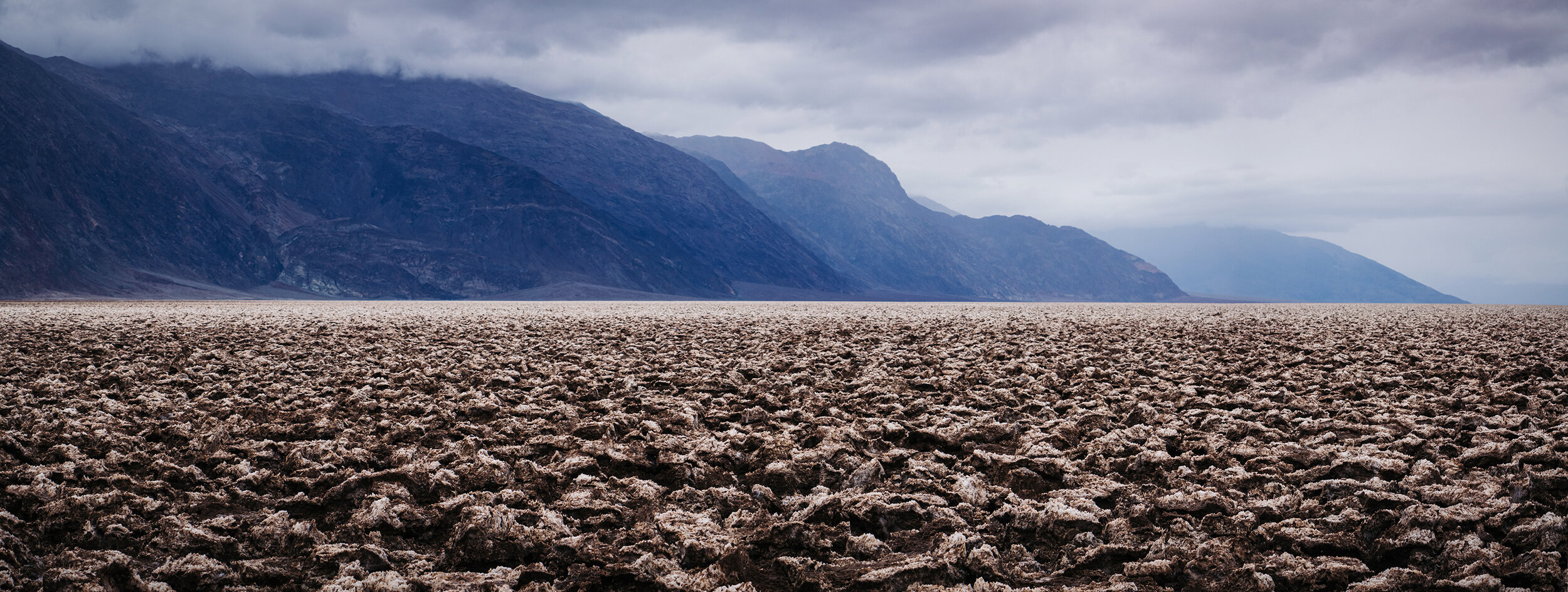
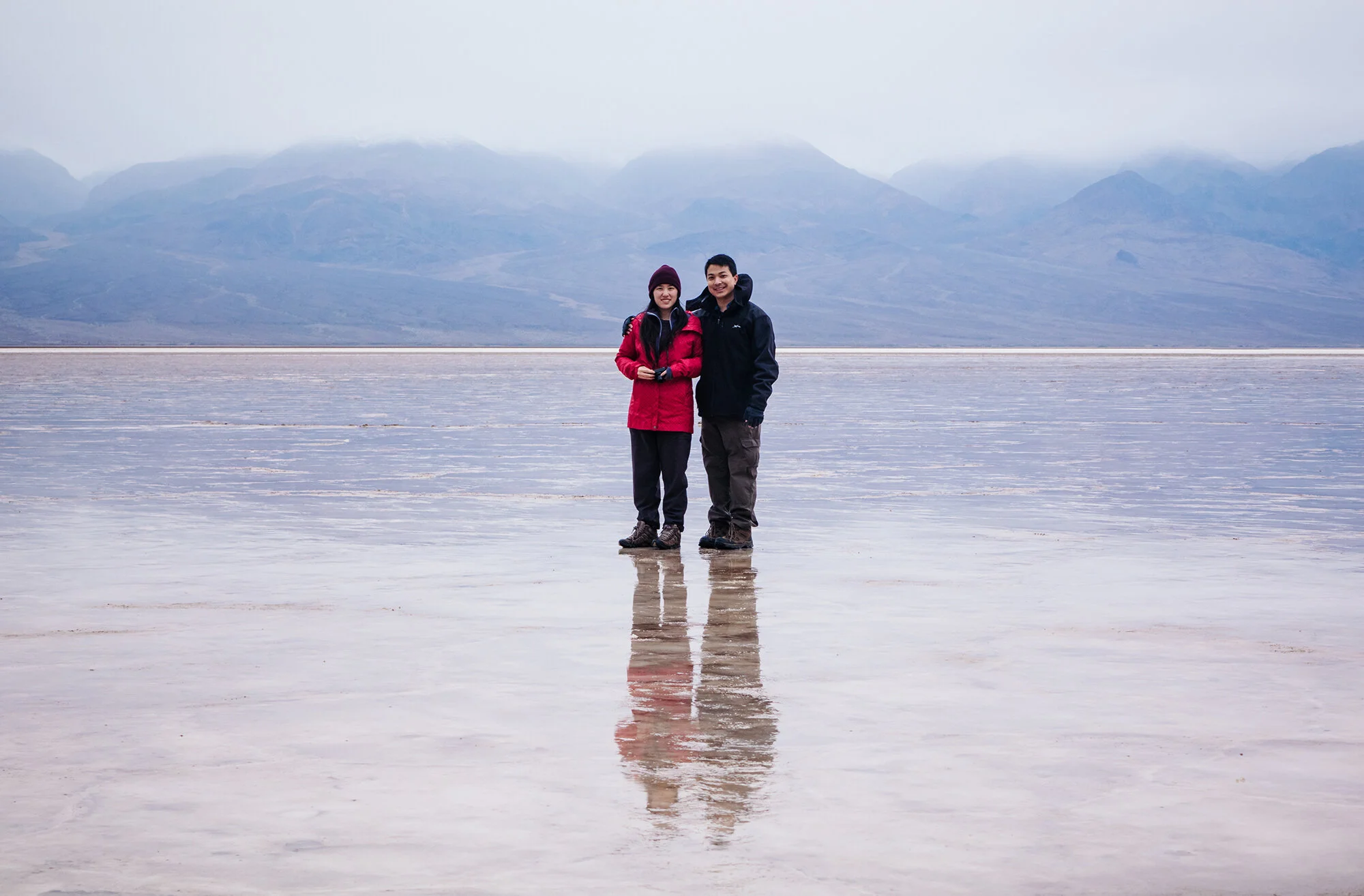
On the second day, Jane and I go out for sunrise at Zabriskie Point without the others. True to the weather report, we have a gloomy, rainy day in Death Valley - a rarity. Sunrise is nonexistent, but I use the flat light to emphasize the shapes and lines formed by the wind- and water-washed badlands terrain. After a slow morning and a hotel room breakfast, we attempt to drive to Dante’s View (road closed due to the previous night’s snowfall) before circling around the Black Mountains and entering Death Valley proper. We stop at the colorful, oxidized hillsides along Artist’s Drive, at the bizarre salt formations called the Devil’s Golf Course, and at Badwater Basin itself. In the wet weather, the salt flats lack the beautiful geometric crystals and cracked mud that have come to typify landscape photography in Death Valley - but in exchange we get a nice, reflective surface that stretches across the valley floor. After sunset (again nonexistent), we drive back to Furnace Creek and wash the saline off our boots and pants.

On the third day, all of us return to Zabriskie Point to watch sunrise over Golden Canyon, the valley floor, and the Panamint Range. Having staked out a prime spot with my tripod, I’m giddy with excitement as Telescope Peak begins to catch the first pink rays of daylight; I use the wash down below as a leading line toward the mountains. After returning to our hotel, packing, and checking out, we top the gas tank and drive to the west, past the campgrounds at Stovepipe Wells and through the western edge of the Basin and Range province. The highway winds up and down the mountains, through snow-covered Towne Pass, the mud flats of Panamint Valley, and the high, Joshua tree-covered plateaus of the Argus and Slate Ranges. After two hours of driving, we enter the Owens River Valley and turn north from Lone Pine. We first tour the former internment camp at Manzanar before proceeding north to see an ancient petroglyph, carved by an ancestor of the Owens Valley Paiute over 8000 years ago. This site, closely guarded by the photography community, is unmarked and unprotected, so I will not describe its location any further here. Suffice it to say that it is not difficult to find - with some thoughtful sleuthing. At the end of the day, we return to Lone Pine and check into our rooms at the Days Inn.

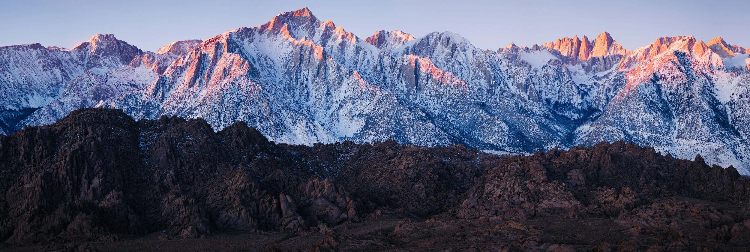
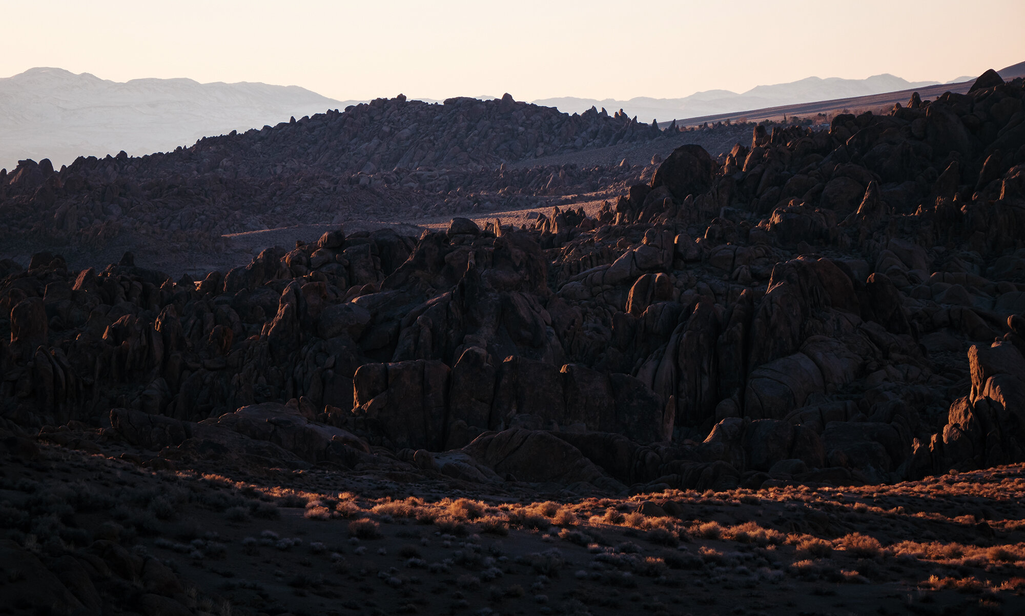
On the last day of our trip, we drive to Movie Flats Road, in the foothills beneath the tallest peaks of the Eastern Sierra. There, we photograph sunrise on Mt. Whitney and Lone Pine Peak before returning for breakfast at the inn, followed by a long drive back to San Bernadino by the early afternoon.

Day 1: The Sunset Coast

For the last big trip of my residency years, Jane and I chose something a little closer to home: a one-way drive from San José to Los Angeles, winding down the continent’s Sunset Coast. Along the way, we would spend three days exploring what the Spanish explorers called “El País Grande del Sur” - the big country to the south of Monterrey, a beautiful place defined more than anything by its contrasts: inaccessible yet teeming with visitors, worldly yet utterly mystical - a borderland where the rocky, reef-strewn tide pools of the Pacific soar precipitously into the peaks of the Santa Lucia Range and the vast Ventana Wilderness. On the fourth day, we would drive down the Central Coast of California, to the outskirts of the L.A. megalopolis, a homecoming of sorts. The fifth and last day would see us boarding a boat from Ventura to Santa Cruz Island, to explore the largest of the Channel Islands before braving the evening traffic toward Orange County.

In hindsight, I have to wonder why we chose this trip, one among many possibilities in the planning folder. It wasn’t for novelty: I’d visited the Sur on a road trip with family as recently as the summer between college and medical school, and Jane and I had spent a day on Catalina Island as Ocean Bowl teammates in our junior year of high school, not far from the Santa Barbara Channel. For photography? Probably not - as much as I love a dramatic seascape, we ultimately chose California over two other options that would have been compositional gold - a return to Scotland for its Outer Hebrides, or a trekking tour for autumn colors in the Patagonian Andes. Of course, there was the issue of family. Aside from attending weddings or planning a wedding of our own, neither of us had spent any extended time in California since 2016. And yes, there is still joy to be found in each reunion with in-laws, relatives, and old friends - even as we silence the little voice that tells us, truly, that no amount of time spent together can erase the lives grown while apart. That “home” cannot be found where the heart no longer is.

Maybe in the end, for lack of a better explanation, this trip was some sort of last, heroic attempt to fall back in love with the state that claims both of our childhoods. A subconscious effort to let visual and experiential beauty persuade us, perhaps, to return - in spite of all that we ‘d seen, lived, and loved in the intervening decade, and all that remains to be seen in the coming years. Were it only so simple.

An early morning flight from Baltimore and a connection in Detroit leave us in San José by mid-morning, Pacific time. We’re fully rested, each rolling a single suitcase with a few changes of clothes, wearing partly empty backpacks with hiking gear and some work material for our time at home. No check-ins, no passports. Truth be told, we’re unused to such a casual pace on day one of vacation. We amble out of the airport terminal and catch a shuttle to the rental car office. Jane watches, bemused, as the desk clerk slowly, slowly… slowly processes our reservation while an irritable line of customers piles up behind me. On taking the elevator up to the parking garage, we discover that my economy-size car has been upgraded to a full-size, 4x4 black Jeep Wrangler, the largest car I’ve ever driven. There’s a full step to climb into the cab of the vehicle; it takes me several attempts - and a few days of habit - to consistently wind up in the driver’s seat facing forward. We ease the car out of the parking garage and into the California sunshine, following the highway south of San José through the rolling green pastures of the Santa Clara Valley. As Jane and I search for something good on the radio, the road takes us past carefully irrigated farmlands and oak-lined creeks, cutting through coastal hills to arrive at the seaside just north of Monterrey an hour later.

We continue through the town of Carmel-by-the-Sea, stopping at its Spanish-styled Safeway grocery store to buy everything we need for the next three days: a bag of oranges, a bunch of bananas, six-packs of chocolate milk and apple juice, a few bags of pea crisp snacks, two loaves of focaccia bread ( jalapeño-cheddar and olive-parmesan), and the fixings for three nights of instant noodle dinners (complete with cans of corn, spinach, carrots and peas, tuna, and my favorite - a hunk of low-sodium Spam). Fully stocked, we continue south, bypassing Point Lobos State Natural Reserve (which is completely full, even at midday on a Tuesday). Past the gated seaside communities of the Carmel Highlands, Highway 1 swings toward the ocean and hugs the rocky shoreline. For the next 70 miles, it holds tightly to its Pacific embrace, climbing, dipping, and swerving along high cliff edges in one of the most harrowing, most beautiful stretches of road in the United States. We follow the road into the fabled land of Big Sur.

For our first stop of the trip, we leave the car on the west side of the road across from Soberanes Canyon, and spend the afternoon exploring the foot trails that crisscross Soberanes Point. It is springtime in the Sur; the weather is brilliant and breezy, and the lush hillsides are covered by blooming coastal wildflowers - quite different from the tawny, bronzed ranges that I remember from our family trip in 2012. As I point my camera along the wave-battered shoreline, I’m greeted by a world of color: the cerulean blue of the Pacific on a sunny day; the bright golden bunches of mustard flowers; the rust-red and olive-green hues of the succulent ice plant, its carpets spreading along the cliffs; all punctuated by clusters of delicate morning glory and stands of audacious poppy flowers. We walk along the coast, through a grove of cypress trees, and out along the bluffs to the seaward edge of Soberanes Point. Through her binoculars, Jane watches seabirds diving from the top of Lobos Rock, and spots a mother-cub pair of sea otters bobbing placidly in the cove. They get spooked when Jane calls me over; the tiny brown heads vanish underwater, re-appearing in the distant surf a full minute later.

Coming back from the Point, Jane and I circle the base of the hillock known to locals as the Whale’s Hump before we return to the car. We continue south, stopping for a brief walk down Doud Creek to the surf at Garrapata Beach. We’re a few weeks too late for the lily flowers in this narrow valley, which are well past wilting on the stem, but the abundance of spring wildflowers is more than adequate compensation. Further south, we stop at the roadside above Notley’s Landing to re-create a shot I took in 2012, of a sea arch with the Rocky Creek Bridge in the distance. We drive over the famous Bixby Creek Bridge, nowadays more of a spectacle for its throng of selfie-snapping tourists than for the grandeur of its architecture. We take our own selfie a little further down the road, at the high overlook of Hurricane Point.

For our last roadside stop of the afternoon, I set up the tripod on a shoulder of the road overlooking the Little Sur River Beach. This beautiful viewpoint, though enclosed by a private property fence, is a terrific place to work at sunset, with its sinuous river curve, its picturesque dunes and driftwood, and a foreground of vibrant pink ice plant flowers. Jane and I sit on the asphalt as I shoot a timelapse into the early evening. Feeling worn from a long day of travel, we leave a few minutes before sundown proper, speeding south past the Point Sur Lighthouse, past the green cattle pastures of the Sur Ranch, and past orderly rows of Monterrey pines silhouetted by the setting sun. The highway turns inland here, entering Big Sur Valley, with its eternal shroud of mist and its ancient groves of coastal redwood.

At the Big Sur Lodge, our destination for the next three nights, we check in at the main office, receiving our cabin key and a complimentary bottle of red wine (ultimately passed on to Jane’s parents a few days later). As we slowly wind up the narrow lane road toward our lodging in the twilight, dodging tree trunks fatter than our Jeep, the scene reminds of something out of Jurassic Park. Fortunately, we crest the hilltop to find not a twenty-foot-tall predatory reptile, but rather a line of cabins set pleasantly against a towering canopy of redwood trees. We park outside our cabin; I unload the car while Jane boils water for an instant ramen dinner, which we enjoy while the light fades from the evening sky.

Day 2: El País Grande

The next morning, we’re up early and on the road again, heading back north to Soberanes Point in the deep blue of the pre-dawn light. Hemmed in as it is by the towering Santa Lucia Range to its immediate east, Big Sur is no trivial place for sunrise photography. In my pre-trip research, I had a hard time finding suggestions for sunrise spots and compositions. Even longtime area photographers seemed to suggest that the Pacific coastline, though rife with sunset opportunities, would be a fool’s errand at daybreak, when its seascapes would be shadowed by the mountains and the ubiquitous layer of marine fog. Short of climbing the range (which Jane and I had neither the time nor the equipment to do), we would have to get creative. Fortunately, after a lot of time spent simulating sunrises in Google Earth, I hit upon a location that I hoped would provide interest: the top of the Whale’s Hump across from Soberanes Canyon, an elevated location between the mountains and the sea. Just a brief climb from the trailhead below, its north-northeast-facing ridge would provide a leading line into the frame and, if conditions were ideal, would be backed by early morning sidelight streaming over the saddle above Soberanes Canyon. Quite happily for us, the location worked perfectly.

After about half an hour of driving and a quick roadside stop above the beach near Point Sur, we park on a dirt shoulder at the foot of the hill, just a few hundred yards south from the cypress grove we passed through on the previous day. A short trail takes us up a well-maintained series of dirt steps, under the branches of a sprawling Monterrey pine, and to the ridge at the top of the hump. We arrive just as the sun is beginning to crest the range, its light diffused by low-hanging clouds on the seaward slopes of the mountains, so that the canyon below is bathed in an ethereal golden glow. Jane climbs to the summit while I take photos of her from the opposite end of the hill; after awhile, we switch positions, and I photograph her facing southward, framed by the open ocean. From the top of the Whale’s Hump, we gaze down on a terrific panorama of the rocky coves and coastal bluffs that we explored the previous afternoon. As the dawn filters through the mountains, it strikes the headlands in patches of dappled light - verdant greens and golds appear on the land, as if lit by a spotlight. Truly one of the loveliest sights of our entire trip, and a sunrise well worth the effort and planning that went into it.

The morning has arrived in full by the time we return to the car. Jane feeds me pea snacks as we drive back south, stopping just before the entrance to Big Sur Valley at Andrew Molera State Park, a sprawling coastal acreage of campgrounds and meadows, wind-swept bluffs, and oak groves abutting the Big Sur River as it flows toward the tidal lagoon where it meets the sea. Unfortunately, most of the trails to the west are inaccessible to us, as the footbridge across the river has not yet been installed for the season. We make do with a short stroll down the Bobcat Trail, a flat dirt path along the eastern bank of the river, which takes us past the derelict buildings of the old Molera Ranch - now converted into a historic museum and a headquarters for the Ventana Wildlife Society. Jane and I spend the morning birding and taking photos of the ranch’s beautiful, century-old oak trees, which stand majestically against hillsides of coastal scrub beneath a brilliant sun - the classic chaparral landscape that so completely embodies coastal California.

Afterwards, we drive the short distance back to our lodge at Pfeiffer Big Sur State Park. Leaving our car near the main office, we set off on the Valley View Trail, which follows Pfeiffer Creek through groves of coastal redwoods before switchbacking to a ridgeline east of the valley. Jane and I have some fun posing with these thousand-year-old organisms. The trees thrive in the Sur’s heavy winter rains and temperate, year-round fog, which condenses and provides moisture all along the height of their colossal boughs. At one bend in the path, Jane poses for a photo inside the trunk of a burnt-out redwood. The result is comically Lilliputian; wearing her field hat and pink windbreaker, she looks like a Columbia-sponsored human field mouse, huddled at the base of a hollow oak tree.

As the trail turns uphill, we leave behind the temperate rainforest world of redwoods, ferns, and clover carpets, and ascend into the sage scrub hillsides of the coastal range. Though the path is steep, the transition feels quite gradual, as the high branches and rich sienna bark of the redwoods continue to greet us switchback after switchback. Panting for air, we eventually make it above the treetops; the climb flattens into a ridge walk along the eastern rim of the valley. A mile later, we reach a west-facing overlook that serves as a breezy rest stop and turnaround point. The view across the valley, especially at mid-day, is nothing to write home about (dominated as it is by the highway), but there is a lovely glimmer of the blue Pacific to our northwest. As Jane and I pose for a selfie, I tear a hole in the butt of my hiking pants on a perfectly positioned sharp rock. Despite my wife’s protestations, I refuse to wear a different pair of pants for the remainder of our trip (or indeed, for the rest of our time with family in California).

After a water break and a snack, we retrace our steps back down the trail and return to the main lodge, where I order a vanilla ice cream float with orange cream soda; Jane has an iced tea. We also pick up our first of three (!) fridge magnets for this trip - an adorable image of Smokey the Bear with a beady-eyed fox and fluttery-lashed doe, presumably all smiling because of their confidence in our ability to not incinerate their natural habitat while we thoroughly trespass upon, trample, and develop it for our recreation. A high standard for ecological harmony. After we enjoy our drinks, we retreat to the cabin to eat lunch and settle in for an afternoon nap.

We leave the cabin again in the late afternoon, heading south to explore more of the winding coastline before we have to hustle for a sunset position at the famously picturesque McWay Cove. At the crest of Partington Ridge, we leave the car on a dirt shoulder and make our way down the canyon along a steep trail. At the bottom, the path levels off and follows the bank of a small creek before splitting toward a pair of rocky coves. Jane and I visit the southern cove first, which is accessed through a tunnel through the hillside - constructed in the late 1800s by homesteader John Partington’s for his oak harvesting business. Today, the landing is empty but for a few iron hoops drilled into the rock, and a solitary wooden bench looking over the water. We sit for awhile and are approached by an overly curious California gull, whose diet probably includes fish as well as sandwich scraps. On our way back, we visit the other cove, which is accessed by a narrow path through brush and ivy. The waves are booming on the boulders here, knocking over fancifully built rock cairns as the tide rises. As the afternoon sun vanishes behind the pines on the cliff above us, we make our way back up the canyon.

A short distance south on the road, we stop at a cliff-top vantage point with a classic Big Sur view: a winding coastline dotted by stately sea arches and hidden coves, with rolling foothills receding into a mist of marine fog. For a rare moment, I wish I had a camera lens with longer focal length, so that I could zoom in on the many lovely details in this landscape.

Past Partington Point, we come to a long and crowded shoulder in the road overlooking McWay Cove. As Julia Pfeiffer Burns State Park was heavily affected by mudslides and fires in 2018, the parking lot and short trail that lead to a vantage point of McWay Falls are still closed, and the roadside overlook is our only option to catch a glimpse of the famous waterfall. Truth be told, having seen the falls from the lower trail in 2012, I actually prefer the higher angle of view, which affords a more balanced composition of the entire cove, the waterfall, the surrounding cliffs covered with pine trees (to me, actually the most affecting and defining characteristic of the scene), and the blue horizon beyond. Fortunately, we arrive well before sunset, so I am able to get my tripod squared away in a nice corner of the overlook before a flood of photographers, smartphone wielders, and drone enthusiasts (seriously, so many drones) descends upon the scene. I take a timelapse of the changing colors and light, which dance across the falls and their surrounding cliffs as the sun falls in the west.

Leaving the waterfall overlook, Jane and I move the tripod thirty yards up the road to the side of our car, where there is a lovely, north-facing view toward Partington Ridge, with layers of coves and promontories in between. As the sun sets, it casts shadows across the beaches and cliffs, making for a mesmerizing scene full of depth and detail - honestly, a more impressive subject than McWay Cove itself. As is the case for so many high-traffic photography locations, we have this second overlook completely to ourselves, even though the scrum above the falls is just a few yards down the road. I take another timelapse here before we pack up the tripod and retrace our route toward home. As we enter Big Sur Valley from the south, from a high bend in the road, we’re surprised by a gorgeous sight: the day’s last light on the valley walls to our northwest. I quickly swing the car into a shoulder and hop out to take a photo from this impromptu overlook, just moments before the light fades. The glimpse of it is tantalizing enough that we decide to return here for sunset the next day - though the weather and lighting conditions would prove to be quite different on our third and final day in the area. For now, we make the brief drive back to the lodge, where we enjoy another ramen dinner before heading to bed early, in anticipation of a long day of exploration in the southern reaches of the Sur.