Utah: Canyonlands

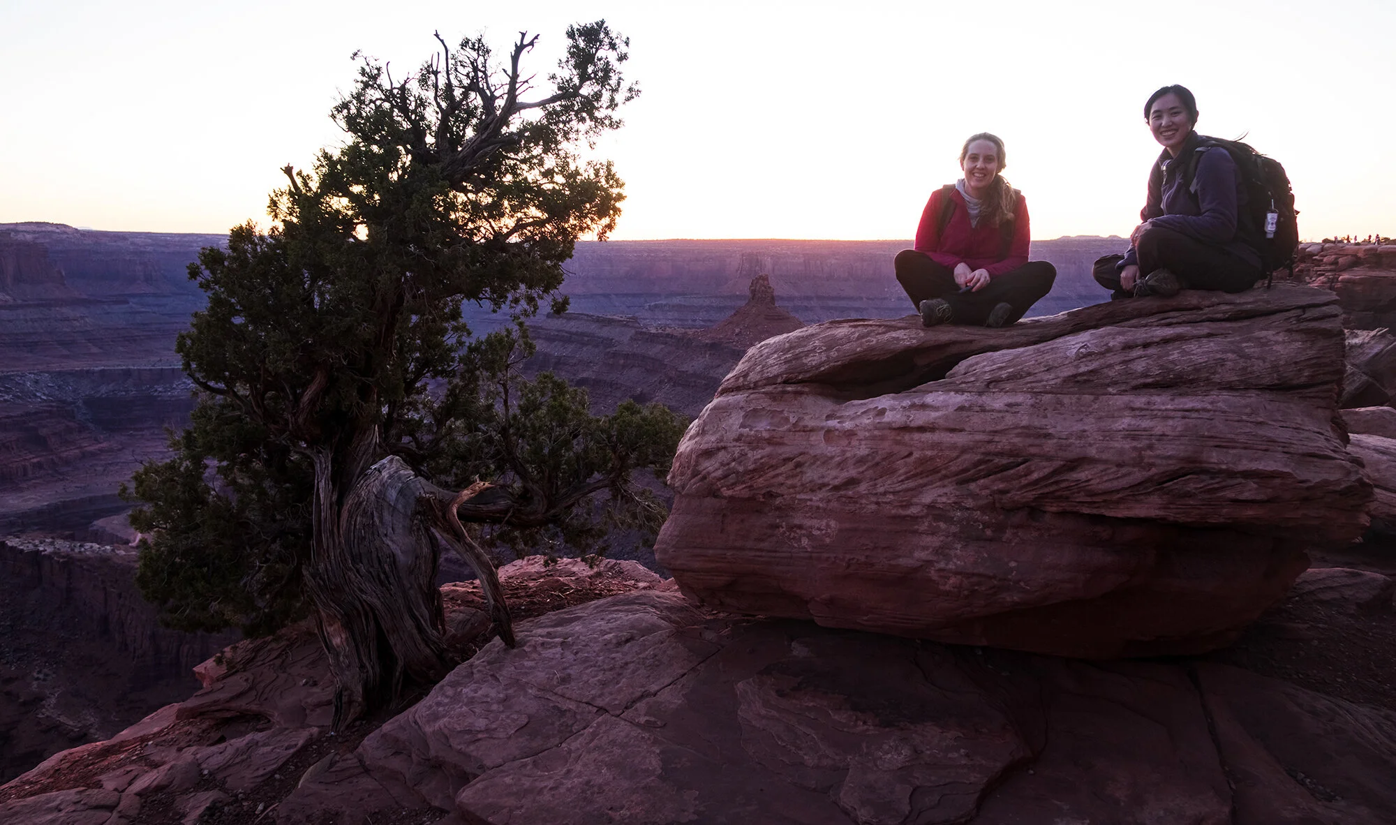
April 10, 2021: After flying into Grand Junction, CO and making the fast drive west to Moab, Jane and I meet up with Lindsey, who has blazed her way from Baltimore by way of Salt Lake City. After dinner, we speed up to Dead Horse Point State Park, only catching the last bit of sunset on the canyon walls.

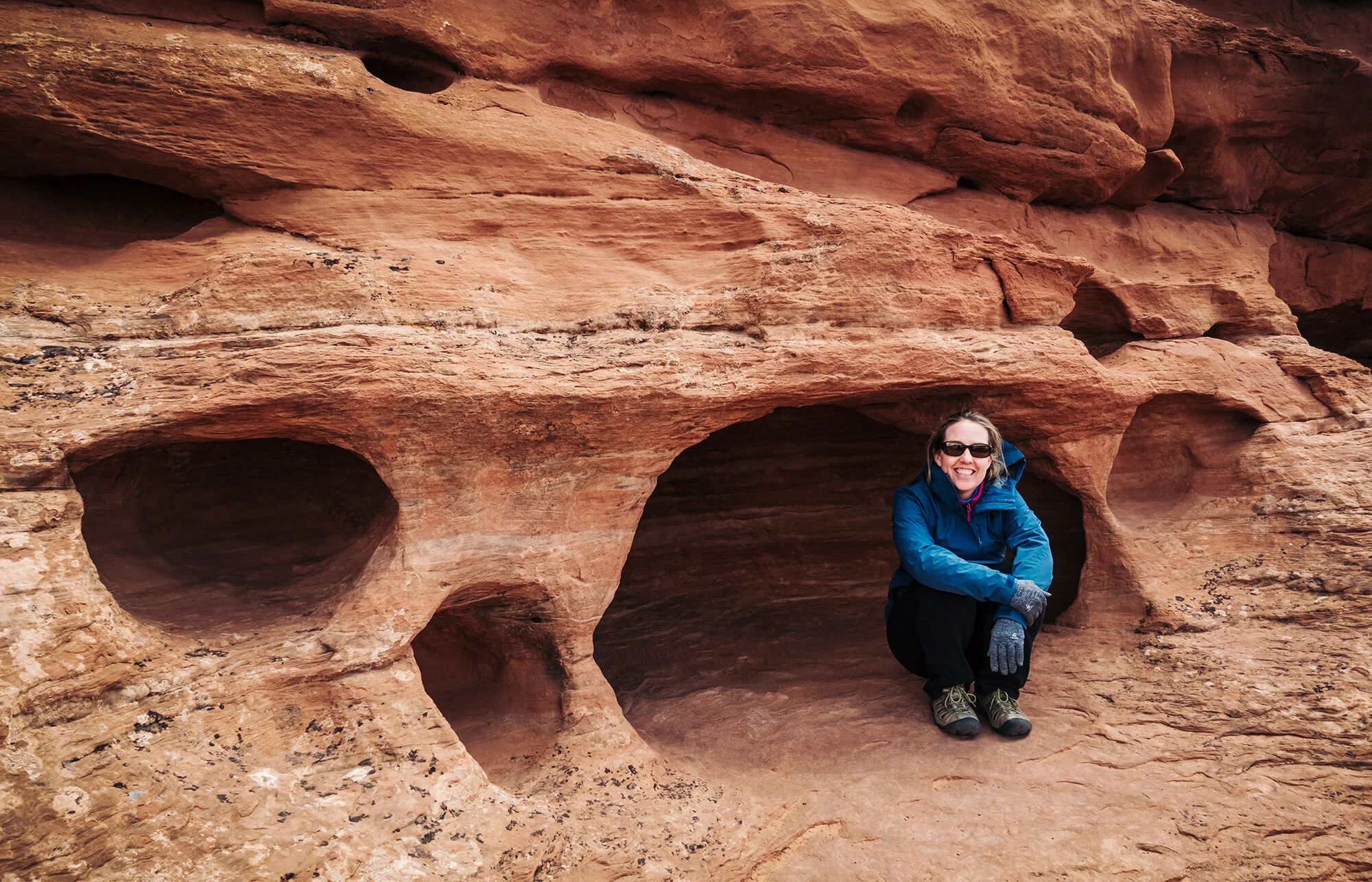
April 11, 2021: Jane and I return to Dead Horse Point for an early sunrise before returning home to have breakfast and meet up with Lindsey. After our morning at Corona Arch, we grab ice cream in town (big mistake…) and return to Canyonlands NP in the afternoon. Jane starts vomiting at the tail end of a short but very exposed, steep, and isolated hike to the False Kiva. Lindsey makes the final climb to the Kiva’s alcove (verdict: behind its current chain-link fence, the views aren’t worth the effort - an unfortunate result of vandalism at the archeological site), while I help Jane stagger back to the car. In typical Jane fashion, she insists that she feels fine while we watch her rapidly deteriorate on the ride back to town. She is in pretty rough shape by the time we reach the motel, but recovers with gradual fluid intake over the course of the night.

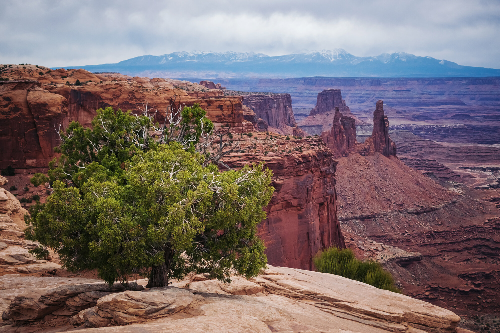
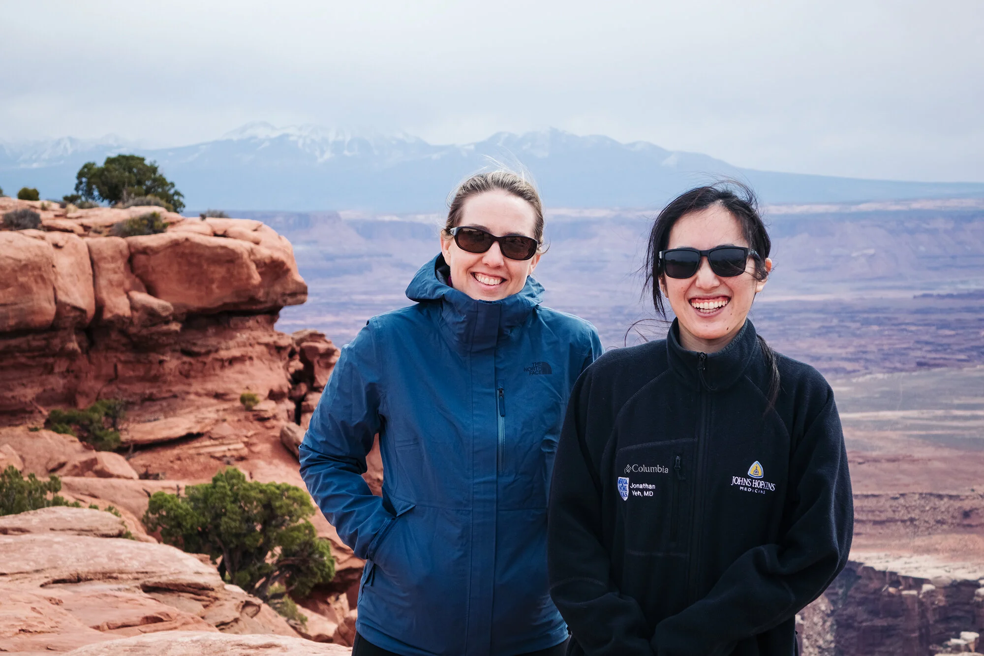
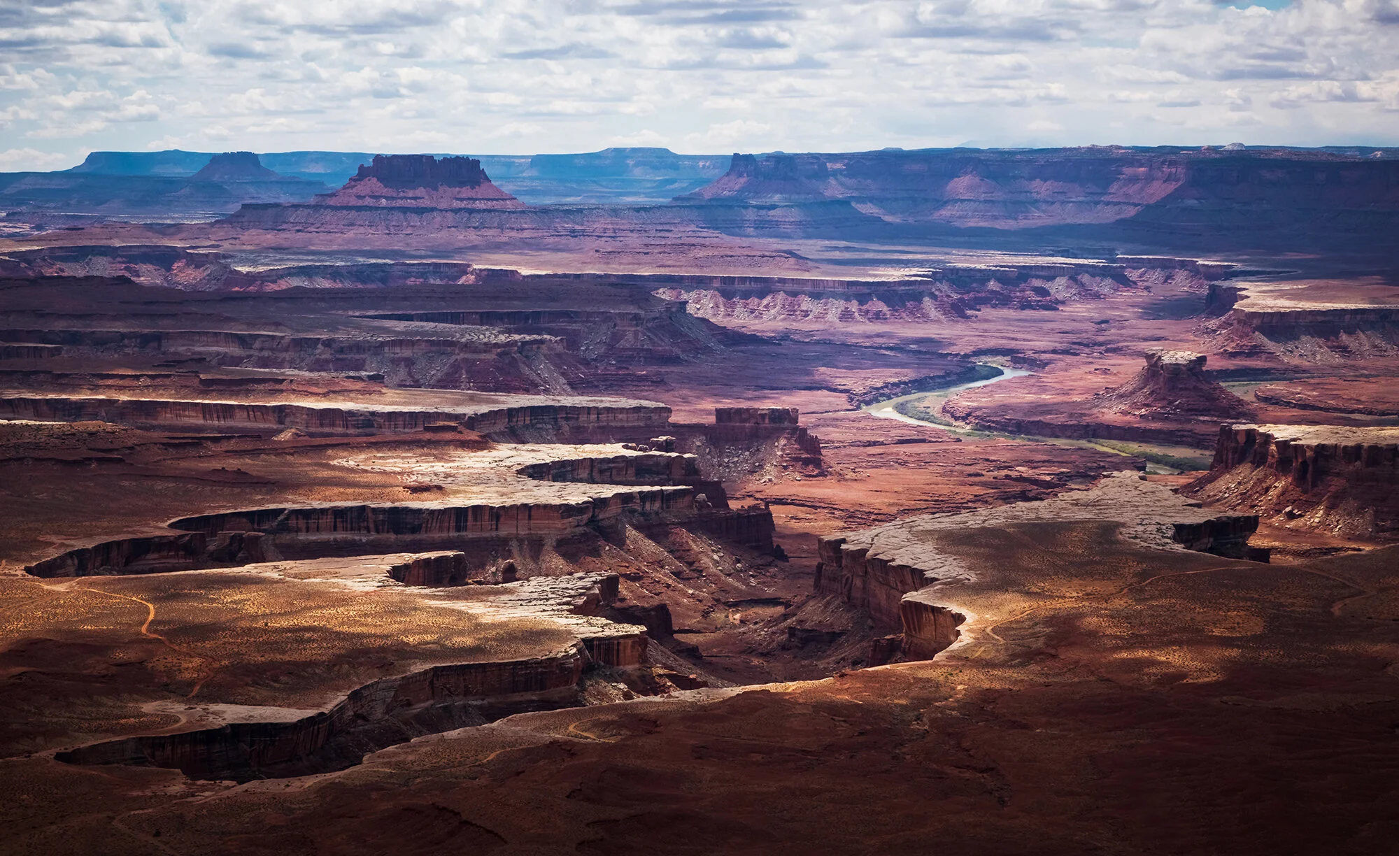
April 13, 2021: After a lovely day at Arches, we return to Canyonlands to see Mesa Arch and take a walk to Grand View Point. Back in town, we eat lunch at the same place we got ice cream two days earlier (why oh why?!). It’s my turn to be miserable, although my symptoms are a lot more vague and persistent than Jane’s food poisoning episode (indeed, I’m not fully myself until well after our return to Boston); Lindsey goes out to explore on her own.

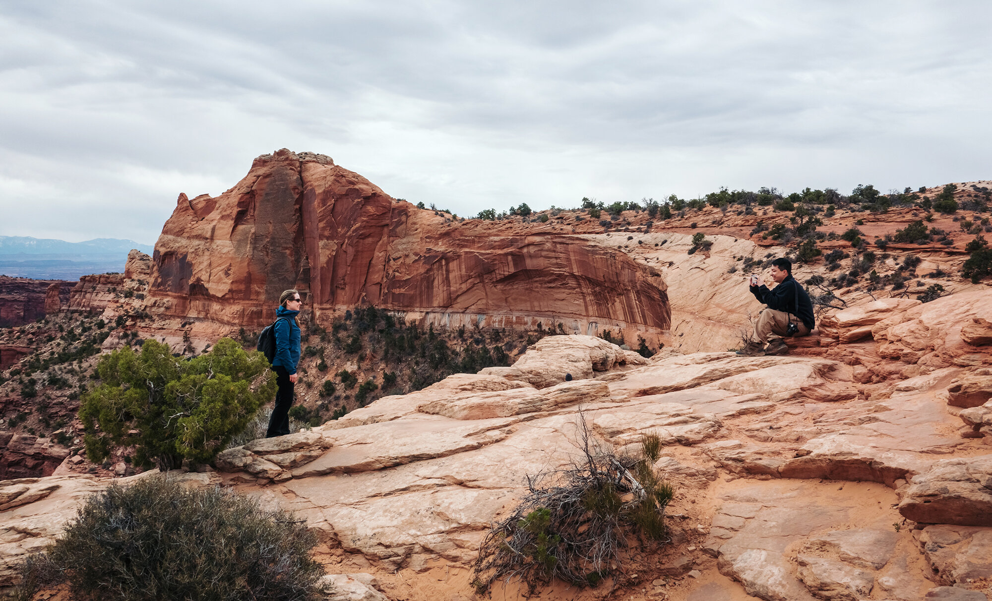
April 16, 2021: In between Longbow Arch and Delicate Arch, we trek out to Canyonlands one final time, photographing the Green River Overlook and taking a brief walk to a pair of Anazasi granaries near Aztec Butte.


Death Valley and Owens River Valley

On a trip home over the winter holidays, Jane and I took my mom and my sister on a 3-night trip to explore Death Valley National Park and the Owens River Valley. On the first day, we drive out of East Los Angeles in the morning, having lunch at the Arby’s in Baker in the late morning before turning north along the Amargosa Mountain Range. Evelyn drives us through the desert into the national park, where we stop at the visitor center to buy a fridge magnet and an American the Beautiful annual pass (for our upcoming trip to the Four Corners region in May 2020). We head northwest to Stovepipe Wells, and spend the late afternoon climbing up and down the sand dunes at Mesquite Flat. Despite the heavily trafficked, footstep-laden dunes, we get some great light along the alluvial fans to the west and southwest during the golden hour. We drive back to our little hotel room at Furnace Creek, and begin to work on our shipping box full of instant noodles, canned foods, and snacks.

On the second day, Jane and I go out for sunrise at Zabriskie Point without the others. True to the weather report, we have a gloomy, rainy day in Death Valley - a rarity. Sunrise is nonexistent, but I use the flat light to emphasize the shapes and lines formed by the wind- and water-washed badlands terrain. After a slow morning and a hotel room breakfast, we attempt to drive to Dante’s View (road closed due to the previous night’s snowfall) before circling around the Black Mountains and entering Death Valley proper. We stop at the colorful, oxidized hillsides along Artist’s Drive, at the bizarre salt formations called the Devil’s Golf Course, and at Badwater Basin itself. In the wet weather, the salt flats lack the beautiful geometric crystals and cracked mud that have come to typify landscape photography in Death Valley - but in exchange we get a nice, reflective surface that stretches across the valley floor. After sunset (again nonexistent), we drive back to Furnace Creek and wash the saline off our boots and pants.

On the third day, all of us return to Zabriskie Point to watch sunrise over Golden Canyon, the valley floor, and the Panamint Range. Having staked out a prime spot with my tripod, I’m giddy with excitement as Telescope Peak begins to catch the first pink rays of daylight; I use the wash down below as a leading line toward the mountains. After returning to our hotel, packing, and checking out, we top the gas tank and drive to the west, past the campgrounds at Stovepipe Wells and through the western edge of the Basin and Range province. The highway winds up and down the mountains, through snow-covered Towne Pass, the mud flats of Panamint Valley, and the high, Joshua tree-covered plateaus of the Argus and Slate Ranges. After two hours of driving, we enter the Owens River Valley and turn north from Lone Pine. We first tour the former internment camp at Manzanar before proceeding north to see an ancient petroglyph, carved by an ancestor of the Owens Valley Paiute over 8000 years ago. This site, closely guarded by the photography community, is unmarked and unprotected, so I will not describe its location any further here. Suffice it to say that it is not difficult to find - with some thoughtful sleuthing. At the end of the day, we return to Lone Pine and check into our rooms at the Days Inn.

On the last day of our trip, we drive to Movie Flats Road, in the foothills beneath the tallest peaks of the Eastern Sierra. There, we photograph sunrise on Mt. Whitney and Lone Pine Peak before returning for breakfast at the inn, followed by a long drive back to San Bernadino by the early afternoon.

Day 1: The Sunset Coast

For the last big trip of my residency years, Jane and I chose something a little closer to home: a one-way drive from San José to Los Angeles, winding down the continent’s Sunset Coast. Along the way, we would spend three days exploring what the Spanish explorers called “El País Grande del Sur” - the big country to the south of Monterrey, a beautiful place defined more than anything by its contrasts: inaccessible yet teeming with visitors, worldly yet utterly mystical - a borderland where the rocky, reef-strewn tide pools of the Pacific soar precipitously into the peaks of the Santa Lucia Range and the vast Ventana Wilderness. On the fourth day, we would drive down the Central Coast of California, to the outskirts of the L.A. megalopolis, a homecoming of sorts. The fifth and last day would see us boarding a boat from Ventura to Santa Cruz Island, to explore the largest of the Channel Islands before braving the evening traffic toward Orange County.

In hindsight, I have to wonder why we chose this trip, one among many possibilities in the planning folder. It wasn’t for novelty: I’d visited the Sur on a road trip with family as recently as the summer between college and medical school, and Jane and I had spent a day on Catalina Island as Ocean Bowl teammates in our junior year of high school, not far from the Santa Barbara Channel. For photography? Probably not - as much as I love a dramatic seascape, we ultimately chose California over two other options that would have been compositional gold - a return to Scotland for its Outer Hebrides, or a trekking tour for autumn colors in the Patagonian Andes. Of course, there was the issue of family. Aside from attending weddings or planning a wedding of our own, neither of us had spent any extended time in California since 2016. And yes, there is still joy to be found in each reunion with in-laws, relatives, and old friends - even as we silence the little voice that tells us, truly, that no amount of time spent together can erase the lives grown while apart. That “home” cannot be found where the heart no longer is.

Maybe in the end, for lack of a better explanation, this trip was some sort of last, heroic attempt to fall back in love with the state that claims both of our childhoods. A subconscious effort to let visual and experiential beauty persuade us, perhaps, to return - in spite of all that we ‘d seen, lived, and loved in the intervening decade, and all that remains to be seen in the coming years. Were it only so simple.

An early morning flight from Baltimore and a connection in Detroit leave us in San José by mid-morning, Pacific time. We’re fully rested, each rolling a single suitcase with a few changes of clothes, wearing partly empty backpacks with hiking gear and some work material for our time at home. No check-ins, no passports. Truth be told, we’re unused to such a casual pace on day one of vacation. We amble out of the airport terminal and catch a shuttle to the rental car office. Jane watches, bemused, as the desk clerk slowly, slowly… slowly processes our reservation while an irritable line of customers piles up behind me. On taking the elevator up to the parking garage, we discover that my economy-size car has been upgraded to a full-size, 4x4 black Jeep Wrangler, the largest car I’ve ever driven. There’s a full step to climb into the cab of the vehicle; it takes me several attempts - and a few days of habit - to consistently wind up in the driver’s seat facing forward. We ease the car out of the parking garage and into the California sunshine, following the highway south of San José through the rolling green pastures of the Santa Clara Valley. As Jane and I search for something good on the radio, the road takes us past carefully irrigated farmlands and oak-lined creeks, cutting through coastal hills to arrive at the seaside just north of Monterrey an hour later.

We continue through the town of Carmel-by-the-Sea, stopping at its Spanish-styled Safeway grocery store to buy everything we need for the next three days: a bag of oranges, a bunch of bananas, six-packs of chocolate milk and apple juice, a few bags of pea crisp snacks, two loaves of focaccia bread ( jalapeño-cheddar and olive-parmesan), and the fixings for three nights of instant noodle dinners (complete with cans of corn, spinach, carrots and peas, tuna, and my favorite - a hunk of low-sodium Spam). Fully stocked, we continue south, bypassing Point Lobos State Natural Reserve (which is completely full, even at midday on a Tuesday). Past the gated seaside communities of the Carmel Highlands, Highway 1 swings toward the ocean and hugs the rocky shoreline. For the next 70 miles, it holds tightly to its Pacific embrace, climbing, dipping, and swerving along high cliff edges in one of the most harrowing, most beautiful stretches of road in the United States. We follow the road into the fabled land of Big Sur.

For our first stop of the trip, we leave the car on the west side of the road across from Soberanes Canyon, and spend the afternoon exploring the foot trails that crisscross Soberanes Point. It is springtime in the Sur; the weather is brilliant and breezy, and the lush hillsides are covered by blooming coastal wildflowers - quite different from the tawny, bronzed ranges that I remember from our family trip in 2012. As I point my camera along the wave-battered shoreline, I’m greeted by a world of color: the cerulean blue of the Pacific on a sunny day; the bright golden bunches of mustard flowers; the rust-red and olive-green hues of the succulent ice plant, its carpets spreading along the cliffs; all punctuated by clusters of delicate morning glory and stands of audacious poppy flowers. We walk along the coast, through a grove of cypress trees, and out along the bluffs to the seaward edge of Soberanes Point. Through her binoculars, Jane watches seabirds diving from the top of Lobos Rock, and spots a mother-cub pair of sea otters bobbing placidly in the cove. They get spooked when Jane calls me over; the tiny brown heads vanish underwater, re-appearing in the distant surf a full minute later.

Coming back from the Point, Jane and I circle the base of the hillock known to locals as the Whale’s Hump before we return to the car. We continue south, stopping for a brief walk down Doud Creek to the surf at Garrapata Beach. We’re a few weeks too late for the lily flowers in this narrow valley, which are well past wilting on the stem, but the abundance of spring wildflowers is more than adequate compensation. Further south, we stop at the roadside above Notley’s Landing to re-create a shot I took in 2012, of a sea arch with the Rocky Creek Bridge in the distance. We drive over the famous Bixby Creek Bridge, nowadays more of a spectacle for its throng of selfie-snapping tourists than for the grandeur of its architecture. We take our own selfie a little further down the road, at the high overlook of Hurricane Point.

For our last roadside stop of the afternoon, I set up the tripod on a shoulder of the road overlooking the Little Sur River Beach. This beautiful viewpoint, though enclosed by a private property fence, is a terrific place to work at sunset, with its sinuous river curve, its picturesque dunes and driftwood, and a foreground of vibrant pink ice plant flowers. Jane and I sit on the asphalt as I shoot a timelapse into the early evening. Feeling worn from a long day of travel, we leave a few minutes before sundown proper, speeding south past the Point Sur Lighthouse, past the green cattle pastures of the Sur Ranch, and past orderly rows of Monterrey pines silhouetted by the setting sun. The highway turns inland here, entering Big Sur Valley, with its eternal shroud of mist and its ancient groves of coastal redwood.

At the Big Sur Lodge, our destination for the next three nights, we check in at the main office, receiving our cabin key and a complimentary bottle of red wine (ultimately passed on to Jane’s parents a few days later). As we slowly wind up the narrow lane road toward our lodging in the twilight, dodging tree trunks fatter than our Jeep, the scene reminds of something out of Jurassic Park. Fortunately, we crest the hilltop to find not a twenty-foot-tall predatory reptile, but rather a line of cabins set pleasantly against a towering canopy of redwood trees. We park outside our cabin; I unload the car while Jane boils water for an instant ramen dinner, which we enjoy while the light fades from the evening sky.