Day 7: The Moorland

“The dig was not far from the village. It was situated where the old marine terrace gave way to rolling, empty moorland. Here, the ground became boggy under the interminable light of arctic summer, and the wind was always whipping across the treeless expanse, carrying with it the faint smell of salt and sea in the distance. Even up here in the moors, you never felt far from the ocean, nor could you ever forget its presence.”
-
Opening lines, Jordan and the Milky Way Sutra

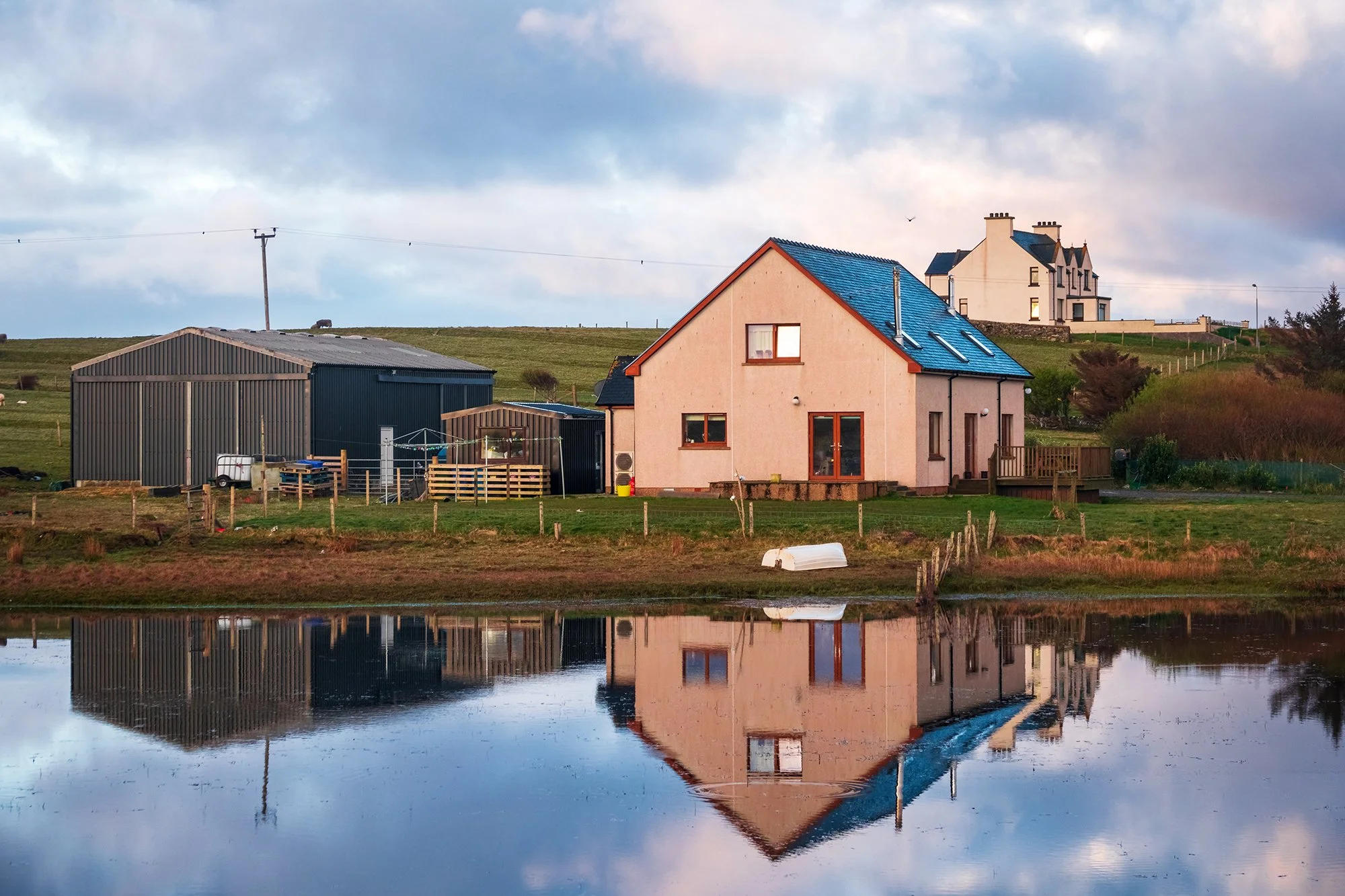
My final full day of the trip. Today will finally see me finishing my tour of Harris and Lewis, having gone from their southern terminus (Rodel) to the very northern tip at the Butt of Lewis. I sleep in a bit, but am still up early enough to drive out for sunrise scenes in the villages to the northeast. From the far side of a nearby pond, I shoot the stately church in Cross; the air is calm (a genuinely rarity in these windy parts), and the village buildings are cleanly reflected in the pond’s surface. Walking back to the car, I see grey rain clouds developing off the coast to the northwest, while the sun rises progressively higher in the east. Recognizing an opportunity, I drive on to a smaller single-track road (the Cross-Skigersta road, which parallels the two-lane highway into Ness), and am rewarded when a beautiful and tall rainbow forms between the bands of sunlight and smirrs of rain. On the smaller road (and on a lower elevation than the main road), I am able to pull over more casually and hunt for interesting foreground subjects to pair with the weather. I find such a subject: a ruined, derelict house with a classic red telephone box (also ruined) standing by its side.

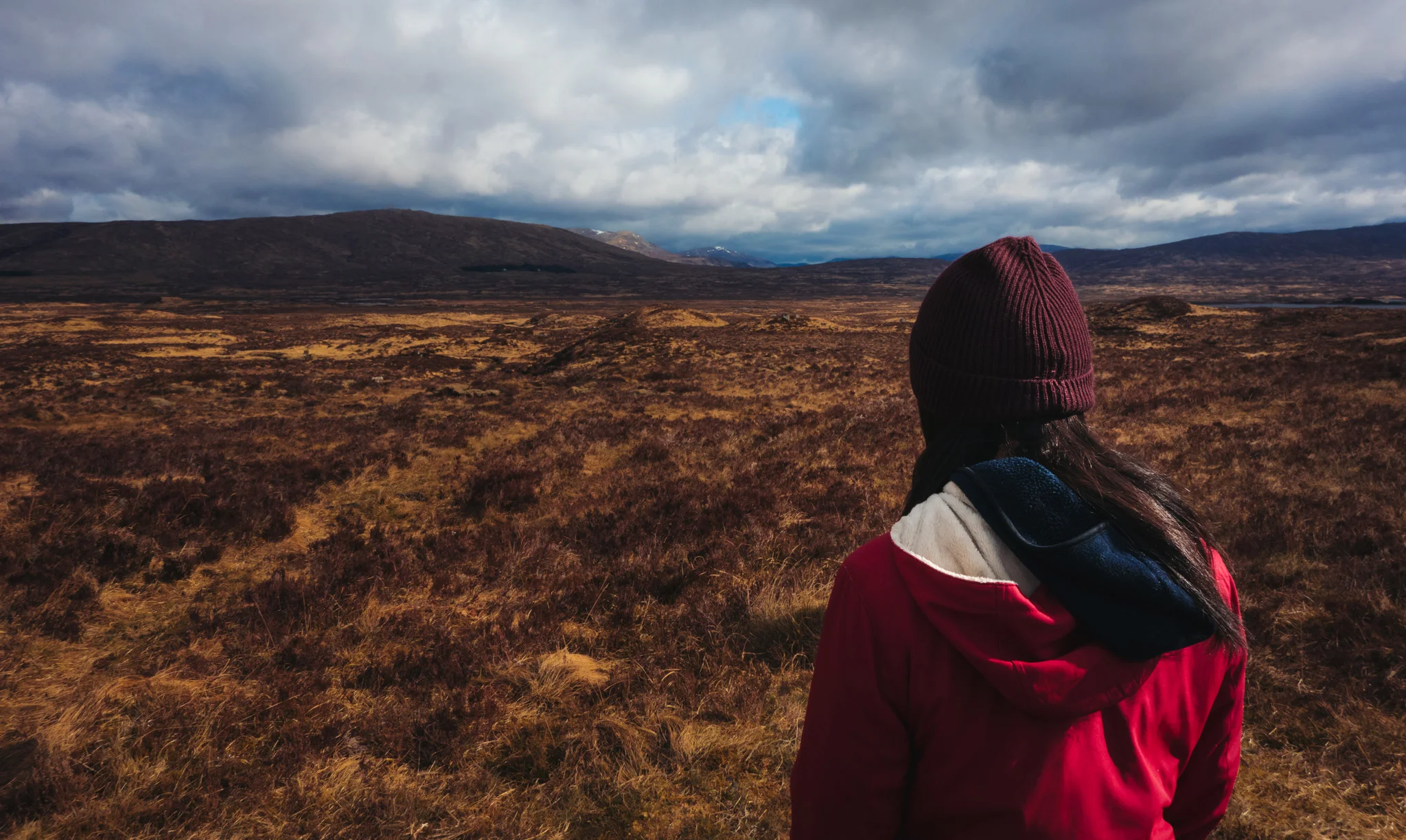
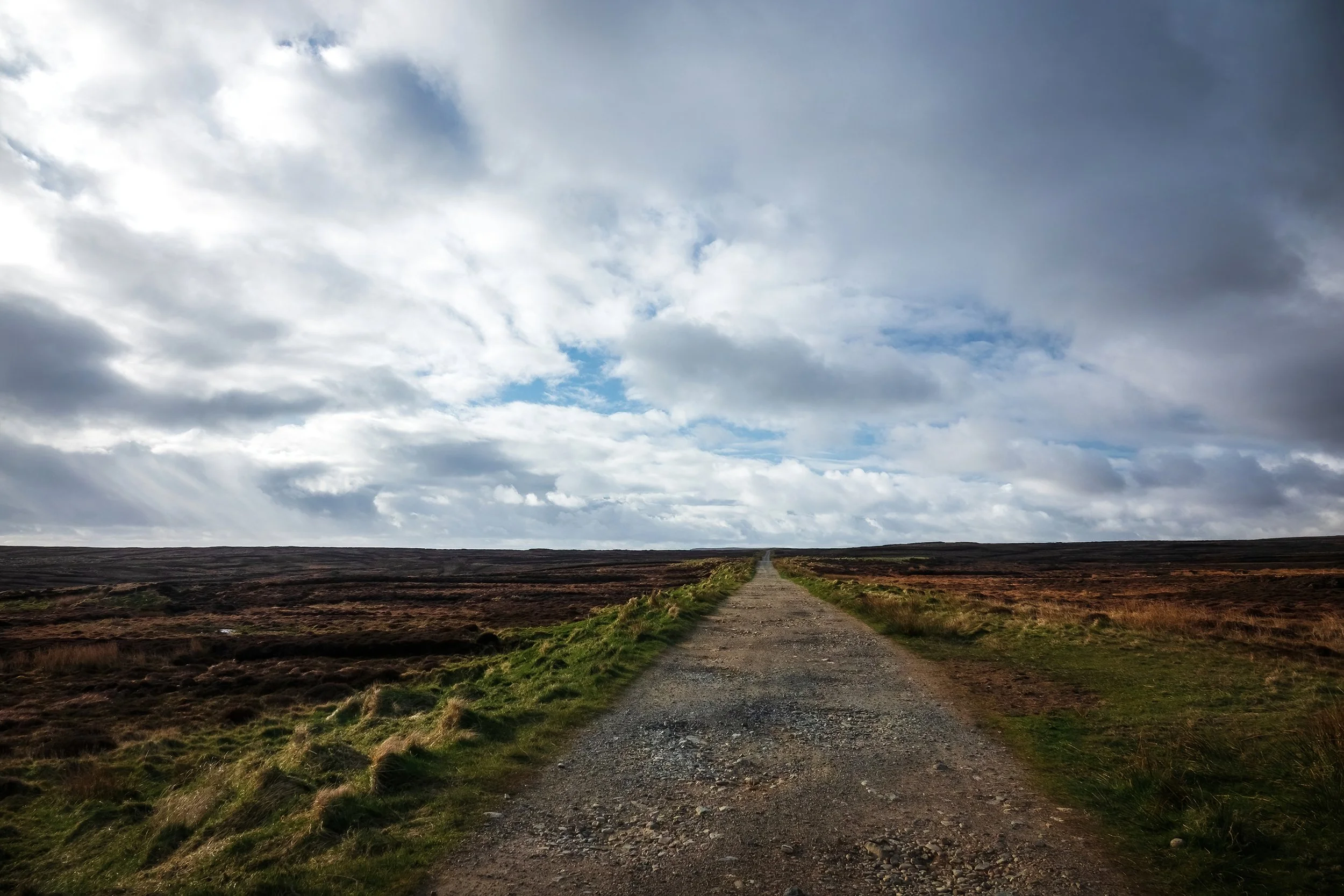
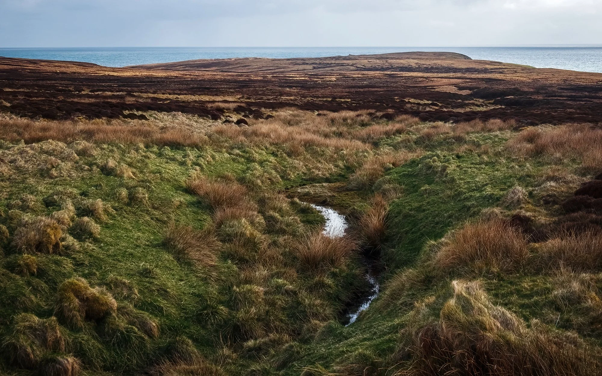
To the east, I visit the tiny settlement of Skigersta, stopping by the boat jetty to photograph the cliffs, as well as the nearby, stone-cold white house overlooking the ocean, which was writer Peter May’s inspiration for protagonist Fin’s aunt’s house in his Lewis-based mystery trilogy, which I have been reading during this trip. After another viewpoint in nearby Adabroc (again making use of the rainbow) and a bathroom break by the breakwater in Ness - then I head south from Skigersta to walk a stretch of the Ness-Tolsta Heritage Trail, a long unfinished road into the moorland that runs down the east coast of the island. The road, such as it were, leaves Skigersta and passes through the miles of peat banks outside of the village. On either side, I see the neat channels, lined with freshly cut blocks stacked atop one another, drying in the sun. There are locals at work in the fields, stacking the finished blocks onto their trucks. It’s hard work - the dried, compressed plant matter (which forms inch by inch over the years as dead plants accumulates faster than they decompose in the wet, anoxic bogs) is light, and burns easily, though it can take over a hundred thousand blocks to heat a home through the winter. Gas and electricity prices being what they are on the island, it’s unsurprising that many households still use this ancient source of fuel. In the distance to my east, the land terminates in the ocean, and there are no outlying isles or silhouettes to see here on the horizon, for aside from Cape Wrath and the Orkney and Shetland Islands (far away to the east across the Minch), I am near the northernmost limit of Scotland.

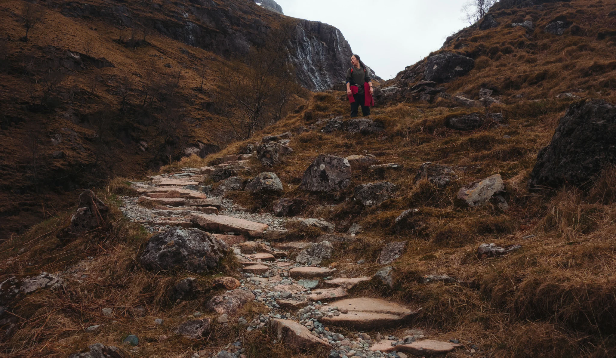
After over two miles of easy walking along the gravel, the road curves around a rise and descends to a small cluster of summer shielings (an airidh) - outlying huts used in the past by families moving their animals between seasonal grazing grounds. After a stream crossing, the road terminates, and I quickly find myself walking a fairly minimal path through the bog (albeit marked intermittently by trail markers, which seem almost to be taunting one from afar across the undulating, wet terrain). Although my hope for the morning was to reach the ruined chapel of Filicleitir (which I can see on a distant cliff, barely half a mile away), things soon take a nasty turn when I misjudge a small stream crossing for a patch of moss-covered solid ground, immediately find myself almost waist-high in surprising deep, peaty water. Hauling myself out of the pool using some nearby heather, I re-assess the situation and decide to return to the car as quickly as possible to change out of my wet clothes and boots. Thankfully, it’s a fairly clear and (by Lewis standards) temperate day, and my camera and phone are still working well enough. Nevertheless, what felt like a survival situation for a few seconds soon becomes a hilarious and humbling reminder about the difficulties of wayfindjng in the moorland. I stop by the shieling village, using a convenient bench to take my water-logged boots off and wring out my socks, before power-walking the rest of the distance back to the car. The brief car ride back to Galson is a smelly one (coated and permeated as I am by bog aroma and fine particulate plant matter), and I spend most of the afternoon hand-washing my clothes, spraying down my boots, and hanging everything up to dry as best it can before my flight home on the morrow.

In the early evening, after a bit of rest, I head out again (donning the still-damp boots) to see the final few sites of the trip. At the northernmost point of Lewis, I stop by the lighthouse to watch the crashing waves and the marine birds circling the rookery on the nearby rocks. Nearby, I leave the car in the village and visit St. Moluag’s Chapel, located down a long, daffodil-lines grass walk in the outskirts of the settlement. The church is deserted at this hour, but its cold stone interior feels oddly comforting to me - a break from the wind and the gloom developing outside. I sit for awhile in the pews, and photograph the stained glass behind the altar before moving. Finally, I move down the road to the dunes overlooking Eoropie Beach, where a very subdued sunset is beginning. Rather than walk out to the beach, what catches my eye is the children’s playground overlooking the dunes. Perhaps it’s because of my fatigue and damp boots, or perhaps it’s because I’m at the end of my week-long trip, and missing Jane and Jordan more than a little bit. In any case, I step into the abandoned playground and make its equipment - the swings, the seesaws, and the little merry-go-round - the subjects of my final sunset shoot, and my last photographs of this unforgettable trip.

The next morning, it’s a mid-morning drive over the Barvas moor, passing roadside by the small shieling with a green tin roof (a place of significance in Peter May’s novel The Blackhouse - where protagonist Fin was orphaned by a motor vehicle accident). In Stornoway, I pass the remainder of the morning sitting by the harbor relaxing in the car, as it’s raining in earnest and I have no desire to put on my boots any sooner than I have to. Then, after a lovely lunch of fish and chips at Cameron’s Chip Shop, it’s out of town and to the airport - three flights and a long journey home to be reunited with my lovely ones.

“He who farthest away did e’er roam // Am fear is fhaide chaidh bho’n bhaile
Heard the sweetest music on returning home // Chual e’n ceòl bu mhlis’ nuair thill e”

- Gaelic saying

Day 1: The Trossachs

We are landing again on the southwestern tip of Iceland, one year and one month later. This time, the sun is already rising, and from the airplane window I can see it cresting the mountain ranges and moss-covered lava plains that lead to the island's interior. As we disembark onto the tarmac, I feel the fresh morning air admixed with a flurry of ice descending out of a completely clear, warm sky. It is good to be back north.

This time, we are destined to never leave the airport terminal. We buy two cups of skyr and a pair of ham sandwiches, and munch as we wait for our short flight into Glasgow. Most of the planning for this trip has taken place over the past year, but my minor obsession with the Scottish highlands and islands dates back to high school, when KT Tunstall was making waves in the continental music scene and before the Skye Bridge was toll-free. I remember this because the Isle of Skye was the first place I looked for when Google Maps was launched, and I can recall staring dumbfounded at its topography, plotting driving routes from the south, and thinking, "Yeah, that'll never happen..."

Almost a decade later, I am three weeks from receiving my medical degree, and we are pulling out of a Glasgow airport parking lot in a shiny diesel-engine Mercedes Benz, which the Hertz representative swears is a free upgrade. Quite atypically, we take out an insurance policy. "Drive on the left," he says helpfully. (We will become quite used to this phrase over the next ten days. Translated from the native Scotch: "Have a lovely trip, y'bloody Yanks!")

I am fine driving on the left after New Zealand, but I still manage to give Jane a few blood pressure spikes as we leave the airport, where each country's most convoluted roundabouts and traffic flow patterns are always conveniently located. We drive north out of Glasgow, stopping first for groceries at the Morrison's in Dumbarton. Loaded down with juice boxes, chocolate milk, a bag of clementines, tuna and sweetcorn sandwiches, and several bags of sausage rolls and mini-pies, we continue on toward Loch Lomond National Park; it is just past noon. We soon turn from the highway onto a two-lane country road. Jane is fast asleep as we wind through the mountainous eastern half of the park, through the raised meadows and old fir forest glens of the Trossachs. Just beyond The Duke's Pass and on the north shore of Loch Achray, we arrive at the trailhead for our single walk of the day - a 3-mile climb up to the summit of Ben A'an ("Pointed Peak" in Gaelic).  Jane sleeps an extra ten minutes while I try to figure out how to use the pay machine in the parking lot.

We set off on the diversion route toward Ben A'an (the regular route has been closed for the past year due to repairs and forestry activities). Here, there are no trail blazes and, most of the time, no obviously maintained path. Jane quickly finds herself mired in mud; we will both come out of this trip with a healthy upgrade to our pathfinding skills and our ability to navigate boggy terrain.  Boots sucking and squishing in the peat, we proceed through the upland forest. The trail soon climbs along rocky dirt slopes with the aid of hand-ropes tied between tree trunks. Just over a mile in, we turn onto the original track up the mountainside. Below the main body of the mountain, we reach a clearing with beautiful views of Ben Venue to our southwest and the woodlands to our south.  We stop to hydrate and watch a group of walkers play with their dogs, before starting the final climb up a tall, stone staircase.

Jane climbs ahead as the grade steepens, and I realize that I am not nearly as in shape as I want to be. At some point a fluffy gold terrier bypasses both of us, happily leaping from stone to stone, its belly fur matted with dirt and mud. It takes a liking to Jane and waits for her to catch up before proceeding, turning around every few steps to watch her with ears perked.  It is adorable but humiliating; we are being outclassed on the mountain by a ten-pound lap dog. Near the summit, we crest the spine of the mountain to reach a cairn site with sweeping views of Loch Katrine to our west, surrounded by an amphitheater of wooded hills and heathery mountains. It is mid-afternoon, and sun shines down in spotlights across the lake and on patches of barren hillside. Our friend the terrier watches me set up my camera gear before catching sight of its owners and running up the mountainside. We take some photos together before continuing to the summit, where there are a few hikers sitting among the rocky crags.

Back in the car, Jane promptly falls asleep as I drive us north to the village of Crianlarich. On the outskirts of the village, across a fenced-off plot of pastureland at the foot of the mountains, we pull off the highway into a long driveway lined with bright golden daffodils, which leads to a charmingly rustic, two-story house nestled into the hillside. As we park our car and step out, we hear the tinkling of the little creek in the glen beside the house; smoke is drifting out of the chimney, and the sun is setting on the moss-tiled roof. After filling out our breakfast card, we spend the night at the Inverardran House, where we sleep very, very well.

Day 2: West Highlands

The next morning, we wake to a full breakfast of coffee and tea, juice, milk, and toast; bacon and sausage, fried eggs, grilled tomatoes and mushrooms, baked beans, and grilled slices of black pudding. I have never had the latter, but it is delicious - crunchy, and reminiscent of but more strongly flavored than Taiwanese pork blood cakes made with rice. Our innkeeper is evidently impressed by my culinary openness. "Next you'll be movin' rae on to haggis, no?" he says with a hearty guffaw. "We'll see about that," I say cautiously. After breakfast, we bid farewell to our host ("Drive on the left!" "We'll try!") and load up the car.

Leaving Crianlarich, we continue north over a mountain pass and into a broad glacial valley. The hilly forests of the Trossachs are now behind us, with the exception of the occasional clearcut stand of young pine trees lining a hilltop, its boundaries neat and sharp. The road curves through a wide expanse of moorland dotted with eutrophic lakes and lone trees, a landscape so flat and desolate that the distant mountain glens seem to tower over us from miles away. We stop at several places on the roadside, and climb a small hill with an eastern view. Below us, Rannoch Moor stretches far away across the western highlands, an endless wasteland of peat and bog that, on foot, would take you halfway across the breadth of Scotland in three days. We watch the fishermen on the banks of Loch Ba before continuing on.

We approach the mouth of Glen Coe, the glacial trough that connects the West Highlands with the sea lochs to the north, a relic of an ancient tendril of ice not unlike the ones now carving out the highlands of Iceland.  This is a valley steeped in the history of the highland clans, an enduring symbol of avarice and betrayal after the massacre of the MacDonald clan by Campbell clansmen as the former sought shelter with the latter during a winter snowstorm. It is an ancient home of a now-displaced, proud people - a place of incredible pain and beauty.

Off a side road, we stop the car under the mighty Buchaille Etive Mòr ("The Great Shepherd of Etive"), the imposing guardian of the east entrance to the Glen. At the foot of the mountain, we creep down to the riverbed, and I take some long exposures of the stream where it trickles and gives tribute to the River Etive, which then flows through Glen Etive to the southwest.

Back on the highway, we head into Glen Coe proper, a valley nestled between the massif of Bideam nan Bian ("Peak of the Mountains") to the south, and the imposing rock wall of Aonach Eagach ("The Devil's Ridge") to the north. We leave the car at the trailhead and join the path that cuts through the glen. A bagpiper is playing at the parking lot overlooking the landscape, the instrument's mighty blasts echoing up and down the valley. On a footbridge, we cross over the River Coe and soon begin climb out of the valley. Past a gate in the sheeps' fence, we continue upriver along a steep, wooded ravine between the eastern two of the Three Sisters: Beinn Fhada ("Long Hill") and Gearr Aonach ("Short Ridge"). Passing waterfalls and stream crossings, we skirt the cliffs, hopping over granite boulders and glacial erratic as we go.

Near the top of the ravine, the path narrows into another stone staircase. Jane climbs ahead (again I am gasping for air) and soon disappears over a shoulder of rock. I follow;  suddenly, the staircase terminates and, in one of the most dramatic unveilings of landscape I have witnessed, the view opens into Coire Gabhail ("The Corrie of the Bounty"), a glacial cirque nestled in the heart of the mountain massif. An ancient landslide blockaded the valley entrance, forming a hanging mountain lake that, over time, bled out of the ravine we just ascended. The result is a flat alluvial plain hidden high and deep within the mountains, accessible only by a narrow cliff path from the bottom of Glen Coe - hence its English name, the Lost Valley. Its Gaelic name stems from its use by Clan MacDonald - as a hiding spot for cattle and livestock pilfered from surrounding settlements (and then as a human hiding spot after their 1692 massacre). Still catching my breath from the climb, I struggle to imagine leading a herd of cattle up the ravine path.  A light flurry of snow, alternating in true northern fashion with glorious beaming sunshine,  begins to blow down from the mountains. We sit and admire this lonely, beautiful place, letting the tiny flakes of snow cool our faces. After awhile, we begin our return descent. It is much more pleasant than the climb, with the distant bagpipe slowly fading in nearly a mile away, and views all the way across the glen to the A82 highway, looking ever-so-tiny beneath the mountain walls.

Continuing west, we exit the glen and stop by St. John's Church in the tiny village of Ballachulish. We walk through the cemetery and enjoy the view of the loch beyond the church; it is still too early to see the bluebells which carpet the church grounds and bloom in early May. Heading north now, we cross a bridge over a sea loch and enter the town of Fort William a little past noon. We stop again at Morrison's, re-supplying with sandwiches, juice boxes, and dessert pastries. In the back seat of the car, I munch on a BLT while Jane eats a tuna sandwich. We finish off lunch with a few clementines before continuing north on the A82. Jane falls asleep (again) as I drive us across the western highlands, passing silver-blue lochs and tawny hillsides covered with patches of clear-cut forest. At Invergarry, we turn west onto the A87, which runs to Kyle of Lochalsh, across the Skye Bridge, and ultimately to the northernmost tip of Skye. The route feels strangely familiar to me - the one that I so feverishly plotted back in high school. "I can't believe we're doing this," I remember thinking in the car. "We're going to Skye."

But not yet. At Shiel Bridge, we turn off the highway, onto an old, one-lane road that was used for transporting troops and materiel during the Jacobite uprising, and for centuries before that, for driving sheep and cattle along the ancient road to Skye. We creep up the winding mountain road through the Ratagan Pass; I become proficient at flicking the headlights on and off (the controls are located away from the steering wheel in the Benz), to signal oncoming cars that I will wait for them in a turn-off, and that they have the right of way. We stop at a mountainside viewpoint which looks out over Loch Duich and the Five Sisters of Kintail, before continuing down into the valley and toward the village of Glenelg.

On the outskirts of the village, we turn into a gravel driveway at the Balcraggie House, a lovely two-story building surrounded by sheep pastures and a little yard with a tire tree swing. Before I even turn off the engine, we are greeted by our hostess Donna Stiven and Bessie, her Scottish collie.  She shows us to our upstairs room, with its lovely blue walls, bookshelves covered with novels, and electric fireplace. We drop off our bags and get a drink of water. Donna confirms our dinner reservation at the Glenelg Inn and looks over our afternoon walking route before we head out again. In the yard, Bessie runs after us and perches herself up on the stone wall by the side of the road,  herding cars as well as sheep.

We continue on into Glenelg, driving south on the one-lane village road as it winds along the western coast of the Scottish mainland. Across the kyle (narrow strait), the Red Hills of Skye rise up over the horizon, silhouetted by the falling afternoon sun.  We pass cute little white houses, fishing boats, and a backyard with an emu. A few miles south of the village,  we stop on the side of a forestry road and begin our walk down to the bay of Sandaig (Norse "sand bay"). We walk along the forestry gravel path, around and down a bleak hillside of recently clearcut forest. A few European swifts flit about the path as we walk, looking for home among the felled logs; the view opens up, and a grey heron flies overhead as we descend toward the sea. The path brings us around and over the bay, and we come at last upon the place that author Gavin Maxwell made his home. He called this Camusfeàrna (bay of alders), and he retreated here for nearly two decades to commune with the nature of Scotland's western coast, raise a succession of otter companions, and chronicle his life in the Ring of Bright Water trilogy. I read Ring approximately one year ago, when we first began planning for this trip, and in a way, we are here solely because of it. I wanted to see the quiet, little place that Maxwell grew so attached to, because in Maxwell's writing, I discerned something that I know very well from my own life:  that landscape can change a person, mold his dreams and aspirations, and grant powerful perspective on his place in and relation to the rest of the world.

We descend to the shore and walk through the wild grass around the abandoned bothy in the southern corner of the bay (not Maxwell's cottage, which burned down in1968).  Jane walks across the field to inspect the gravestone under which Maxwell's ashes are buried, next to a lone pine tree (replacing the famous rowan tree which also burned down) under which his otter Edal is buried. Upon Edal's stone is inscribed the following: "'Whatever joy she gave to you, give back to Nature.' - Gavin Maxwell." The stone is covered by scallop shells, limpet shells, smoothly rounded stones from the sea; old ship rope, a conch, a dreamcatcher. Items foraged from the coastline, just as Maxwell would have done. Jane inspects these silently as I walk back toward the bay. We stand together on the shoreline, watching the quiet, tiny waves lap up on the sand, at the place where the stream surrounding the cove, like a "ring of bright water", curves into the sea. The waterfall which feeds into the stream, somewhere out of view in the valley behind us, roars steadily, constantly, and gently; Maxwell wrote, "It is the waterfall, rather than the house, that has always seemed to me the soul of Camusfeàrna," and I can understand now why he felt so.

In hindsight, I should have proposed to Jane here, in a quiet, secluded bay with the waterfall roaring and my tripod set up far, far away. But the ring box is sitting in my bag at the Balcraggie House, so we stand for awhile, watching the sun set, before crossing the stream and returning uphill via a (not-so-)forested path. I film Jane as she crosses clumsily via a rope bridge; she gets the last laugh as I slip and plunge my entire boot into the running water. Soggy socks in tow, we head back to Glenelg for dinner.

At the Glenelg Inn, we find the table that Donna has reserved for us, and we order starters of mackerel pate and fresh scallops from Skye; main courses of seared monkfish and slow-roasted cheek of beef. It is a welcome change from tuna sandwiches, grocery store pastries, and juice boxes. At the bar, an acoustic band is playing covers of KT Tunstall, and a blackboard on the wall advertises the inn's weekly Sunday roast. We enjoy our candlelit dinner before returning home. At the Balcraggie House, I hang my socks up to dry by the electric fireplace. Donna treats us to a pot of evening tea with homemade chocolate cake; we sit beside the fireplace in Donna and Ed's living room, over which is mounted a massive antique longsword. We chat with our hosts about Scotland, America, and American politics ("Oh, we are just as shocked and angry," we assure them regarding Donald Trump). I flip through a book of Scottish landscape photography while Jane, apparently feeling some level of inspiration, begins to read Ring of Bright Water. At 10 PM, feeling the wear of a long day, we retire upstairs, and I go to sleep while Jane continues to read.