Day 3: Three Lakes

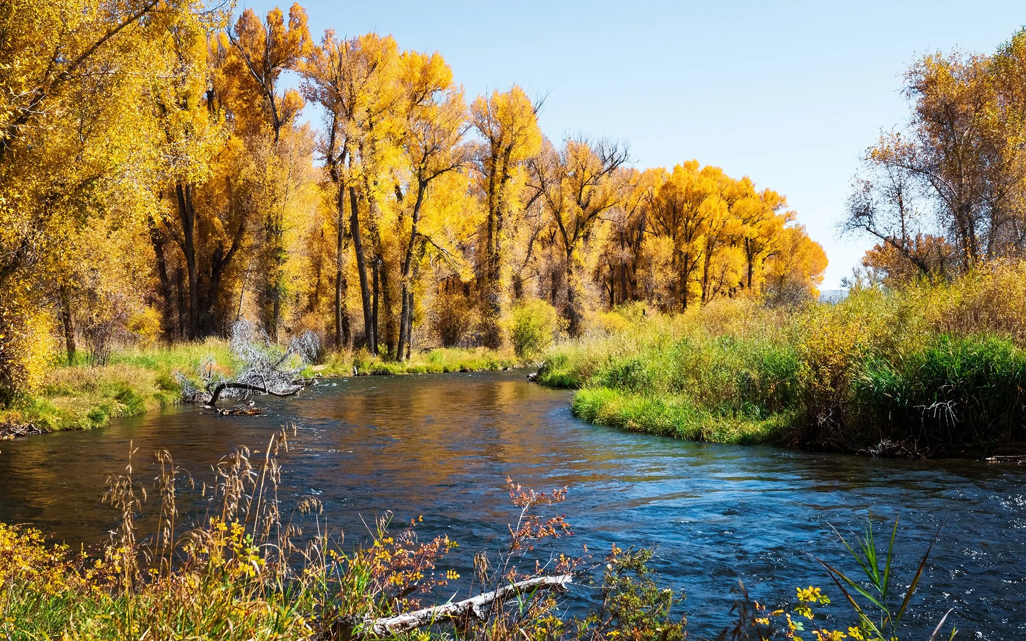
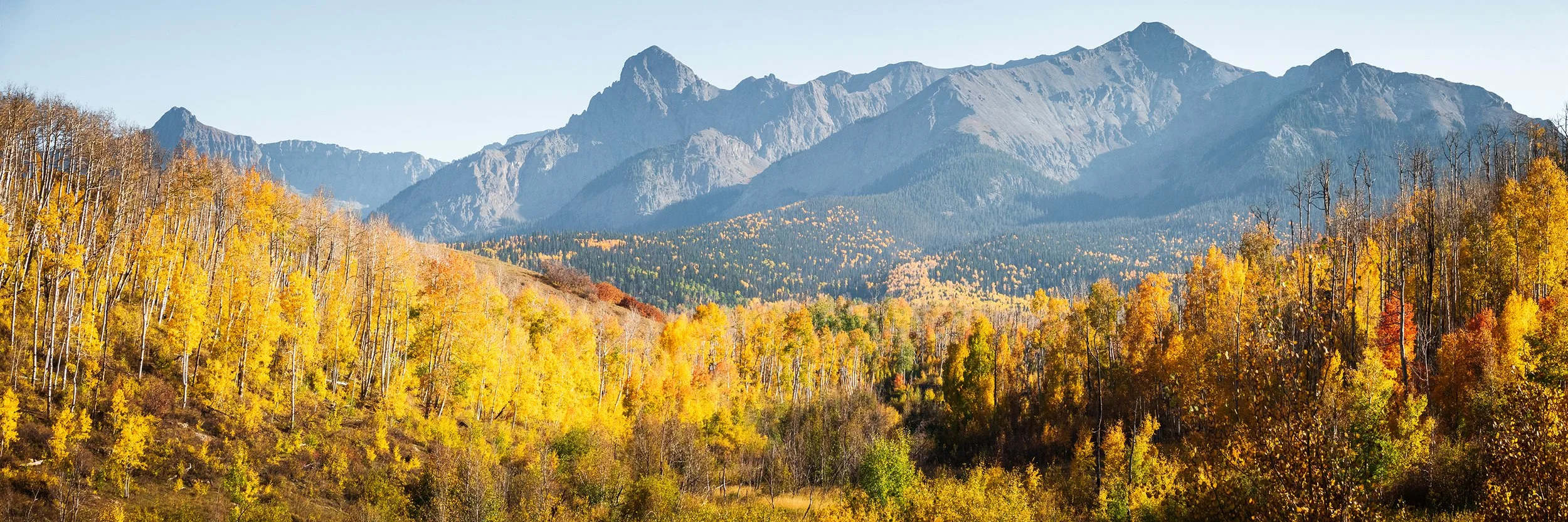
Monday morning. After many drives up and down the mountain pass from Crested Butte in the past two days, this morning marks my final outing to Kebler Pass. After this morning’s hike, I’ll be focusing more on the environs of Crested Butte itself in the afternoon and evening, and moving on westward to the San Juan Mountains tomorrow. For this morning, it’s an early start and a long drive from the guesthouse back up to Kebler Pass, and this time all the way to the Lost Lake Campground in the central part of the pass. It’s still dark when I pull into the parking area and pay the day-use fee, although the slightest glimmer of light to the east is beginning to reveal itself on the horizon. I’m here this morning to shoot sunrise on the flanks of East Beckwith Mountain, this time from the shore of Lost Lake Slough at the mountain’s base. In contrast to last night’s stunning golden hour light, there is only a whiff of cloud on the eastern horizon; the sky is otherwise a blank slate again. I set up my timelapse on the north shore of Lost Lake Slough, not far from the nearby campground, and then take my main camera for a walk along the shore, looking for interesting foregrounds to pair with the mountain and its reflection on the water’s surface. Eventually, sunlight creeps into the scene - first as a pink glow on East Beckwith’s summit, then as a band of fiery gold, lighting up the aspens on the mountain’s flank. As day sets in, I leave the water’s edge and set off on a loop hike around Lost Lake Slough and to two nearby lakes: Lost Lake and Dollar Lake.

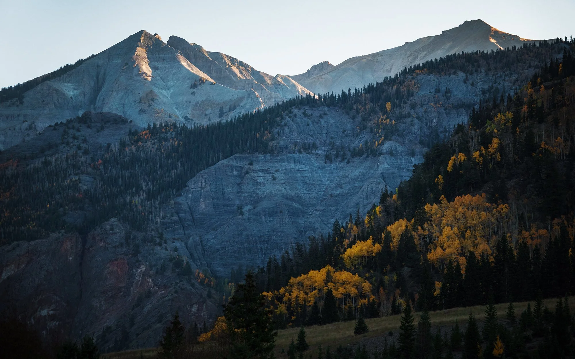
The walk is brilliant and beautiful this morning, and the air is crisp with the smell of evergreen needles and forest floor. The trail heads uphill from the Lost Lake Slough, cutting sequentially through pine forest and then aspen groves; the sidelight coming through the trees is mesmerizing. Up at Lost Lake, it’s daylight in earnest, and I choose to take a brief detour to circle the little lake and photograph both shores reflected in the water. Crossing Middle Creek near its inlet with Lost Lake, I briefly stop to admire a nearby waterfall before continuing uphill to the top of the hike. Here, the trail crosses a scree slope dotted with pines which opens out above the forest, onto a fantastic panorama of Lost Lake Slough below, and Marcellina Mountain in the distance. I stop here for a water break and a series of photographs - the latest in this blog’s grand tradition of “Taking a Photo of My Parked Car from a Very Faraway Place.”

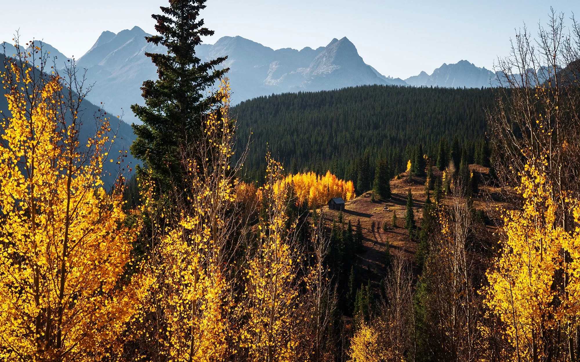
Above the slope, I come to a trail intersection and diverge for a short distance further uphill to come to the shores of Dollar Lake, a magical little lake tucked against the flank of East Beckwith Mountain, where the autumn colours and the admixture of deciduous and evergreen forest is again beautifully reflected in the water. Then, I retrace my steps back to the intersection and make the long downhill run back to the opposite end of Lost Slough Lake, returning to the car after what feels like an interminable series of switchbacks and stream crossings.

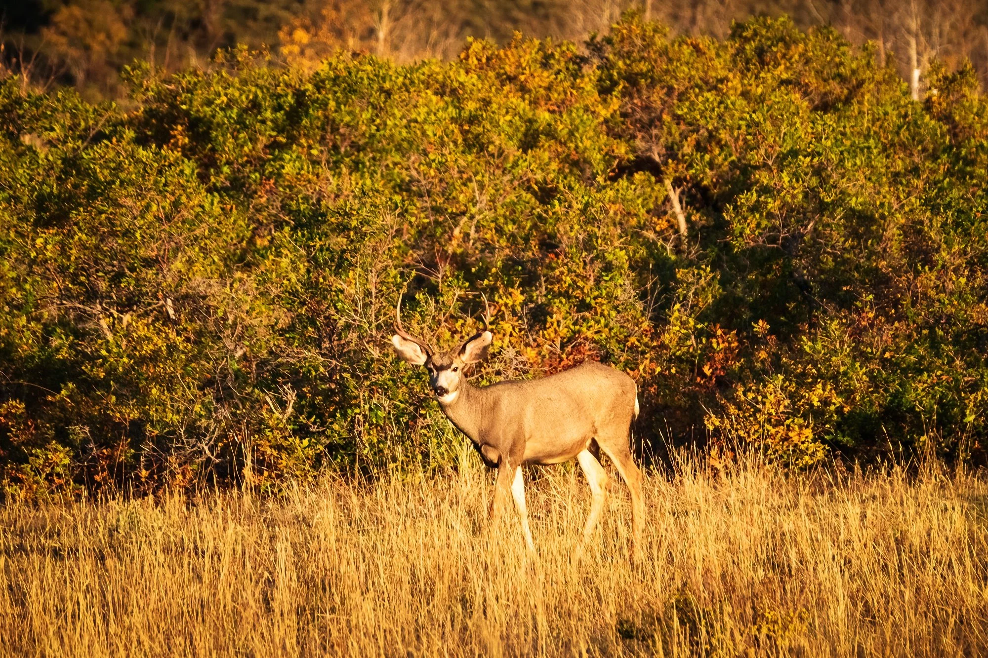
Mid-morning now. With the sun glaring above in a cloudless sky, rendering foliage photography difficult, I choose to leave Kebler Pass behind for the final time, making my way back to Crested Butte. Along the way, I scout for a good sunset spot in the hills above town, and then proceed back into civilization to grab a nice brunch (bacon, eggs, pancakes, and juice) at McGill’s on Elk Avenue. Sated and happy, I wander down the street, photographing the storefronts beneath the looming peak of Crested Butte, and stopping into a souvenir shop to pick up this trip’s magnet - a cute whitetail deer for Jordan. Then, it’s back to the hotel to rest for the afternoon.

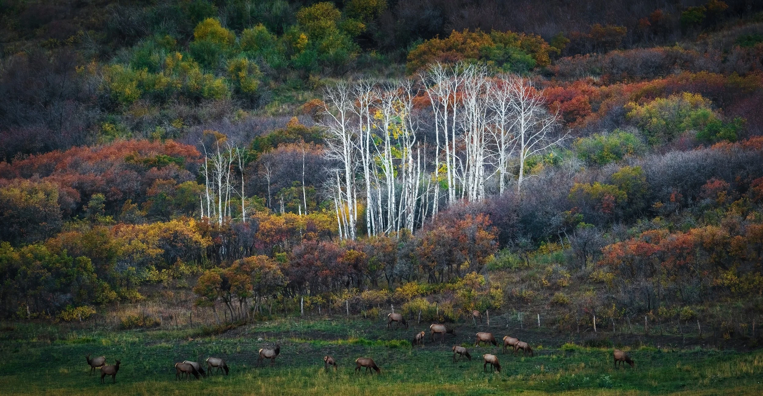
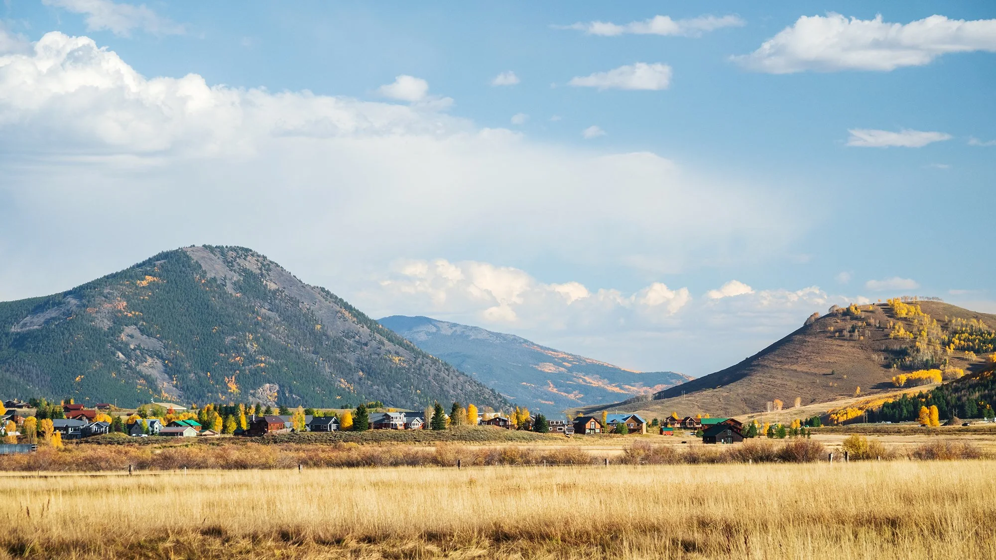
After taking a short nap, spending time off-feet, and catching up on reading and writing, I head back out in the late afternoon to scout a few locations around town before the golden hour sets in. The first location is on the eastern edge of town, where I leave my car parked at Rainbow Park and walk down the street to the fence of McCormick Ranch. Although the road here is private and impassible to cars, pedestrian walkers are welcome, and I take the opportunity to briefly walk along the ranch road, photographing the houses of Crested Butte’s ski resort / condominium village to the north, and the herd of cows standing in the open, grassy valley to the south. It’s a beautiful location, but despite the 360-degree openness of the road and the nearby mass of Crested Butte, I decide that it doesn’t particularly stand out or inspire me to return for either sunrise or sunset.

For my next stop of the afternoon, I drive a short distance north of the town proper, to the top of a residential neighborhood adjoining Mt. Crested Butte (the ski village). Here, I find a nice cul-de-sac to leave the car and walk along the ridgeline, photographing Crested Butte itself, along the with the distant mountains to the north and west, their flanks shadowed by the afternoon light. Nearby, a pair of black-billed magpies hop along the asphalt, apparently waiting to see if they can pinch any snacks or valuables from the newcomer photographer. It’s another pretty spot for photography, and I decide it should do just fine for sunrise tomorrow morning (when the peaks to the west will be touched by first light).

Now, back in the car and back toward Crested Butte to catch sunrise at my earlier-scouted spot in the hills above town. On my way down from the ski village, I first briefly turn up the highway toward the Oh-Be-Joyful Recreation Area, where a series of pullouts on the side of the road reward me with lovely valley views toward Gunsight Pass and the aspen groves below Snodgrass Mountain, beautifully lit in the setting sun. I briefly wish I had budgeted more time to explore the valleys around Crested Butte; but no matter - it’s onward to my golden hour location.

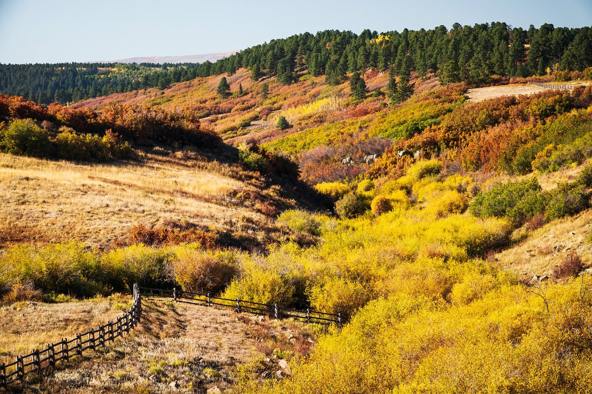
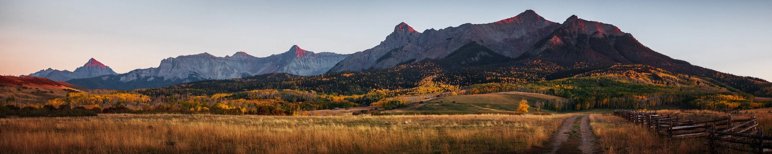
Above Crested Butte, I find a place to park the car and climb just off the roadside, into the sage-covered hills overlooking town. It’s a beautiful meadow fringed by a few stands of red-orange aspen trees, and in the distance, the mountains to the north and east are catching the last of the day’s light. After finding a clear spot in the grass to sit myself down (so as not to draw too much attention from the road below), I set up a sunset timelapse while working with my main camera to photograph alpenglow on Crested Butte and the more distant mountain ranges. Then, it’s a short drive back to the guesthouse for wine, cookies, and my final night in Crested Butte before relocating westward tomorrow.

Day 4: Uncompahgre Wilderness

It’s been a beautiful, productive few days of photography in the environs of Ohio Pass and Kebler Pass, but on Tuesday, it’s time for me to head west and see more of the wild landscape that Colorado’s Western Slope has to offer. First, in the morning, I make the short drive back up to Mt. Crested Butte’s ski condominiums before daybreak, to spend the morning golden hour on a hillside above town. It’s yet another unremarkable, virtually cloud- and drama-free sunrise, but I make the most of it while exploring a small desire path through the sagebrush, shooting the flanks of Mt. Emmons and the surrounding peaks as they glow pink from the rising sun. Back in town, I enjoy a relaxed morning, partaking the guesthouse’s breakfast of ham-and-egg croissants, pastries, milk, yogurt, and fresh-squeezed orange juice not once, but twice, while gradually packing and getting ready for the drive west to Ridgway. I am in no particular rush today, as the day’s itinerary calls for a meandering drive westward past Gunnison and the Blue Mesa Reservoir, then south through Cimarron and the Uncompahgre Wilderness, where I plan to catch sunset in a rather remote and difficult spot before finishing my drive late at night. No use in rushing, as long as I can be in position in time for a wilderness sunset.

In the late morning, I drive out from Crested Butte, taking the highway back south to Gunnison, where I fill up the tank before taking a stroll along the Neversink Trail, which parallels the Gunnison River. It’s another impressively sunny day, but the cottonwoods above offer a good bit of shade, and a splash of colors to boot. After a lazy walk by the river, it’s further west to the Blue Mesa Reservoir, where pink puffs of shaggy portulaca bloom on the shallow, sandy shore. In the car, I head west, passing by two sections of roadwork and bridge repair on U.S. 50 while enjoying my music in the car. Departing from the banks of the reservoir and the waterways of Gunnison country, the highway climbs into a narrow pass and emerges atop Blue Mesa and Fitzpatrick Mesa, where colorful scrub oak, rabbitbrush, and stands of aspen cover the plateau as far as the eye can see. Unable to stop the car along the twisting, winding highway, I forgo any photographs and capture the scene only with my eyes. A few miles further down, on the west end of the mesa, I turn off the highway and onto Big Cimarron Road, which carves its way up-valley into the heart of the Uncompahgre Wilderness.

My main regret from this trip, aside from the preponderance of clear blue skies, is that I did not budget any more than an afternoon drive to explore the Uncompahgre Wilderness, a vast and isolated area of steep canyons, mountainous plateaus, and forested slopes centered upon the rocky massif of Uncompahgre Peak and its surrounding high summits. Big Cimarron Road cuts into the wilderness from the north, winding its way south along the valley until its reaches Silver Jack Reservoir and a network of dirt access trails that fade into the surrounding mountain passes. I stop at many points along the relatively maintained gravel road, shooting compositions into the heart of the wilderness with my long lens, which helps cut the blue glare and grey haze induced by the mid-day sun. Further south, the road passes a series of campgrounds and working ranches before arriving at the shores of Beaver Lake and Silver Jack. At Silver Jack, I enter the day-use area, taking a short walk down through a beautiful aspen grove to reach the path around the reservoir. Standing atop a boulder above the forest, I find a wonderful panoramic view of the reservoir and the surrounding hillsides - covered in golden aspens, with the craggy outlines of Courthouse Mountain and Sheep Mountain in the distance, beyond the winding shoreline. Once again, I’ve managed to hit upon excellent foliage conditions here in Uncompahgre - indeed, some of the best leaf colors that I’ll see for the rest of the week.

Back in the car, I continue along the dirt road as it meanders south between the mountain chains, ultimately climbing through forest and turning westward into the Owl Creek drainage. At the top of Owl Creek Pass, I reach the trailhead for my final walk of the day.

When I say, “trailhead for my final walk of the day,” I need you to understand that ‘trailhead’ is a significant overstatement, just as ‘walk’ is a significant understatement. I’ve arrived here a full two and a half hours before sunset, precisely because my next objective involves a steep, uphill bushwhack through the forest, to a clearing overlooking the aspen groves of upper Owl Creek Pass and the mountains of the Uncompahgre Wilderness. Following the contours of the topo map on my phone carefully, I pick my way over, under, around, and in some cases through the jumble and deadfall of the untrammeled forest, making gradual progress along the ridge north of Owl Creek Pass - up one hill using my hands and feet, panting and sweating the entire way, then down, then up again. A few times, checking my progress against the time, I nearly decide to turn around and abort the walk, worried as I am about how deadly this bushwhack will become after nightfall. But I decide to press onward, extremely slowly and carefully, in the hopes that I won’t be alone on the ridgetop and might have company on the journey back down. Despite taking care of where I step, I get at least one or two lashes on my leg from sharp tree branches and downed barbed wire fencing - thankfully, no puncture wounds or significant injuries. After a final steep, breathless climb, the open sky emerges through the golden canopy, and I reach the overlook ridge at last.

I’m joined over the next hour by a few other intrepid photographers who made the climb through the forest — most of us having started from various places on either side of the pass, apparently none of them any easier than what I just endured. We set up our cameras carefully on the open ridgeline, using rocks and backpacks to anchor tripod legs onto the steep, loose slope. One hiker climbs the rocky bluff to the right (south) of the ridge; we gasp as she nearly loses her footing shimmying around the fully vertically-exposed cliff face; a pile of loosened rocks goes hurtling off into space, landing with a shuddering crack in the forest below. After exhaling a collective gasp (alongside the line of photographers who nearly recorded a fatality), I take a shot with the hiker overlooking Owl Creek Pass.

After a long period of sitting, chatting with other photogs about our individual adventures, and tending to my timelapse, the sun begins to fall to the west of Owl Creek Pass, bathing the intervening aspen forests, and the flanks of Courthouse Mountain, in a maroon-and-gold glow. Packing my tripod and donning my wind layer and headlamp for the journey back down the hill, I fall in with a fellow photographer from North Carolina. The two of us decide to stick together for the long, dark descent back to our cars. The return, harrowing as it is to pass through the deadfall with only our headlamps, is made a lot more bearable by safety in numbers - although we do spot an ominous pair of glowing eyes at one point (some sort of fairly large mammal in the darkness), and toward the end, we manage to veer off-course onto the eastern side of the ridge and wind up having to slog partly back uphill to our vehicles at Owl Creek Pass.

Back at the car, after saying farewell to my walking companion, wiping off, rehydrating, and doffing my sweat-soaked beanie and dirt-crusted gloves, I make the long, bumpy drive down the road from Owl Creek Pass westward to US 550. It’s a somewhat creepy drive in the darkness - made worse by the knowledge that I am fairly isolated out here, many miles from civilization, with zero cell coverage, and unlikely to find help for hours if I puncture a tire or suffer any other car trouble. To compound matters, my GPS unit keeps pointing me toward odd turns onto various dirt offshoots which appear scarcely more than hiking trails crisscrossing the wilderness - a recipe for a disastrous survival situation, if I ever knew one. Fortunately, I studied the area map carefully before my trip, and have grown over the years to be naturally distrustful of the old Garmin’s bizarre fetishes and fallacies. After a long and careful drive, shortly after 9 PM, I exit the county road and pull onto the highway; a few minutes later, I reach town, where I settle in for the night at Mtn Lodge Ridgway. A long shower, a careful wash of the tree-lashed nicks and bruises on my lower legs, and a hot bowl of noodles later, I climb into bed and fall into a deep, well-deserved sleep.

Day 5: The San Juan Mountains

So it’s onward to the latter half of my trip, where I’ll be exploring the backroads and highway passes of the San Juan Mountains, focusing most of my time on Ouray County and the north front of the Sneffels Range, just outside of Ridgway. On Wednesday morning, my main objective is to drive the Million Dollar Highway, the stretch of US 550 that heads south from Ridgway, winds into Red Mountain Pass between Ouray and Silverton, and then to the top of Molas Pass, sitting high at 10,910 feet above sea level in the San Juan National Forest. In hindsight, it might have been better to start the week’s trip here for better foliage conditions, as many of the aspen groves surrounding Ouray and Ridgway have already become barren and windblown; however, it’s all a fair deal in the end, as I would not have traded anything in the world for the past few days of glorious shooting around Crested Butte and Kebler Pass.

In the morning, before sunrise, I set off southward out of town, passing through Ouray’s sleepy main street and climbing up toward Red Mountain Pass. At the roadside overlook for Bear Creek Falls, I briefly stop to admire the waterfall and photograph the view up Uncompahgre Gorge. A few miles down the road, I stop by Crystal Lake, where the faint colors of sunrise on Red Mountain and the placid movement of waterfowl upon the lake’s surface exist totally in contrast to the firing squad of a photography workshop (the first of several I’ll encounter in the coming few days) gathered upon the lakeshore, and the rumble and drill of the construction crews hard at work across the road. I stick around long enough to photograph first light on the mountaintop, then stroll briefly to the western shore of the lake, where I frame some nice telephoto compositions involving Red Mountain, Darley Mountain, and the pencil-smudged aspen groves on their hillsides.

Down the road, the highway climbs into a series of hairpin turns near the famous Red Mountain Pass. Although reportedly treacherous in rain or winter conditions, the pass is eminently driveable on this calm, breezy (and yet again totally cloudless) autumn day. Near the top of the hairpins, I stop for a look back down the valley, and some lovely shots of morning light breaking over the wall of the mountains to the east. Then, it’s further south to the other end of the pass, where the road descends into another valley as it makes its way toward Silverton. I decide not to stop in Silverton, continuing onward to Molas Pass, where I stop at a few overlooks to photograph the forest, the mountains, and a distant cabin on a plateau, which acts as an object of interest.

At Molas Pass, I reach my turnaround point for the morning. The overlook here is a stunning panorama ranging from the north to the east and south, covering alpine plateaus, rugged mountain peaks, and glistening, jewel-like lakes studding the landscape. If it were earlier in the trip (if my legs were fresher) and the sun weren’t so glaring and oppressive, I would have loved to wander down the plateau and take a walk into this idyllic landscape. However, achy and sore as I am from yesterday’s wilderness hell-climb atop Owl Creek Pass, I settle for quick detour to the shore of nearby Little Molas Lake, before making the drive back to Ridgway. The return drive is mostly uneventful, save for spotting a tall moose buck moseying along the highway just outside of Silverton. At the hotel, I get a takeout lunch from the Million Dollar Roadhouse restaurant downstairs (a smoked beef brisket sandwich with fried shallots, au jus dip, and fries - yum!) and settle in for a mid-day rest. Television and a nap to escape from the sun — yep, it’s that part of the vacation week, already.

In the afternoon, I head out west from Ridgway, planning to scout some of the dirt roads that branch off of CO-62 into the Mt. Sneffels Wilderness. To my disappointment, I find that much of the area, similar to the mountains around Ouray, is quite patchy in color - the mountainous roadside vista at the Dallas Divide, gazing toward the Sneffels Range, appears scattered, and while there are groves of colorful oak and aspen on the hillsides, many of the treetops are barren and the scene looks mostly windblown at best. Undeterred, I continue onward to Last Dollar Road, a long gravel drive that cuts through the mountains southward to Telluride. Only the first six or seven miles of the north side of Last Dollar Road are passable in my rental car, but these include some beautiful open landscapes, airy views toward the mountains, and working ranches which provide foreground and midground interest. I spend the hour or two before sunset casually scouting along the road, getting out of the car a few times to document the beautiful scenery and the autumn foliage.

At the start of golden hour, I make my way back to a spot just a few miles from the highway, at the edge of a large meadow near a ranch’s fenceline. Here, there is a broad sweeping view of the mountains to the south, and the play of sunset on the distant hillsides makes for wonderful light conditions. I set my tripod up just behind the fence, and it fires off a timelapse while I pace about with my main camera (including accidentally walking into the timelapse for a handful of seconds before I notice my stupidity…). With the long lens, I capture many things over the subsequent hour: a Cooper’s hawk that swoops down and perches in a nearby tree. A trio of whitetail bucks browsing in the nearby scrub oak, stopping once in awhile to stare in my direction. Reflected sunset light from the window of a distant cabin. A panorama of the ranch road leading into the mountains. Then, from a hillside to the west comes the bark of an Rocky Mountain elk; using my camera, I spot an entire herd, which gradually makes its way down to the nearby meadow. With my long lens propped up against a fence post for stability, I take one of my surprisingly favorite images of the entire trip - a photograph of the elk herd grazing beneath a rainbow hillside of scrub oak, with a small grove of barren white aspen trunks forming the central interest in the scene.

As the sun sinks lower toward the horizon, I eventually pack up the tripod and head back eastward into town. It’ll be a full day of exploring the Sneffels Wilderness tomorrow - largely, but not only, from the comfort of the inside of my car.