California: Inland Empire

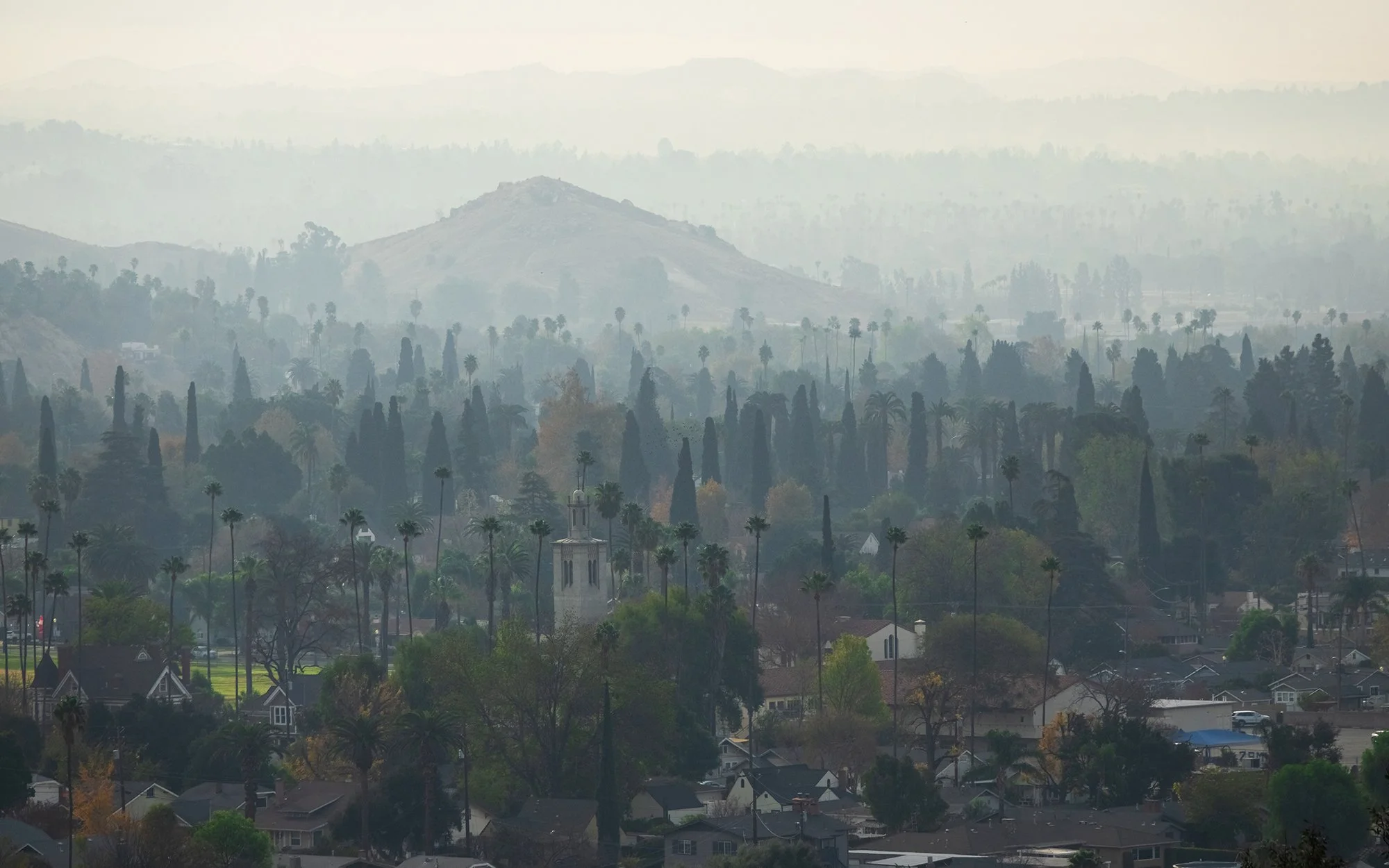
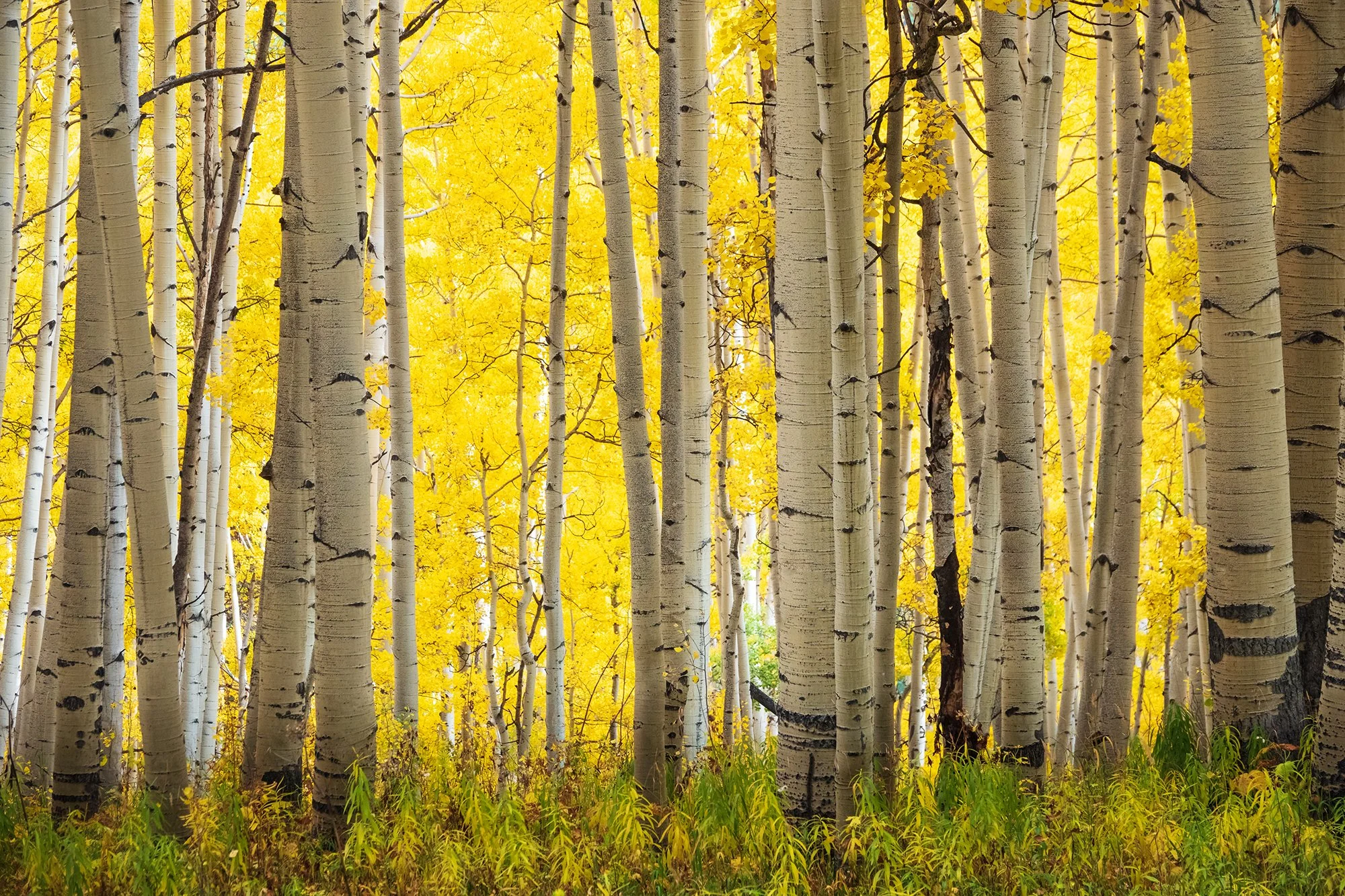
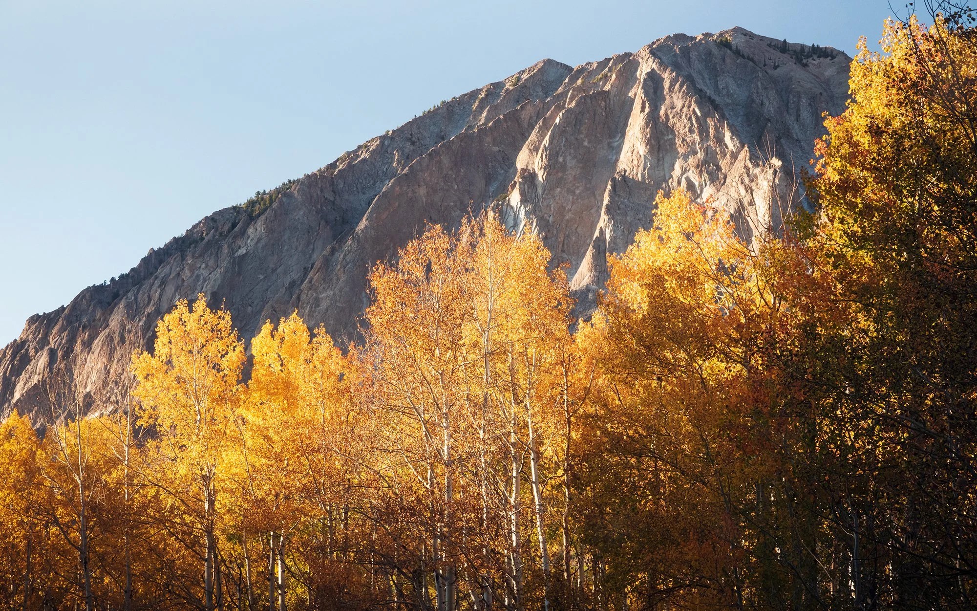
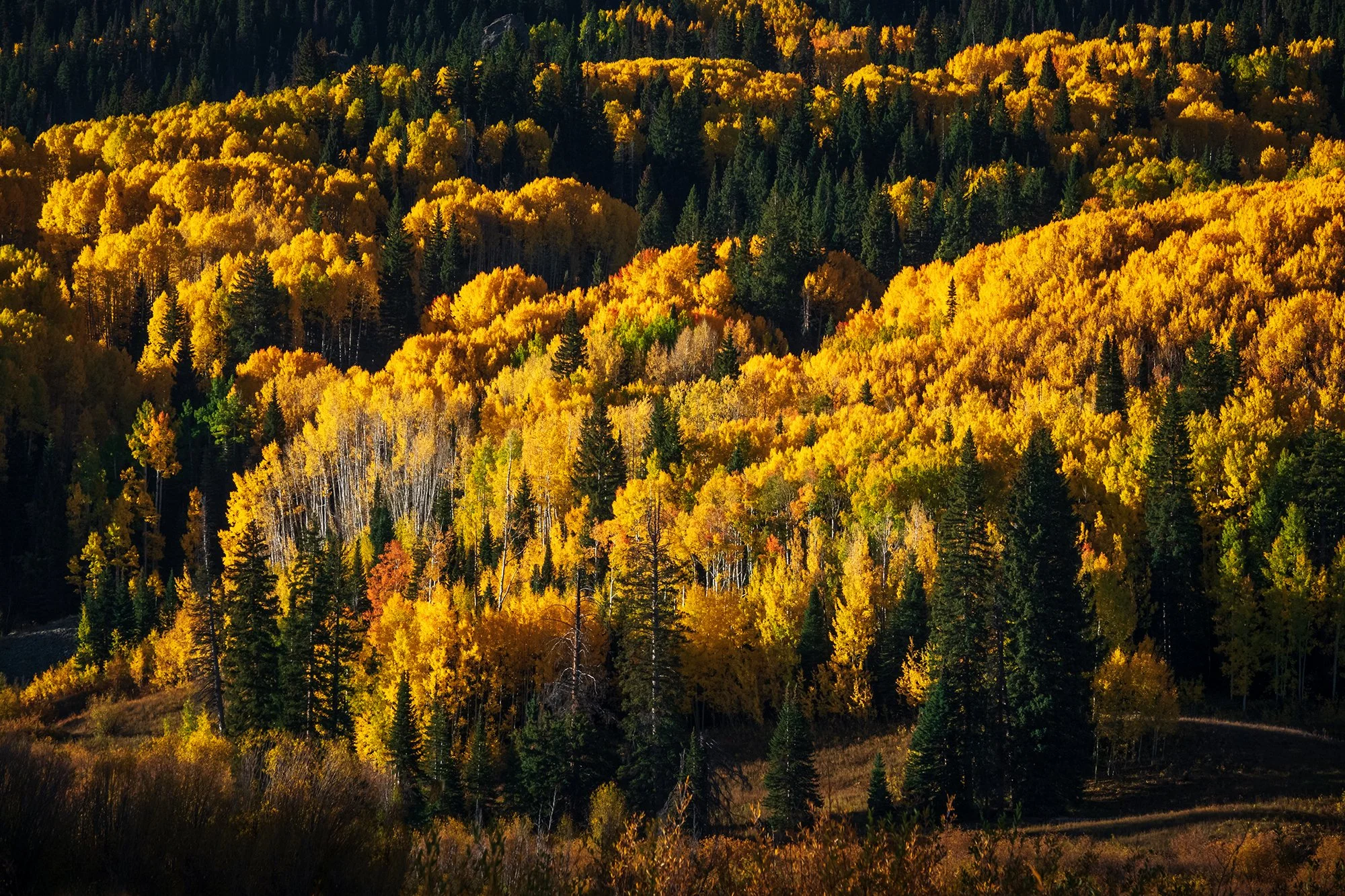
Our second week in Southern California is spent on my parents' side of the megalopolis: the arid region of desert bedroom communities, chaparral steppes, and sandy arroyos known as the Inland Empire. My parents relocated here from Rowland Heights after my sister and I both left for college, sliding ever eastward and inland from Los Angeles proper, and downsizing into separate homes. Although the boundaries are certainly blurred and ever-shifting, and all of the region looks rather samey from the freeway carpool lane, the IE has a distinct physical and cultural identity compared to the posh, gleaming communities of seaside Orange County. The morning haze, a combination of coastal mist and air pollution, is more prominent, blown inland and caught between a few different mountain ranges. The land is drier, freer, more open. The highway cuts east-west through miles of desert scenery, and beyond the car window, the San Bernadino Mountains loom ever closer - appearing over twice as large on the horizon compared to where we were the week earlier. The diaspora is well and alive here, with all its attendant immigrant mentality and nouveau riche materialism - but here, there are noticeably fewer staid fusion restaurants where one pays for novelty, and noticeably more homestyle restaurants, family-run joints, taco trucks, and michoacanas. In short, the Inland Empire is more my speed: a relative bastion for the more authentic and cherished scenes from my childhood, which are being buried beneath a landscape that I increasingly cannot identify with. Our brief week here is focused on exposing Jordan to the bits of his family and legacy that can be found nowhere else:

———

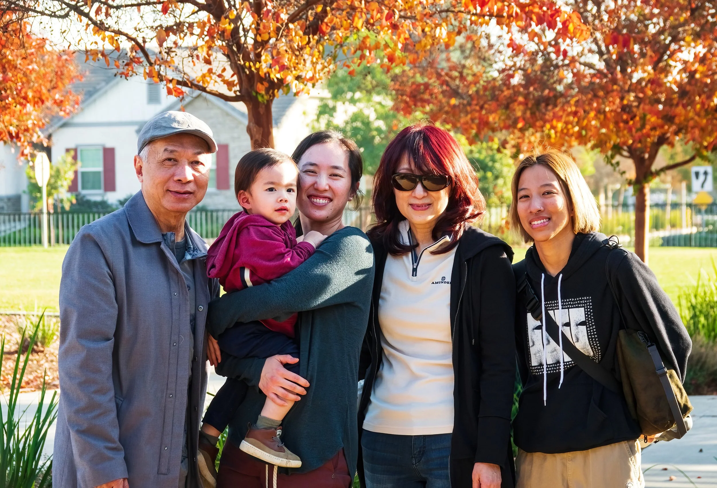
December 21, 2024: A quiet afternoon after my mom drives us over to her home in Chino. Jordan plays with the toy model train set that I grew up with (and my parents have re-assembled in my mom’s living room). We take some family photos at the nearby community lawn, with its colorful winter crape-myrtles, and my mom prepares an extensive seafood spread for dinner.

December 22, 2024: Jordan (and we) accompany my mom to church in Rowland Heights; from the kids’ room behind soundproof windows, we watch her perform in the choir. For lunch, we takeout El Pollo Loco. In the afternoon, we drive to Highland Park to visit my cousin and meet her kids (Jordan’s second cousins), and eat dinner with Jordan’s great-aunt and more second cousins at Jiang Nan Spring in Alhambra.

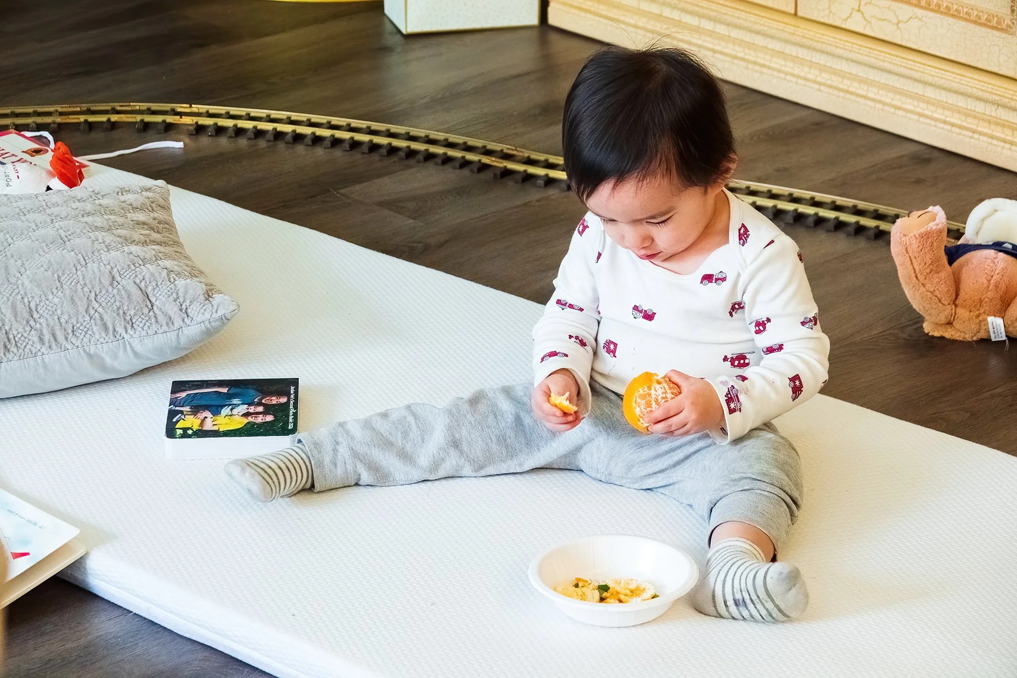
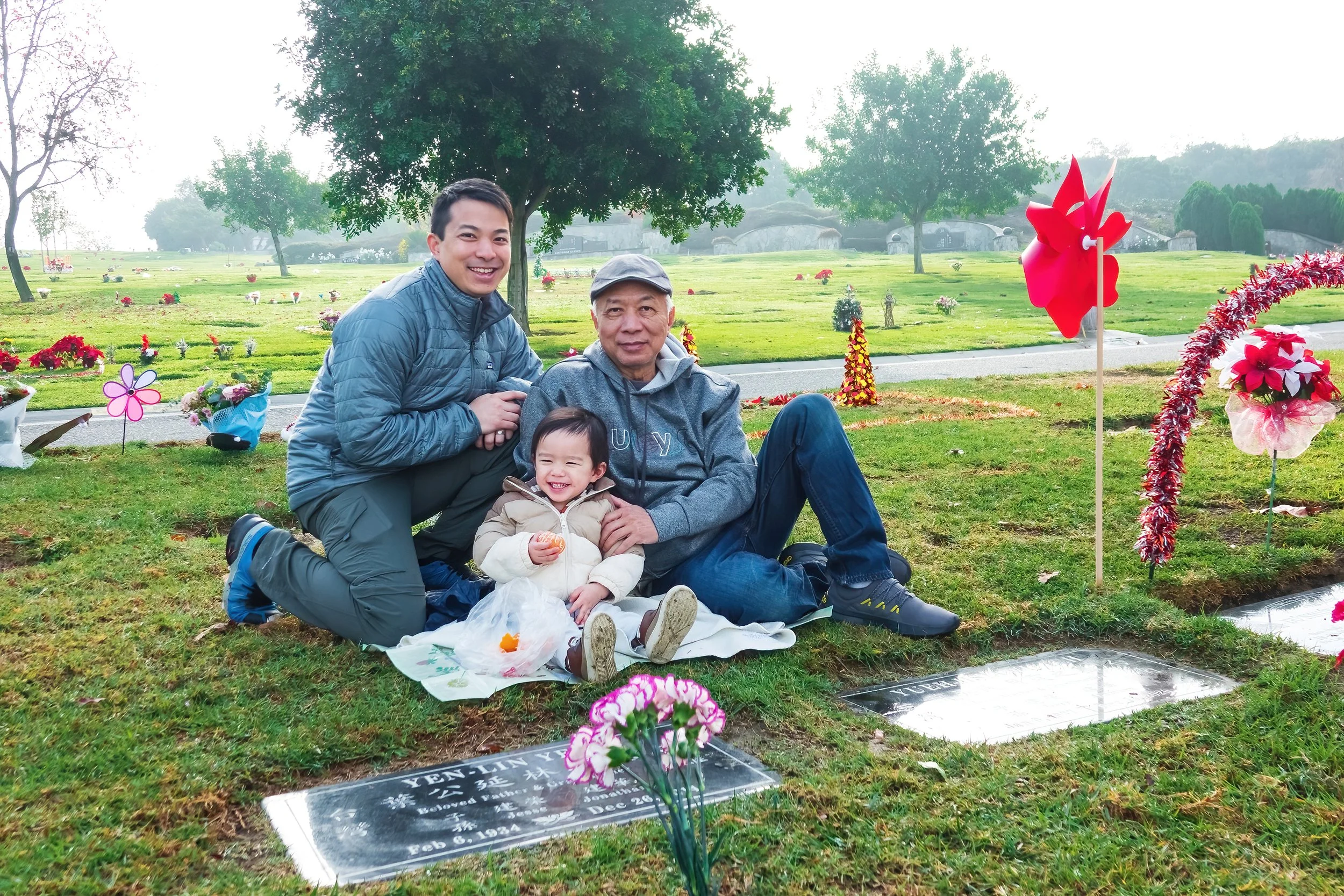
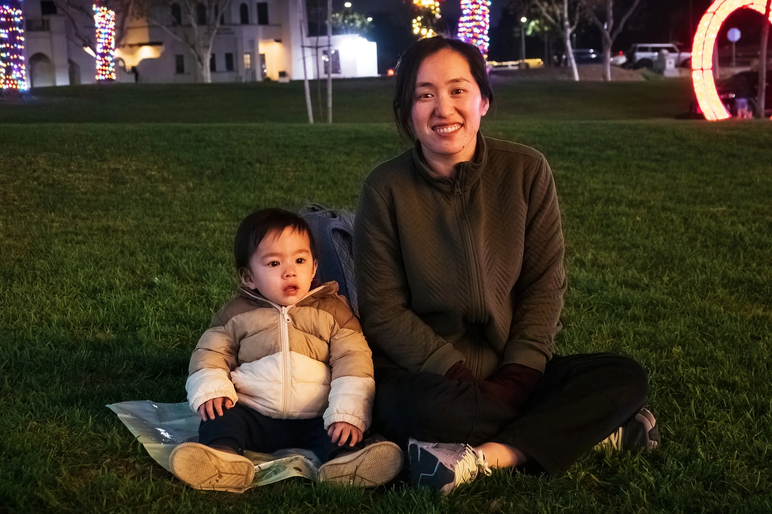
December 23, 2024: A morning trip to my Ah-Ma and Ah-Gong’s graves in Rose Hills Memorial Park (Jordan’s paternal great-grandmother and great-grandfather), in between the 4th and 10th anniversaries of their deaths respectively. Jordan peels an orange for each of them (his favorite activity recently - why buy your todder toys when you can just have him peel fruit for you?). We then take Jordan to see the Hsi Lai Buddhist Temple in Hacienda Heights, which I grew up visiting around the major lunar calendar holidays, and made a large early impression in my own spirituality. The little man, unfortunately, takes a faceplant and concrete bonk to the forehead in the temple’s central courtyard. He is all better, though, by the time we eat a huge Chinese-style breakfast at nearby Four Sea. In the afternoon, we take a brief photo trip to Chino Hills State Park, and the grandparents treat Jordan to a sashimi dinner. We stop by Chino’s city hall after dinner, where there’s a pretty display of Christmas lights and a holiday performance of How the Grinch Stole Christmas. Jordan enjoys wandering across the lawn, looking at the giant tree, and making a few toddler acquiantances.

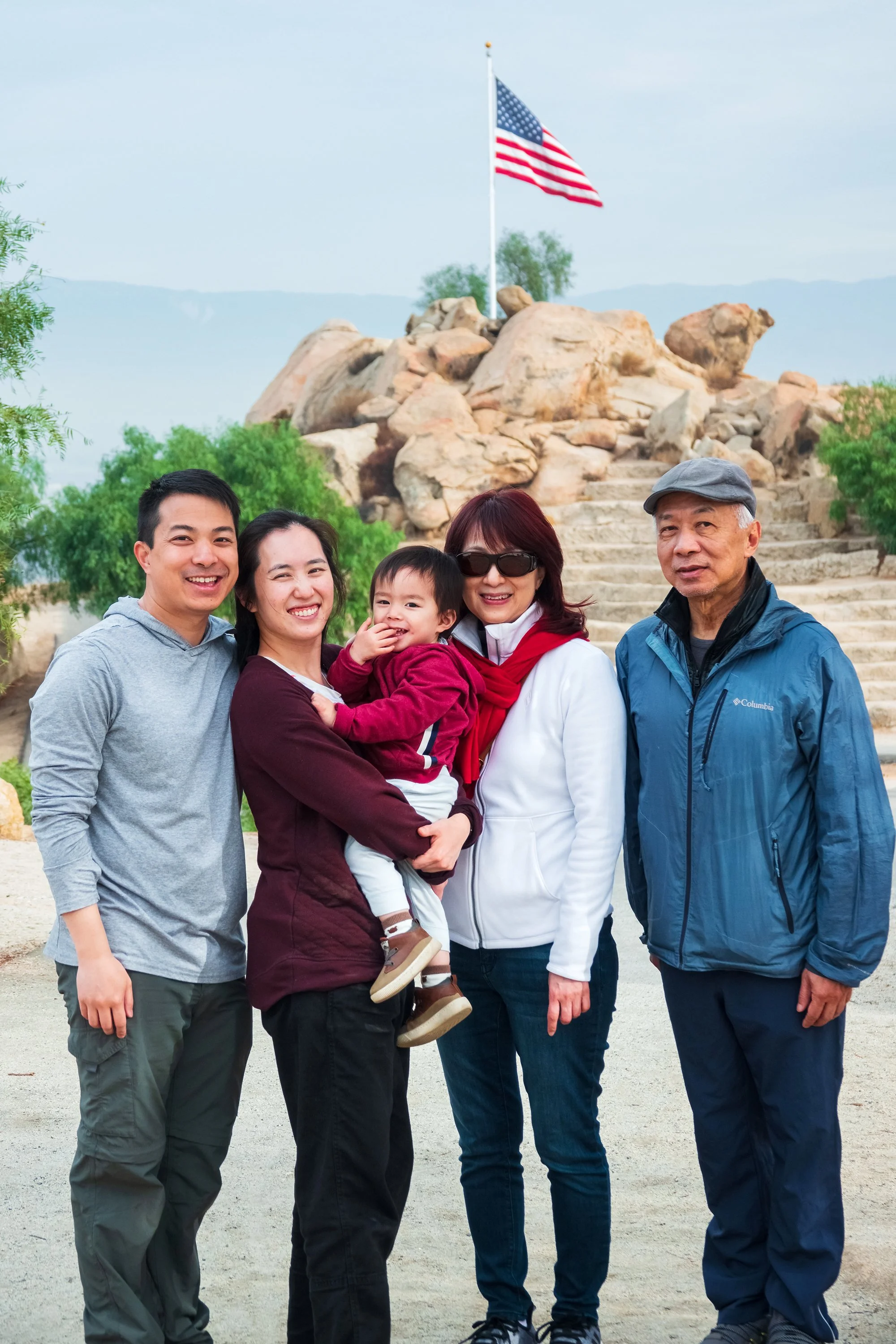
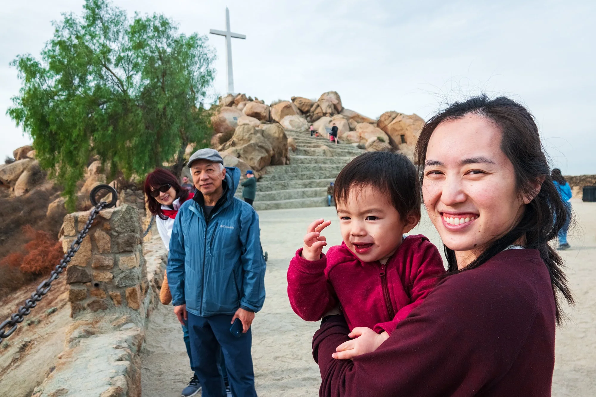
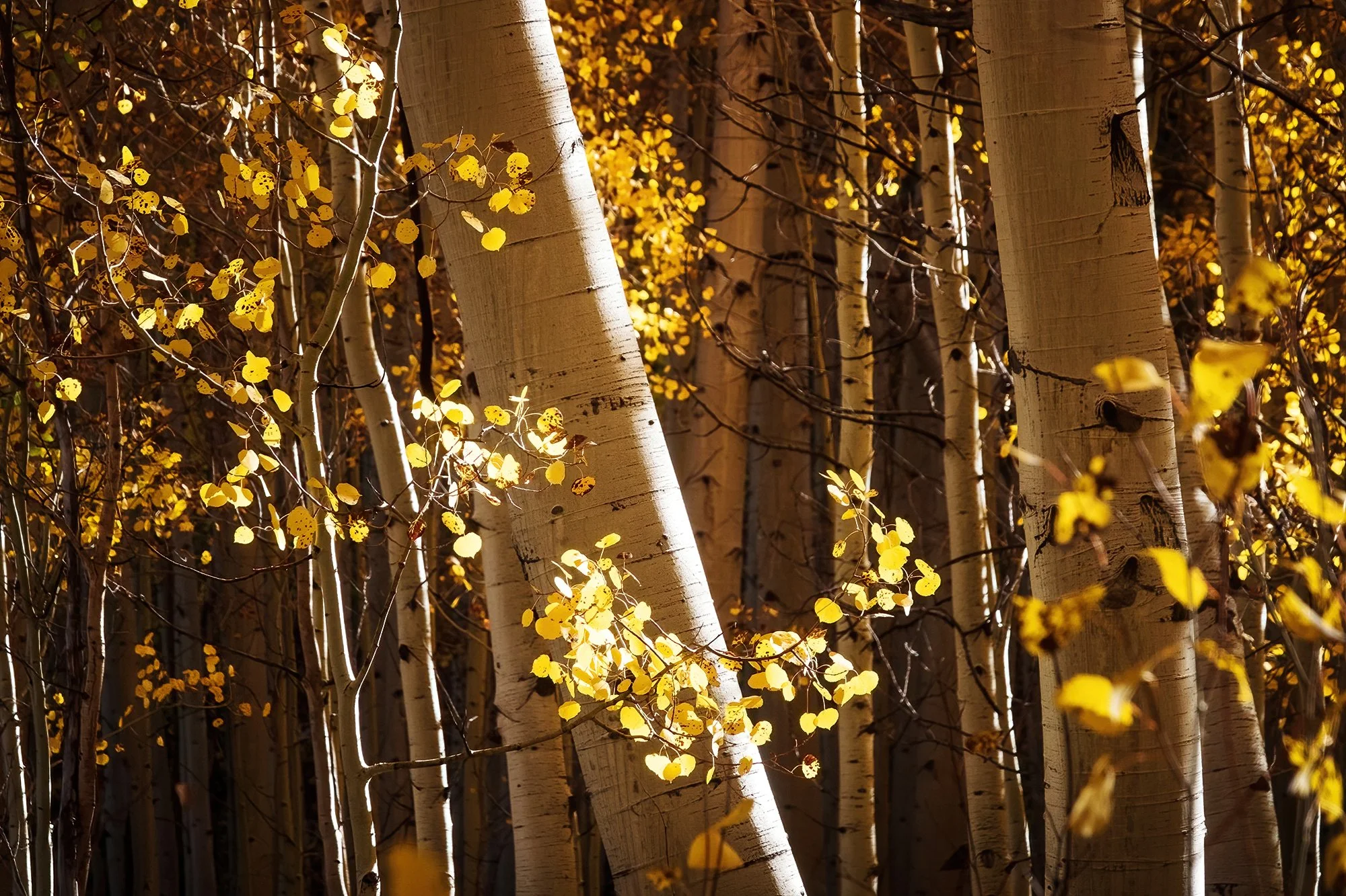
December 24, 2024: We head out to my dad’s neck of the woods in Riverside, hiking up to the summit of Mt. Rubidoux in the morning. While the others forge ahead with Jordan in the stroller, I take great interest in faraway landscape shots toward the mountains, and involving the sweeping expanse of desert washes below. The cottonwood groves lining the Santa Ana River, snaking its way westward across the plain, make for a particularly colorful subject. After photos at the summit, we return to the car and get takeout tacos from Taco Station (a cute little breakfast-and-lunch joint built into a remodeled gas station) to eat at my dad’s house. The afternoon is a quiet one spent at home.

December 25, 2024: On Christmas morning, continuing to intentionally expose Jordan different cultures and faiths, we visit the BAPS Shri Swaminarayan Mandir in nearby Chino Hills, a massive Hindu temple complex that I have seen many times from the highway but never had an opportunity to explore. It’s a quiet morning at the temple, and Jordan enjoys running up and down its mostly deserted sandstone walkways and open courtyard. We admire the astoundingly ornate interior shrine (carved entirely from imported white marble) before having a quick breakfast of pakoras, cloyingly sweet treats, coffee, and lassi. In the afternoon, we go to Jane’s parents’ house in Anaheim for a Christmas dinner gathering with both sides of the family.

December 26, 2024: We, Jordan, and Ah-Ma drive to Brea’s Carbon Canyon Regional Park to meet back up with Jane’s parents, sister/brother-in-law, and Jordan’s cousins. We take the quick walk to the park’s small grove of 80-year-old redwood trees - diminutive compared to their old-growth counterparts up north, but nevertheless a special (and artificially maintained) sight in the arid canyons of Southern California. On the way home, Jordan begs for pancakes, so we stop at the IHOP in Chino for second breakfast. Jordan devours a plate of hashbrowns, eggs, pancakes, sausage, and ketchup in between sips of apple juice. The afternoon is a quiet one, spent mostly cleaning, packing, and finishing leftovers at home.

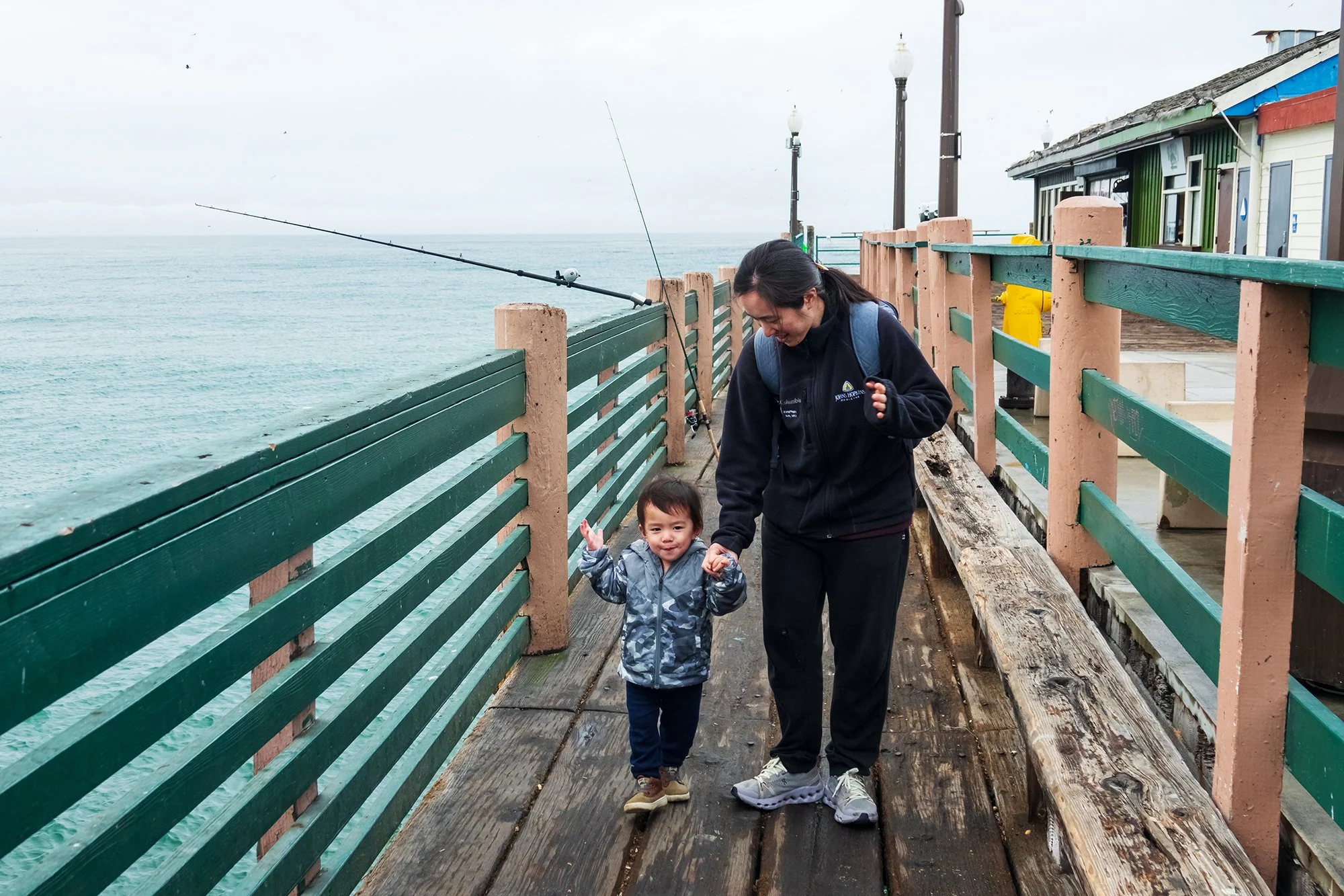
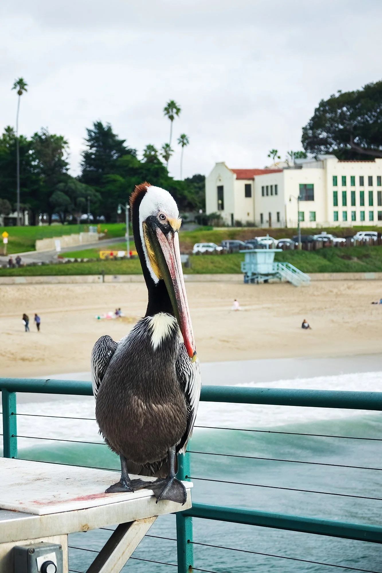
December 27, 2024: Our final full day in California. After a relaxed morning of packing and loading the car, my mom and dad drive us to the Redondo Beach Pier for a magnificent seafood lunch at Pacific Fish Center & Restaurant. I grew up coming here for special occasions - usually around holidays, with family friends, or classmates. It’s an impressive place to spend an evening, out on the water with the pounding surf below, the hubbub of the pier fishermen and beachgoing tourists around, and the gulls screaming and crashing through the air above - a place of many sonic, visual, and tactile memories. We stroll around the pier, and Jordan takes a liking to a giant brown pelican. The surf is impressive today - remnants a major offshore storm blowing off the Pacific; I photograph waves exploding on the nearby breakwater. In the afternoon, we drive the short distance up to our hotel near LAX, where we’ll be staying before our flight the next morning. I’m nursing a worsening respiratory infection (in fact, have been suffering from symptoms for most of the trip, likely a series of back-to-back-to-back viruses acquired from the cauldron of toddlers we have been stewing around), so my parents say goodbye, and the three of us settle into the hotel room after I walk down the boulevard to buy another round of In-N-Out burgers, fries, and shake. Jane takes Jordan, bored out of his mind in the hotel room, on several spins around the towering hotel atrium in his stroller.

December 28, 2024: The next morning, it’s an early ride to the airport and a breeze through security (we are way too early to the gate, so Jane and Jordan take a bunch of walks while I make repeated trips to the bathroom to remove my mask and blow my nose), followed by a long but uneventful flight back to Boston. Notwithstanding my plane-induced hearing loss and subsequent week of sinus and middle ear infections, we make it back to Brookline by early Saturday evening. Jane and Jordan take the following week to relax and play together at home, recovering from jetlag and travel fatigue; meanwhile, my hearing slowly returns over the course of a workweek (with no small help from steroids, antibiotics, and every decongestant on the planet I know how to self-prescribe). We exit 2024 much as we entered it: a bit sneezing and congested, but in good spirits, and mainly glad to be back on home turf.


Day 1: Two Passes

After a busy few months of summer work, distance training, and the hubbub of fall recruitment, I set out on my final solo trip of 2024, a weeklong hiking and photography tour of Colorado’s Western Slope, specifically focusing on Gunnison National Forest, the San Juan Mountains, and the wilderness areas in between. It’s a beautiful part of the country that I have just barely touched the periphery of (having come as close as Cortez, CO during our Four Corners trip in 2022), but have never visited truly. I’ve timed my trip fairly well for autumn foliage - those few weeks each year when mountainsides of quaking aspen and riverways lined by cottonwood transform the entire state into a colorful bonanza - a natural “gold rush,” as they say out West. Although by the end of my time in Colorado the forests in many areas are becoming windblown and barren, and the entire trip’s photographic conditions are generally plagued by empty blue skies more often than not, I manage to come away with some beautiful landscape images, and a week of memorable adventures on foot.

My trip starts with an early morning transfer via Denver to the small regional airport in Gunnison, CO; from the air, we pass over the Continental Divide and the bulk of the Rocky Mountains, their jagged granitic peaks and broken scree slopes mostly free of ice at this time of year. The land falls away to a series of faults and ranges, the basins between which are covered by mixed conifer and hardwood forests. From above, the aspens groves are a sea of gold and orange hues - mesmerizing, inviting. In Gunnison, I pick up my rental (a Ford Escape that escapes nicknaming the entire trip) and head out on the road after a pit stop for groceries at the local Safeway. My driving playlist, again retooled toward the calm acoustic and folk tracks of autumn, blares over the tinny speakers of my fifteen-year-old iPod Nano - a device so geologically ancient that it has apparently grown increasingly incompatible with USB connections in rental cars (note to self: aux cable next time, sigh). Following the highway north out of town, I soon turn off onto Ohio Creek Road, which winds its way along cottonwoods toward Ohio Pass. My objective for the afternoon is to explore two passes to the north of Gunnison - Ohio and Kebler Passes - before making my way to Crested Butte, where I’ll be based for the first half of the week. Along the way, the road cuts along the edge of the West Elk Wilderness, and tantalizing mountain-and-forest views begin to reveal themselves at every turn. I make frequent stops by the side of the well-graded gravel road, taking plenty of a long and panoramic shots with my polarizer on.

Nearing the botton of Ohio Pass, the road winds into the foothills below the Anthracite Range, which has been steadily looming to the north. Here, I enter the aspens in earnest, the ghostly trunks rising up on both sides of the road. Mid-afternoon, I stop at a trailhead to hike the half-mile up and half-mile down to a series of beaver ponds nestled beneath the mountains. It feels wonderful to be finally exploring on foot after a few hours of (albeit very slow and relaxed) driving and roadside photography; I climb into the aspen forest, thrilled by the beautiful canopy of golden leaves, which cast a surreal, warm hue on everything below. The pale white trunks of the aspen trees, especially, make for compelling subjects against the backdrop of colorful foliage, and it seems I can hardly help but stop every few feet to shoot into the dense forest. Worth noting, too, is that the slender, straight trees afford much cleader compositions than I’ve become used to in the jumble of New England’s mixed deciduous forests (or more recently, in Cascadia’s old-growth rainforests). For a woodland photographer like myself, this is such a treat! On my way back down the trail, I sneak a few choice aspen leaves off the forest floor and press them between the bills in my wallet; I’ll wind up bringing them all the way home to Boston, to add to my collection of pressed leaf specimens.

Moving on from the Beaver Pond Trailhead, I briefly return downhill to photograph the view from the foot of Ohio Pass, before turning the car around and proceeding to the top of Ohio Pass. Here, beneath a scree slope, there’s a festive crowd of gathered foliage viewers and photographers admiring the expansive panorama to the south and west, which sweeps over many miles of forested wildernes and several mountain ranges, most notably the peaks of the West Elk Wilderness to the southwest, including the distinct rock minarets known as the Castles. I set up my tripod to take the first of many timelapses on this trip, while hand-holding my main camera to make panoramas and zoom shots of the amazing landscape. It’s a high traffic situation on this balmy Saturday afternoon above Ohio Pass’s golden aspens — multiple parked cars barely pulled over onto the scree slope, SUVs trying to pass each other on a steep dirt road, narrowly avoiding the human conga line. I exchange pleasantries with another photographer and a drone operator, and help a family of four (the teenage daughters treating Mom and Dad with complete and utter disdain) take a family portrait before my timelapse finishes. I relinquish my spot, moving on to the top of the pass and down the other side, to the north.

To the north, the road intersects Gunnison’s County Road 12, which runs between Crested Butte to the east and Paonia to the west, passing through Kebler Pass in the middle. I’ll be returning this way after sunset on my way to Crested Butte, but first, I take a left turn and proceed into Kebler Pass, intending to scout as much of it as I can before selecting a sunset spot for my first day in Colorado. Just as in Ohio Pass, I seem to have chanced upon pretty good foliage conditions here at the tail end of September. The east end of Kebler Pass (the area between Ruby Peak and the Beckwith Mountains, and the aspen groves leading to the west) is carpeted with color, and there is a wonderful blend of golden, orange, and red leaves strewn across the hillsides. Further to the west, the gravel road continues through a several-mile stretch of aspen forest, some of the densest and oldest clonal aspen forests I’ll see during the entire trip. The western part of Kebler Pass, beyond the forest, opens into a mixture of ecotones - in many places the landscape is almost tundra-like in appearance, and in other places it is covered in scrub oak and patchy hardwood groves. Though it’s stark, expansive, and beautiful, the west side of the pass is also in worse photographic condition; the aspen groves beneath Marcellina Mountain have clearly been stripped bare of their leaves, while other places are not yet at peak color. After driving all the way to the west end of the pass and taking a quick photo at a dirt overlook above the road, I turn the car around and head back east for sunset. The falling sun and its illuminating sidelight through the aspens is utterly magical.

Having scouted a few different roadside perspectives along the eastern part of Kebler Pass, I ultimately settle on a spot near Horse Ranch Park, from where I can shoot the play of sunset colours on Ruby Peak and the adjoining aspen groves rising up above the valley to the north. After a tough bit of setup (to avoid including road, parked cars, and a few camper/RV setups with quite a bit of verticality), I manage to shoot a timelapse of Ruby Peak while again working panoramas and detail comps with my main camera. Although I did not know it yet, this first sunset wound up being one of the better-lit and more colorful ones of the entire trip (and one of the very few golden hours with any clouds…). The results (below) are some of the more print-worthy landscape photos I have taken in some time.

After sunset, I join the procession of cars leaving Kebler Pass. It’s only a twenty-minute drive eastward to Crested Butte, but it’s pitch-dark by the time I arrive in town, and it takes me some time to locate a good parking spot for my guesthouse (the innkeepers kindly suggest that I park in a secluded spot in the back of the building, which becomes my designated park-up for the next few days). After settling in, unpacking, enjoying complimentary homemade cookies, and making myself a hotel-room dinner (the usual noodle setup), I go to sleep early in anticipation of an active day ahead.

Day 2: Dark Canyon

In the morning, it’s back to Kebler Pass. In the darkness of the hour before dawn, after a few bites of raisin bread and a bottle of chocolate milk, I creep back through the old Western set that is the town of Crested Butte (which I still haven’t seen in daylight), and up the road into the mountains. My sunrise destination is a fairly obvious overlook that I scouted the day before, along a hairpin turn on the road just before it descends into the pass, with a nice wide view of East Beckwith Mountain to the south and the Dyke (a serrated ridge of granite) to the north. Joined by a few other photographers (all of whom are very gracious and equally sardonic about the cloudless skies), I shoot a sunrise timelapse of East Beckwith Mountain while using my main camera to focus on some of the nearby aspens, as well as the moonrise behind us. Eventually, as the sun fully crests the horizon, I move on downward into the pass.

My second stop is a brief walk from the roadside down to a group of beaver ponds that I noticed the night before. Here I meet two other photographers working the early morning scene - a calm, perfect reflection of East Beckwith in the water. I make a mental note of this place, and plan to return later in the day, for sunset. From here, I drive a short distance to Horse Ranch Park and my main objective for the day: a seven-mile hike along the Dark Canyon Trail, looping up to the foothills beneath Ruby Peak and the Dyke. Although the hike will prove to be more challenging than I anticipated (a chunky but reasonable two thousand feet of cumulative elevation gain over the seven miles, but at a much higher elevation than my coastal New Englander lungs are used to extracting oxygen from), it will simultaneously prove itself as one of the most beautiful, most photographically productive hikes I have ever done.

After turning north from the car park, the trail quickly plunges headlong into some of the densest and most beautiful aspen forests anywhere in the world. What I love so much about the Dark Canyon Trail, however, is its variety. Even in its initial (relatively flat, easy) few miles hiking the loop clockwise, the trail and its scenery bear constant surprises. It weaves its way along forested slopes, through aspen groves, to the edge of open meadows, and past creeks and enormous beaver ponds (one of them practically damming a 10-foot water level difference between two ponds!). The trail notably opens up several times, revealing stuning views of the Beckwith Mountains. In the light of a totally cloudless mid-morning, conditions are too harsh to really benefit large landscapes, but the Dark Canyon Trail provides me many opportunities to shoot intimate forest scenes, backlit foliage, and detailed flora. I keep a pitiful pace, stopping to shoot the forest every few hundred feet, leapfrogging back and forth with a group of older hikers with big day packs and hiking poles. Mindful of the time, I eventually holster the camera and forge on, as I’d like to be able to tackle the back part of the loop and its significant elevation gain before the relatively warm morning gets any hotter.

After passing an impressive overlook of Kebler Pass to the west and north (where the hiking group stops for a snack and asks me to take a group photo of them), the trail enters the Ragged Wilderness and begins to rise sharply uphill onto the flanks of Ruby Peak. Although I’m well-geared and carrying all the food and water I need, it’s truly an arduous stretch of trail for me. I feel far more winded than I was expecting to be near the end of half-marathon training, and have to pause to take some deep breaths every few minutes along the ascent. After a tough, sweaty uphill slog (and a few startling encounters with very loud click beetles), I reach the apex of the loop at an airy ridge overlooking the pass and mountains to the south, where other hikers and picnickers are gathered. After shooting the obligatory panorama, I sit and rest for awhile, shielding my face from the harsh sun using my shirt hoodie, and re-hydrating and enjoying a snack (second breakfast really) of bread, cheese, a banana, and a fruit bar. Then, it’s quickly downhill through the aspen forest, covering three miles in an hour and rejoining the original trail back to the parking lot. Along the way, semi-trail-running through the trees and passing equally sweaty uphill hikers, I feel a slight twinge in my left middle toe (where I’ve been nursing a toenail bruise from running) and wonder for awhile whether I’ve lost the toenail entirely. Alas, upon checking my foot back at the guesthouse, this turns out to be a false alarm. For weeks to come (indeed, all the way past the actual race day in November), I’ll be stuck staring at this blueberry-of-a-toe and wondering when it will look and feel normal again.

Back at the car, it’s early afternoon, and I’ve completed seven miles in roughly four hours (about as long as I thought it would take, given all the amazing photography opportunities). I choose to head back to Crested Butte to eat lunch and rest up at the guesthouse. Although I won’t be doing much exploring in town itself until tomorrow, I do take the opportunity to lounge around a bit in the downstairs living area of the guesthouse, where there’s a roaring fire, delightful savory and sweet pastries for breakfast, and complimentary cookies and red wine in the afternoon. Strolling into the wooden salon, with my twin cameras slung across my chest and holstered against my hip - I feel like a bonafide country cowboy. A Chinese-American leaf-peeping tourist-photographer cowboy. “Howdy,” I say with my best drawl to the mostly geriatric leaf-peeping tourists sitting in front of the fireplace. They nod silently. I head back up to my room and take a nap.

In the late afternoon, I set out to do some more exploring before a planned sunset shoot in Kebler Pass. This time, I choose to turn off the main road before reaching Kebler in order to explore the shores of Lake Irwin, just a few miles up another dirt road. Nestled on the other side of Ruby Peak and its oxidized, stony flanks, Lake Irwin is a prototypical summerland paradise. There are no aspens here — just an evergreen forest of pine and spruce that leads right down to the water’s edge, where rope swings and iceboxes await. I meander along a small fisherman’s trail that encircles the lake, check out some of the campground cabins (closed for the season), and skip some stones while watching a group of teens try to figure out the outboard motor on their boat. At length, they make it out into the middle of the water; their laughs and yips and happy chattering carry clear all the way across to the other shore. Mindful of the time, I turn around at the eastern end of the lake, making my way back to the car while photographing the peaceful surroundings. On the drive back out from the lakeshore to the county road, I pass a white-tailed fawn munching contentedly by the roadside. Then, it’s back, again, to Kebler Pass.

A lightshow among lightshows, tonight at Kebler Pass. Sunset tonight will prove to be the most rewarding one of the entire week (and basically the only one with any clouds in the sky). After stopping by this morning’s sunrise location to take some overview shots of East Beckwith Mountain, I proceed a few miles down the road, walking through the brush down to edge of the beaver pond I scouted in the morning. From here, there are terrific views of East Beckwith (directly to the west) and the adjoining aspen groves, as well as fantastic compositions involving the distant trees to the west and northwest. The light is moving quickly - rays of falling sun shining through between layers of cloud and radiating from behind the mountain. In addition to setting up another (this time, very long timelapse), I take my main camera and walk around and above the beaver pond, looking for varying ways to compose the mountain, trees, and water in pleasing configurations. After settling on a bundle of compositions, I return to these cyclically over the golden hour to capture the rapidly changing light. Sunset is capped off with a burst of luminous light and a refracted, rich pink-and-salmon colors in the clouds surrounding East Beckwith. After documenting as much as I can, I retreat back to the car and return to Crested Butte for the night, satisifed at having been in-position for one of the best sunsets I’ve shot in a very, very long time.