Vancouver Island: The Pacific Rim

“On the Northwest coast, there is no graceful interval between the ocean and the trees; the forest simply takes over where the tide wrack ends, erupting full-blown from the shallow, bouldered earth. The boundary between the two is unstable… from the beach you can see as far as height and horizon will allow, but turn inland and you will find yourself blinking in a darkened room, pupils dilating to fill the claustrophobic void. The trail of a person, or the thread of a story, is easily lost in such a place. Even the trees, swaddled in moss and draped in ferns, appear disguised.”

John Vaillant
The Golden Spruce

In the morning, the world is still and blue outside my bungalow off the main road. I’ve deliberately slept in past the 5 AM sunrise (ugh…). The early hour at this northern latitude is a deterrent to any sunrise photography, as is the rainy, misty weather that continues to roll in off of Port San Juan. After a simple breakfast of bread, fruit, juice, and trail mix, I gather my belongings and head back out on the road, leaving northeast from Port Renfrew along Pacific Marine Road. My first roadside stop of the morning is at nearby Fairy Lake, to photograph an iconic subject of Vancouver Island: a shapely, bonsai-like miniature Douglas fir growing upon a rock just offshore. A family of sparrows is nesting in the Fairy Lake Tree this morning, dodging the light rain that continues to fall across the mountains. Doing my best to keep the camera dry, I set up a mix of long and short exposures with the bonsai tree framed against the blue waters of the lake.

Past Fairy Lake, Pacific Marine Road crosses the mountains of southern Vancouver Island, passing over numerous one-lane bridges along the Gordon River and Harris Creek drainages. Although there are road signs warning drivers to watch for logging trucks, I see hardly any traffic as I wind through the mountains on this early Monday morning. I make a stop at the Harris Creek Spruce, a massive Sitka spruce standing amidst a small grove of second-growth forest, wedged between the highway and the creek itself. It is an incredible specimen, thirteen feet in diameter and reaching 260 feet toward the sky; using my tripod, I take a selfie with the tree before taking a walk down to the creek and returning back to my car via a short trail through the forest.

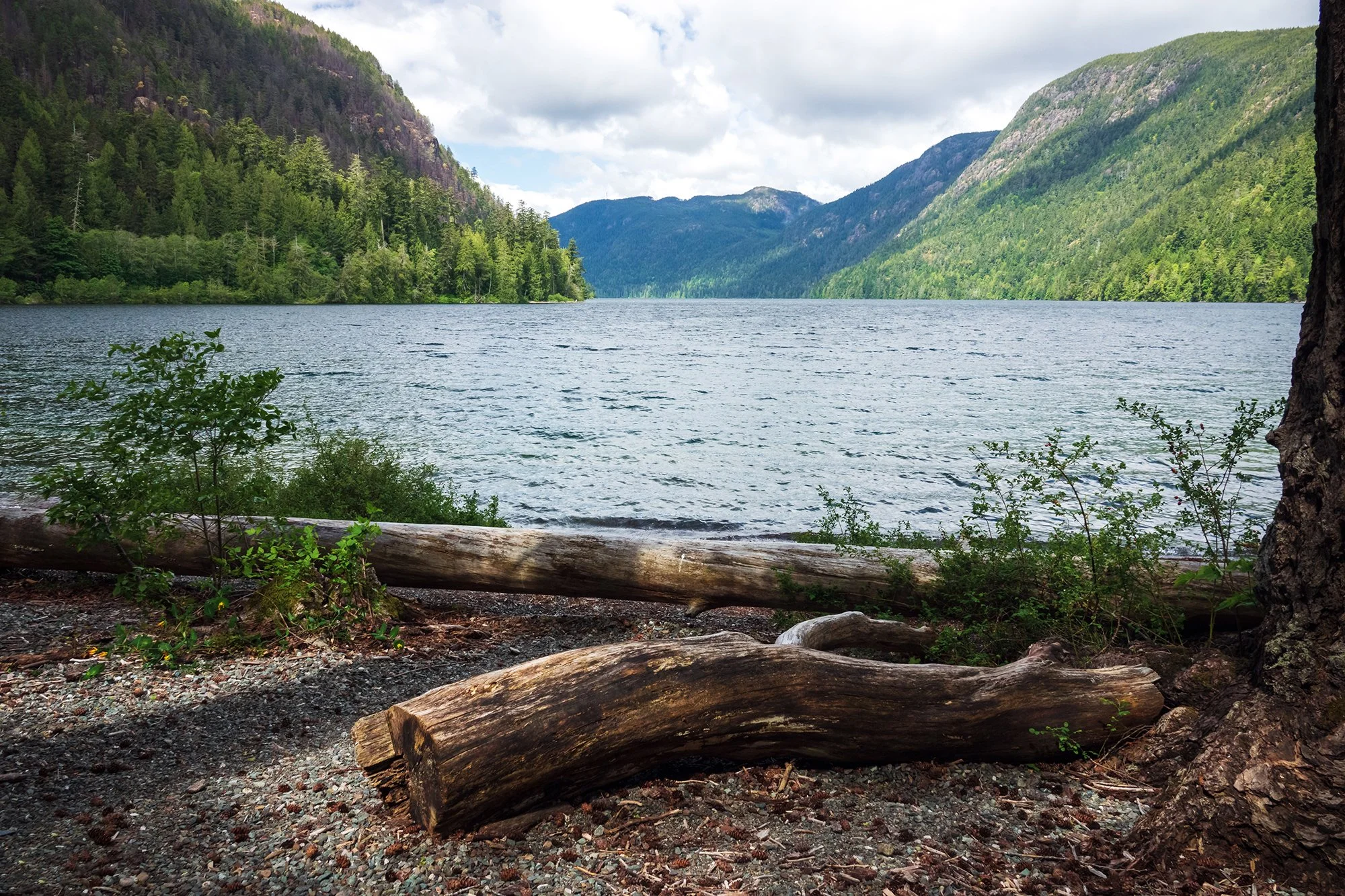
From here, I drive about an hour northward, crossing the mountains to Lake Cowichan and the Cowichan River Valley. Today will be the longest driving day of my trip, as I have to extricate myself from the southern island, return eastward to the Trans-Canada Highway, follow that northward past Nanaimo and Parksville, and then turn west along the Alberni Highway and ultimately reach the coast along the steep and winding Pacific Rim Highway. All-in-all, five hours on the road before I can rest. At the terminus of the Pacific Marine Road, I make a slight detour through the sleepy town of Honeymoon Bay to visit Gordon Bay Provincial Park. It’s just after 8 AM, and morning mist is still rolling off the lake and across the distant mountains to the east. I spend some time photographing at the lakeside, and walking a short trail onto a rocky headland that juts into the bay. With plenty of time to spare, I also turn my camera to smaller details in the forest: the ubiquitous witch’s hair lichen that clings to the trees, and the clusters of wildflowers and fruiting plants that carpet the trailside, including western starflowers, large-leaved avens, cascade oregon-grapes, and western columbines.

Back at the car, I settle in for a long drive to my next destination: a lunch pit stop at the Old Country Market in Coombs, outside of Parksville. Leaving the Cowichan River Valley behind and joining the main highway that courses northward along the Island’s east coast, I come across an incredibly Canadian (or perhaps Vancouver Island-specific) road phenomenon that drives me and my inner Masshole bonkers: They actually use the left lane only to pass. In no place else in the world have I ever driven a 2-lane road where 95% of the drivers hugged the right lane, regardless of level of congestion, content to go for miles and miles (or is it clicks and kilometers?) hugging bumpers well below the legal speed limit. With silent apologies, I zoom/weave along the left lane, unable to bear crawling along the highway at a snail’s pace while there is an absolutely open and usable travel lane. Fascinating.

In Coombs after nearly two hours on the road, I arrive at the Old Country Market, a complex that includes, among other things, a bakery, a donut shop, a farmer’s market and nursery, a sizeable gift shop, restaurants, and an ice cream parlour. The market is famed for having goats grazing on its turf roofs; alas, with the steady rainy weather, today there are no goats to photograph. I settle for buying a few sausage rolls, a Portuguese egg tart, and a generous scoop of stracciatella and mango gelato. Then it’s back on the road again, continuing westward toward Port Alberni.

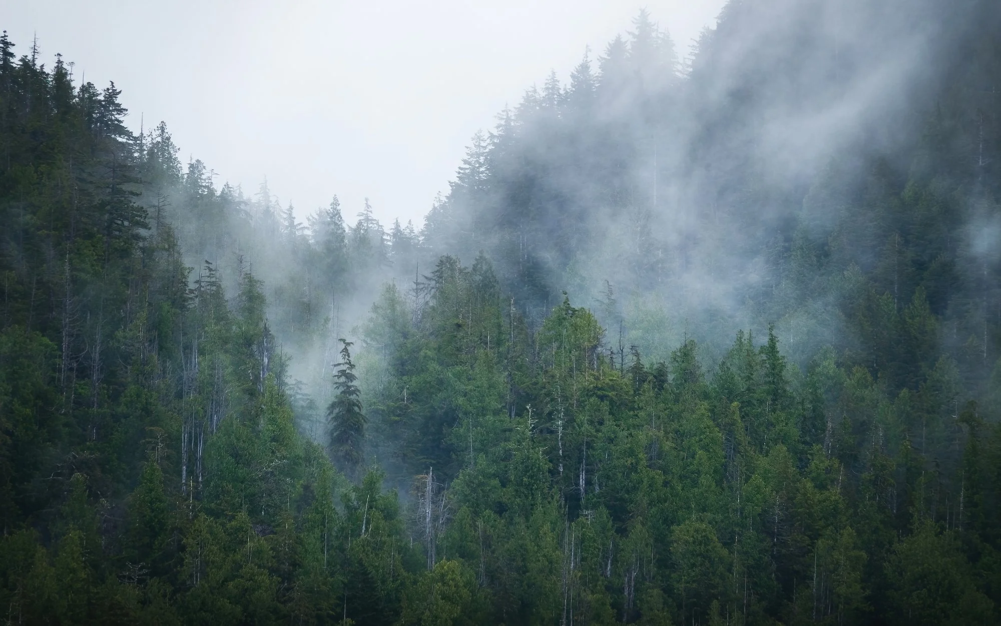
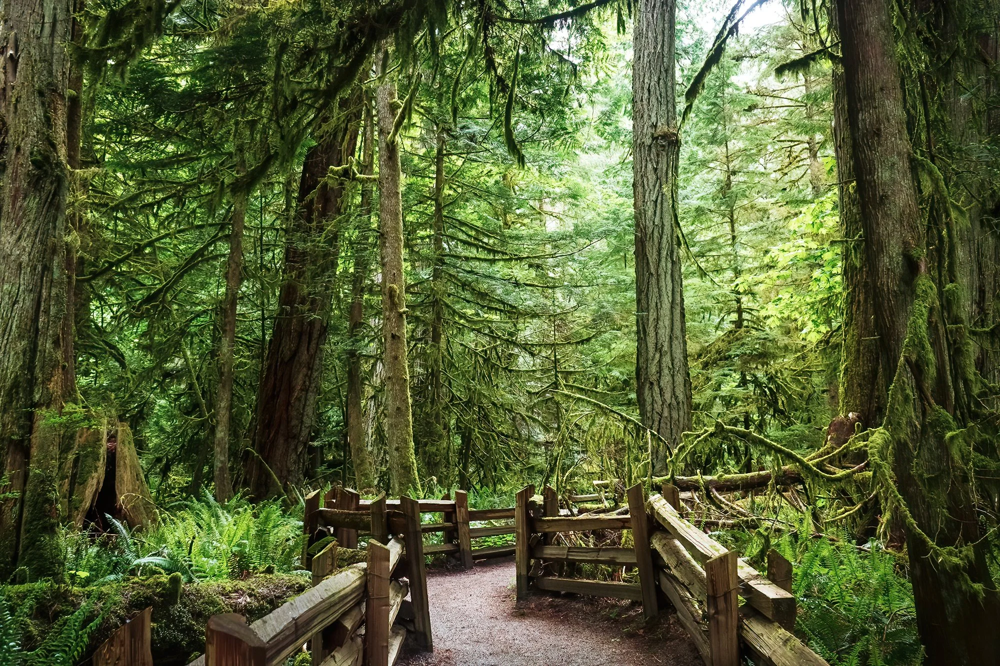
Heading further down the road past Cameron Lake, my next stop is at Cathedral Grove, a well-known and well-visited section of old-growth Douglas fir forest abutting the highway in MacMillan Provincial Park. The trees here are large and the forest is marvelous, but after yesterday’s near-spiritual experience in the silence and solitude of Eden Grove, Cathedral Grove feels more like shadow of what it could be - a pale, Disneyfied imitation of old-growth woodland, replete with walking paths, crowded roadside parking, and a highly calculated yet insufficient number of portapotties. Perhaps it’s just me. Or perhaps it’s the fact that I still have two hours to drive before reaching the coast, and I am growing increasingly sleepy post-lunch after being on the road since 6 AM. In any case, I take a quick walk along the loop trails on either side of the highway, photographing the stately trees and their surroundings as best as I can. The section south of the highway, in particular, is notable for some excellent examples of nurse logs, and a lovely riparian environment adjoining the Cameron River.

Continuing west, I pass through Port Alberni and continue along the highway toward Ucluelet and Tofino. The road now follows the north shore of Sproat Lake; past the trees and across the water, I can see tantalizing glimpses of still-snowbound peaks in the mountainous interior of the central Island; alas, there is nowhere to safely pull over aside from a small rest stop along the Taylor River, so I continue to drive along, a bit distracted. Past Sproat Lake, the highway narrows and winds into the gorge of the Kennedy River, following the contour of the nearby hillsides before emerging on a clifftop overlooking Kennedy Lake, the Island’s largest lake. Here, I see tantalizing glimpses of the fjordlike landscape that characterizes the west coast: curving, steep-sided inlets that join and flow into each other, dotted by an archipelago of tree-covered islands large and small, backed by rounded peaks and rolling banks of mist. To escape a particularly slow driver who seems totally daunted by the highway, I pull away from the caravan on a whim and park beside the Kennedy Lake boat launch, where I take panos and far shots of the lake at eye level. Then, it’s back onto the (now much emptier and more-pleasant-to-drive) road south to my next stop: the Willowbrae Trail near Ucluelet.

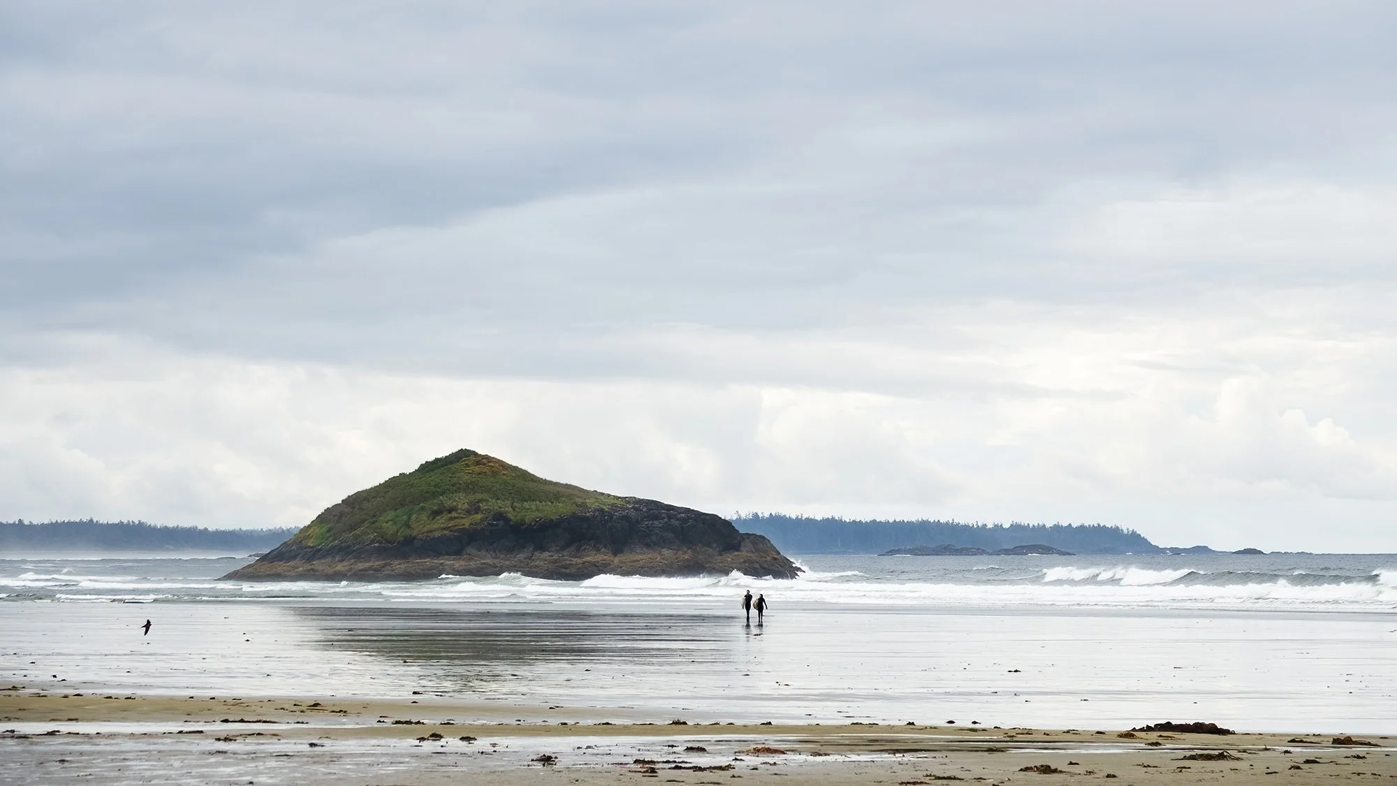
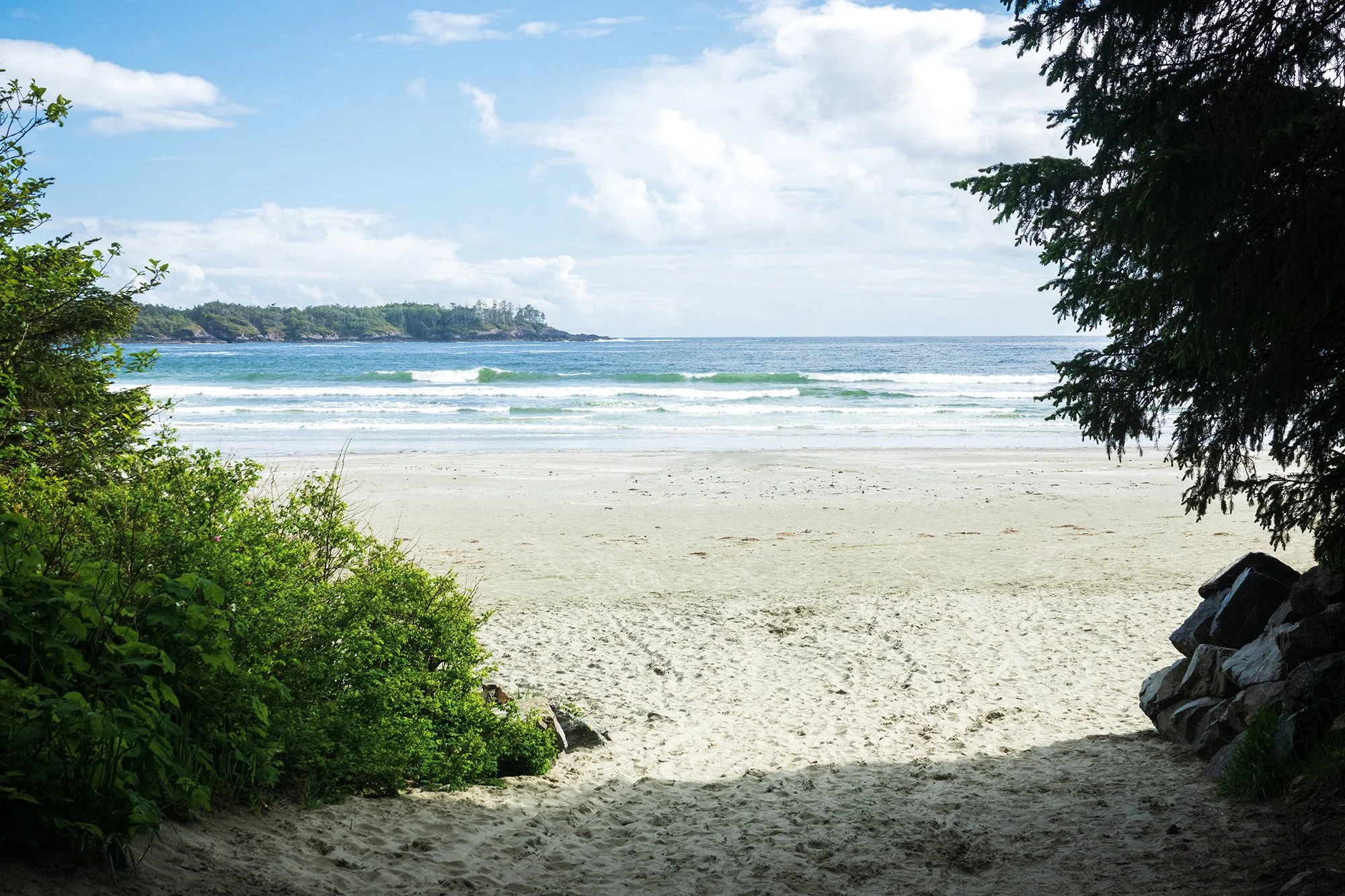
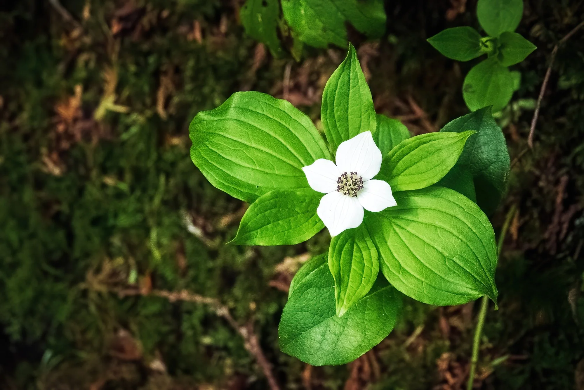
It’s mid-afternoon now. The Willowbrae Trail leads through stands of second-growth pine forest, to the edge of the sea at Florencia Bay and Half-Moon Bay. I walk the undulating path and climb the steep staircases down to both beaches, which are beautiful against the shining afternoon sun and the pounding of the surf at high tide. I seem to have left the gloomy weather behind on the other side of the Island; the tradeoff is that it is fairly hard to get anything but washed-out, white-grey skies on my photos, thanks to the harsh, high-contrast light of the beach and the surrounding forests. The plant life remains stunning, however; here on the coast, I photograph spruce trees, trilliums, ferns, and flowering dwarf dogwoods - all admixed with the the most common shrubs of all: the salal and its accompanying evergreen huckleberries, both of which are fruiting at this time of year. Along the highway and in clearings throughout the forest, I also see amazing, tall bushes of rhododendrons and azaleas. It’s quite a feast for the eyes. After returning from the beaches, I take another stroll starting from the nearby Ancient Cedars trailhead, which winds through stands of old-growth cedar forest, past beautiful examples of culturally modified western redcedars. I follow the trail as its splits onto a section of the Wild Pacific Trail, which paralllels the coastline, before returning to the car and entering Ucluelet proper. In town (“Ukie” for short), it’s early dinnertime now, and I stop by Cedar Grill for a delicious meal of seafood chowder and pasta with a pesto sauce of sautéed smoked salmon, mushrooms, and onions. Next door at the Reflecting Spirit Gallery, I purchase the obligatory trip magnet before the proprietor closes up shop for the evening. Then, it’s further south to the tip of the peninsula, and my final destination of the evening.

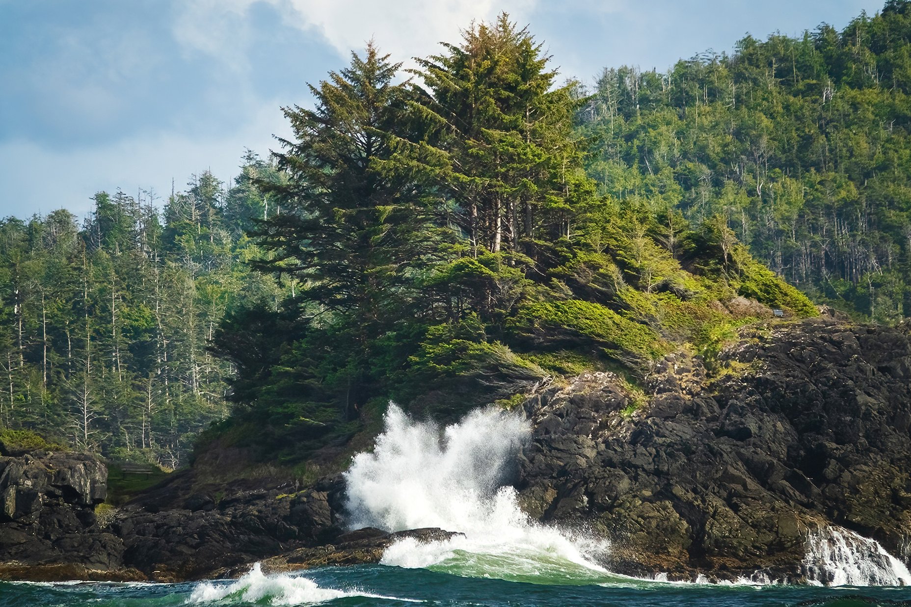
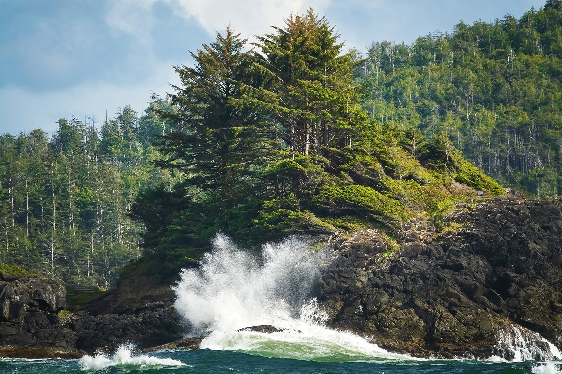
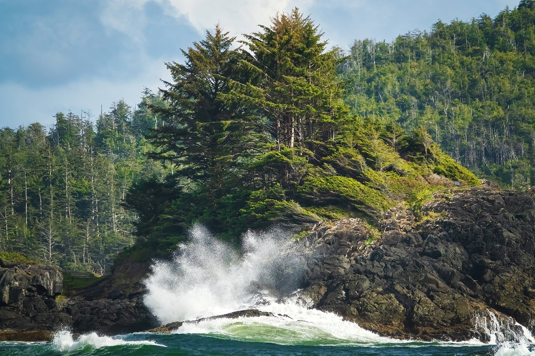
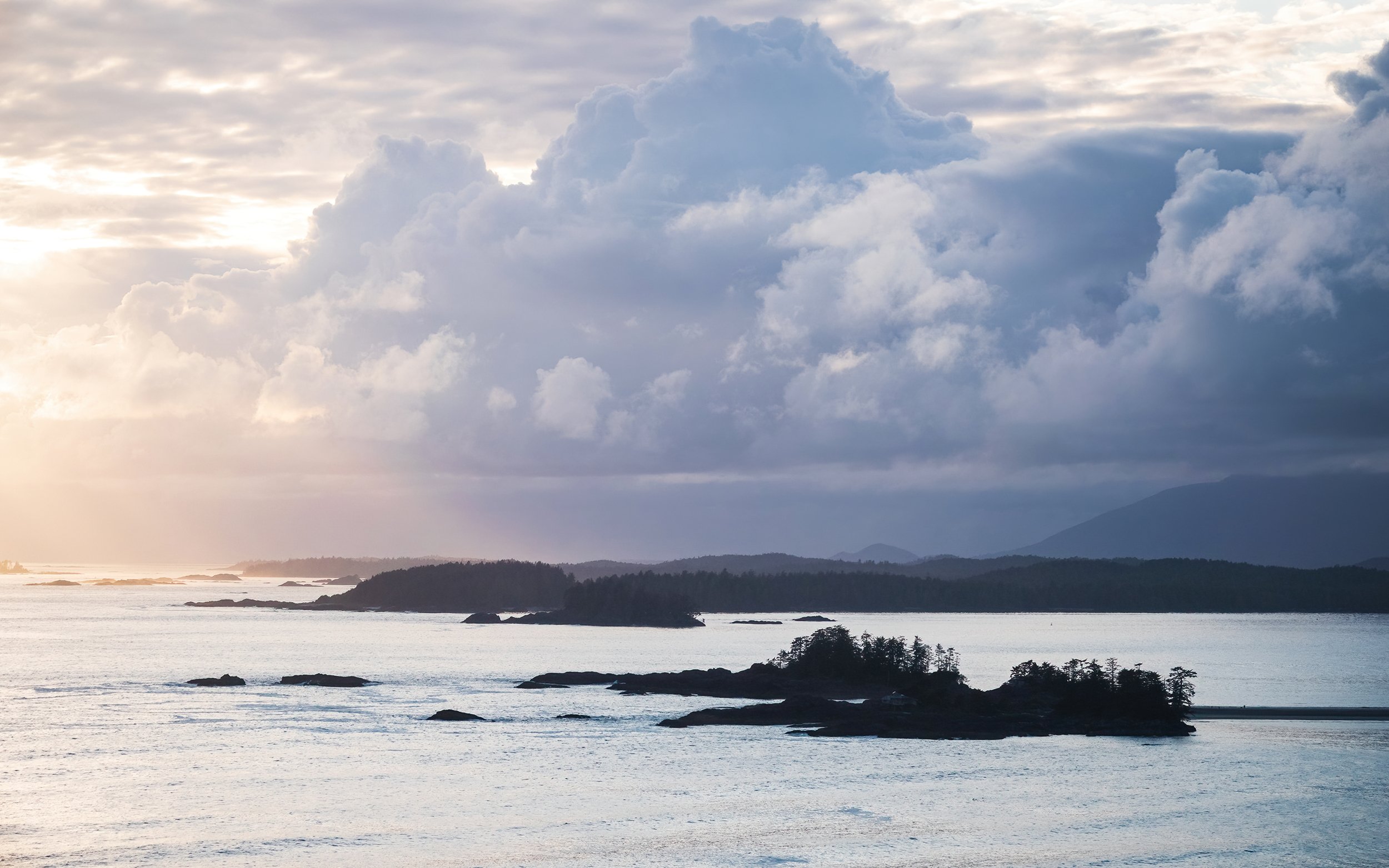
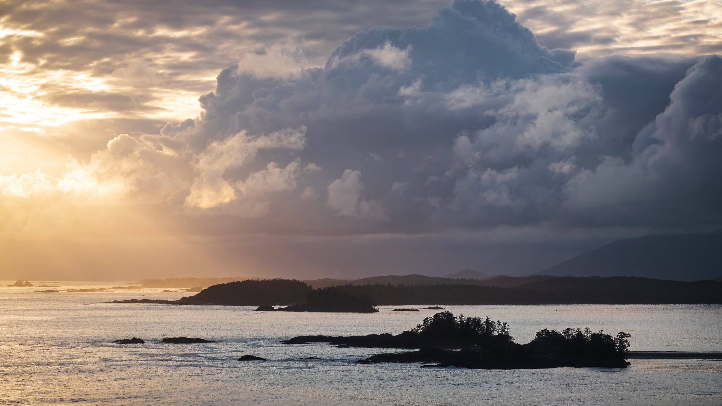
As I drive down to the lighthouse at Amphitrite Point, just a few minutes past Ucluelet, my heart lightens as I realize (with mixed emotions) that the coastal fog is rolling back in, and the chance of a brilliant sunset is all but none. Rain - inches of it - is in the overnight forecast. What this means is that the photos will stink a little more — but I’ll get to GTFO and check in at the hotel a little sooner. A welcome thought after a long day that would have been a 6 AM - 9 PM marathon involving five hours of driving and four or five different walking trails. Out on the headland, I fire up the Alltrails app for the final time today, and proceed in a counter-clockwise loop around the lighthouse. This segment of the Wild Pacific Trail is quite beautiful in the grey light of early evening. To the east, buoys clang and seabirds soar along the Carolina Channel. This stretch of wild water is dotted with islands and rocky reefs, and is loosely known as the northern edge of the Graveyard of the Pacific, for the shipwrecks that have happened along this coast. It’s a beautiful sight, the various islands of the Broken Group skimming the ocean’s surface, with the mountains of the Carmanah region rising statuesquely behind them, faraway and nearer to my starting point earlier this morning. I continue around the coast before cutting across the road to the other side of the peninsula, where there are equally pretty west- and north-facing views. Sunset is patently going to be a nothing-burger (the clouds are quickly moving in), but I spend some time composing images of the wave-dashed shoreline, sometimes with foregrounds of tidepools, salal, and forest.

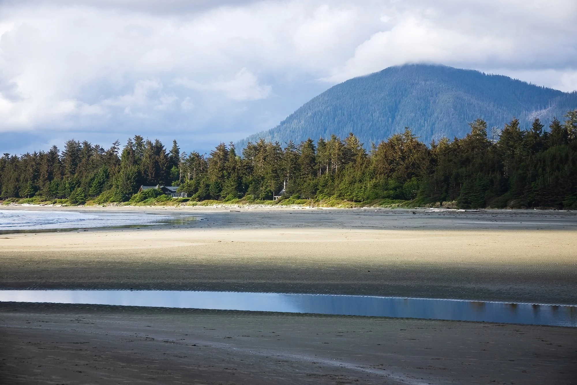
Back at the car at 8 PM, I am exhausted. I clamber back in and make the drive from the peninsula back north past Ucluelet and through Pacific Rim National Park, which I will be exploring on the morrow. I check into the Hotel Zed Tofino not a moment too soon, as the night’s rainstorm has begin to come down in earnest. With still an ounce of adventure left in me, I first check out the tiny path behind the hotel’s parking lot, which leads to a deck with a view of the Tofino mudflats (rain-soaked and zero visibility) before heading up to my room for the next two nights. After provisioning my food, drying my clothes and boots, and taking a hot shower, it’s time to watch some TV (Oh god, such a luxury…) before going to bed.

Vancouver Island: Long Beach Wild

“I loved every bit of it — no boundaries, no beginnings, no end, one continual shove of growing — edge of land meeting edge of water, with just a ribbon of sand between. Sometimes the ribbon was smooth, sometimes fussed with foam. Trouble was only on the edges; both sea and forests in their depths were calm and still. Virgin soil, clean sea, pure air, vastness by day, still deeper vastness in dark when beginnings and endings join.”

— Emily Carr (1871-1945)
Growing Pains: An Autobiography

I wake up after a night of restful, quiet sleep at the Hotel Zed Tofino. It’s a relatively new joint - built in 2020 and opened (post-pandemic) only a few years ago - new enough that it wasn’t on my radar during original trip planning between 2019 and 2022. The whole building has fresh decor and a cool, retro-70’s vibe. After a relaxing rain-shower and breakfast, I head out in the early morning. Again, I’ve intentionally slept in past sunrise, as the rain has only finally let up in the past hour. The rest of the day, though, promises, to be clear and sunny until nightfall - a welcome change after several days of wild and moody weather. In stark contrast to the previous day, drive time will be minimal; most of the day will be spent on-foot exploring the trails of the Pacific Rim National Park Reserve and the environs of the Esowista Peninsula, including the surf-town of Tofino. This fragment of the northwest coast - a jumble of sounds and islands, forests and mountains - is an ecologically and culturally significant place. The Clayoquot Sound was the focus of the “War in the Woods” in the early 1990s, a series of blockades that saw indigenous and Anglo-Canadian residents of the area joining forces to prevent logging on nearby Meares Island. To this day, the UNESCO-recognized Clayoquot Sound Biosphere Reserve protects nearly half a million acres, including ecosystems as varied as temperate rainforests, lakes and estuaries, and alpine peaks. It is a beautiful place to spend time on the ground, photographing the region’s diverse flora and fauna in the context of their living landscape.

My first stop of the morning is the boat launch at the end of Grice Bay Road, which faces out on one of the winding inlets between the forests, and features a stunning panoramic view over the mudflats east of the Esowista Peninsula. It’s a serene morning: clouds rolling across the sound and obscuring the view of distant peaks beyond Indian Island, mist rising from the trees on neigboring islands, a squad of fishing boats quietly loading up and setting off across the water. I make use of the long lens of my camera, zooming in to capture distant features in the landscape. I’m spending part of the morning scouting for potential sunrise locations for the fourth and final full day of my trip, in case the weather tomorrow will allow for golden light (spoiler alert: it will not). Grice Bay, for the moment, is one of my top candidates. I next backtrack to Radar Hill, where a short paved walk leads to a hilltop vista overlooking the entire peninsula, from the open Pacific Ocean to the west, to the mountains and sounds to the north and east.

Zigzagging my way back across the peninsula, I next take a long walk at Long Beach, a massive, 10-mile stretch of sand that spans the length of the Pacific Rim National Park Reserve, and is the very heart and soul of the park. Despite the early hour, there are a few surfers catching waves out beyond Incinerator Rock; I sneak some shots of them as they walk back up the beach, in order to convey some human scale in this enormous place. Turning south down the beach, I set off, walking over a mile across the sands. The coast seems to stretch to infinity, the distant forests always receding no matter how far I walk; in the gloaming and the half-light of the shrouded sun, the boundary between sea and sky seems blurred to my eyes and to the camera lens. I walk along slowly, following the wrack line, admiring the tangles of driftwood and kelp - lost in my thoughts, once again. It occurs to me that, here in the park, with precious few signs of civilization, this incredible beach must appear quite similar to how it did a century ago, or a few centuries ago. A truly timeless place - the wild, western edge of the country. I find myself wondering how it must have felt to be a Anglo pioneer here, a world away from the aristocratic trappings of Victoria, long before the asphalt highway and the logging roads, the beach resorts and tourist towns. In a land inhabited richly by the First Nations, the sea wolves and the black bears, the orcas and the salmon. I find myself full of gratitude, that places like this can still exist, and hopefully will for some time.

Further to the south, I park at a trailhead within the national park that leads to two stands of old-growth cedar rainforest on either side of the highway. Although the environment does not approach the magic of Eden Grove, these forest groves are nevertheless quite dense and lovely. I take photos from throughout my walk - including a selfie along the boardwalk - before returning to my car and driving back to Tofino. On the way into town, I stop a second time at Grice Bay to see if the clouds have lifted at all across the water. The mountains remain invisible, but the inlet appears strikingly different at low tide. I take a few shots of the braiding estuary channels across the mudflats, before moving north into town.

Tofino is a surf town through and through. There is something magical about the place, surrounded as it is by multiple bodies of water, across which sit mountainous island peaks that peer down at you from beyond the clouds. It can get pretty crowded in the high months, but I manage to find easy parking in a pay-lot just off the main street, and set off exploring on foot. Things are quieter this week than they will be for the rest of the season, as I am visiting one week after the Victoria Day holiday week in Canada. Several shops and restaurants in town are closed today - giving the staff a midweek break before the frenetic activity of the summer months. I wander the waterfront, photographing the distant islands, the boats in the marina, the floathouses in the inlet, all the while looking for a bite to eat. Eventually, after dodging around town and into both a grocery store and a bookstore in rapid succession, I settle on grabbing a patio seat at Shed and ordering a burger and fries. After lunch and a bit more wandering back along the road for different views out onto Tofino Inlet, I return to the car and head back to the hotel for an afternoon rest break. Along the way out of the town, we are halted for road construction - preparations for the summer, no doubt. Everywhere along the roadside, rhododendrons and other summer flowers are in full bloom.

In the late afternoon, after a good bit of relaxing in the hotel room and a brief nap, I head back out to Chesterman Beach, just a few minutes away. This L-shaped stretch of sand covers one elbow of the Esowista Peninsula, connected at low tide by a tombolo to nearby Frank Island. I walk the expanse of sand from South Chesterman Beach to the tip of the sandspit - an enjoyable walk with lovely views of the distant mountains rising up over Tofino and its inlet. Along the way, I run into other beachgoers: a raven picking apart a mussel, a flock of sandpipers scurrying between intertidal channels, and a friendly goldendoodle dragging its leash behind it, who brings me a frisbee to throw. I look around for an owner, but they are nowhere to seen; the frisbee is thrown. Along my way up the beach, I photograph the action of the waves crashing on nearby Pettinger Point, and beyond them, the forested knoll overlooking Cox Bay, where I will be spending the sunset golden hour. The beach is expansive and beautiful. I reach the rocks below Frank Island before turning around and making my way (slowly, gradually) back toward the car.

My final stop of the day is only a few minutes away down the road: a walk down Sakurai Lane, along Cox Bay Beach, ultimately climbing to a hilltop overlook of the bay and the entire peninsula. It’s 7 PM now - I’ve budgeted plenty of time until the 9 PM sunset, as it seems almost a certainty that the scramble up and down the hill will be quite an adventure. Before getting there, I photograph the sidelight falling between the trees along my walk (a easy gravel stroll shared only by a few surfers returning from the beach), and the driftwood and tidal channels on the beach itself. Reaching the foot of the hill, I clamber up a stone ledge and begin a steep climb up the hill.

Maybe it’s just me, or maybe it’s the recent rain, but while this trail is a known quantity and a well-visited sunset spot, I would classify it as, at best, “barely better than a bushwhack,” and, to be frank, “the muddiest thing I have ever done.” In some places, I cross through shin-deep mud to find my way through the tree roots and up the mountain. The way up is not so bad, as there are plenty of roots and branches to grab ahold of and pull oneself up. It’s the way down that I fear; even though I am carrying a headlamp, I mentally make a note to myself to get back down to the beach before the post-sunset twilight gets too dark. One wrong move could lead to nasty slip and fall down the slick, muddy slope - messy, if not injurious. Secondly, I make a mental note that this trip will be the final hurrah for my hiking boots, which have accompanied me since our final year in Baltimore, and gone with me to places as varied as the Mid-Atlantic, the Adirondacks, the desert Southwest (three times), Oregon (recently), and throughout New England on multiple backpacking or foliage trips. A cheap pair from an outlet store, they sprang a leak almost immediately when I first began to wear them in 2019. That I’ve worn them for this many years after must be a reflection of either my laziness or my cheapskate tendencies - unflattering either way.

The scramble, thankfully, is not a long one. With socks damp yet again and each boot looking fully like its own chocolate ganache cake, I arrive at the top (sort of) of the hill, which offers expansive views over the windblown pines, to an breathtaking vista that covers the Pacific Ocean, Chesterman Beach and Frank Island in the distance, the waves crashing upon Cox Bay, the distant islands in Tofino Inlet, all rimmed by stunning mountains rising above the forest. After catching my breath, I take a moment to explore the hilltop, which involves some sketchy bushwhacking to reach a true summit viewpoint that faces east and south (perhaps a lovely sunrise location, but too adventurous for my taste, in the wee hours before morning). After confirming I am where I thought I would be, I move back to the northwest-facing slope. From this viewpoint (a false summit of sorts), there is not much room to maneuver, so I set up my tripod and patiently wait. Two other hikers and another photographer (carrying medium-format gear, of all things) reach the top shortly after me; we trade some disbelief about the bushwhack before they move on, returning back down to a lower viewpoint out of sight from me. I am alone up top for the next hour, watching the light gradually change and getting eaten intermittently by some sort of biting fly (the bites don’t itch immediately like mosquito bites do for me, but the next few days prove that my skin is just as horrifically reactive to these as they are to any other insect bite; I return to work a few days later with hilariously large welts on my face and neck). For the moment, I am too caught up by the landscape to care about anything else. I take a mix of long shots and panoramas, using my circular polarizer to bring out the best of the sunset light. We never quite get the fiery skies of a genuine, low-horizon sunset (the sun dips into a marine layer half an hour before setting, an oh-so-common occurrence around these parts, as I realized in Oregon), but the photos below are still quite pretty and hopefully capture the evening’s mood.

As the sun sinks into a bank of clouds, I resolve not to stick around until dark, which turns out to be a wise decision. I get a headstart down the mountain; there is a decent group gathered on the ledge below mine, but I hardly see anyone once I descend into the trees and begin making my way down the muddy slope. After what seems like an eternity (in reality, just 15 minutes or so of carefully lowering myself down some very slick surfaces), I re-emerge onto the beach and begin my walk back to the car. At Sakurai Lane, I turn around and take a final shot of surfers stepping out of the waves and preparing to leave for the night. All in a fine day’s work (and play).

Vancouver Island: On Island Time

“Be warned, this outer edge of Canada is lonely, exciting, and unforgettable. It is a disease. It may fill your comfortable life with restlessness.”

R.M.O. McMinn
Island Events, June 20, 1952

My final morning in Tofino. Peeking outside my window before sunrise, I see that the sky is still a sheet of grey cloud, so I reset the alarm and ensconce myself back into bed. This is vacation, after all. And while I have several hours of driving to extricate myself from the Island’s west coast to the east, the day’s itinerary promises to be a more relaxed one than the past few days. After a few more hours lazing around, eating breakfast, and getting my things re-packed into the car, I set back off along the Pacific Rim Highway, pausing briefly for roadside photos near Kennedy Lake. My first stop of the day, in Port Alberni, is actually a shopping plaza with a shoe store. I’ve resolved to pick up a pair of walking sandals so that I don’t have to lug my muddy, stinky boots onto the plane and all the way back home to Massachusetts yet again; this day will be my au revoir to the faithful Redhead boots I’ve worn since 2019. As I tend to be with any sort of clothes shopping, this is an in-and-out affair. Walk in, grab a pair, try on two sizes, and purchase. After a quick pit stop and bathroom break, I continue east with a tank full of gas and new shoes in the trunk. I briefly pause for a stretch break on the shore of Cameron Lake, a pristine freshwater lake wedged in the valley between Mt. Arrowsmith and Mt. Wesley. This body of water, according to local lore, is reportedly the home of some sort of cryptid lake monster after several sightings in the early 2000s; today, I see nothing except the windy wake on the water’s surface and the traffic along the adjoining highway. A few miles down the road, I stop at Little Qualicum Falls Provincial Park, where a loop trail circles both sides of a deep, densely vegetated gorge, passing by two sets of beautiful waterfalls. It’s intermittently raining, making tripod usage and long-exposure photography more cumbersome than usual, but using my umbrella setup and my sleeve as a lens cloth, I manage to make a few half-decent images.

My second waterfall stop of the day is at Englishman River Falls Provincial Park, a little further down the road, past the Old Country Market in Coombs. Here, I walk the length of another pleasant loop trail that winds through stands of second-growth forest, paralleling the course of the Englishman River as it descends toward the straits east of the Island. The upper falls here are impressive, a canvas of tall white cascades bigger than anything I’ve seen since (as far as I can remember) New Zealand. But it’s the lower falls, emerging from the gorge and plunging into a deep-sapphire pool at the edge of the forest, that is the real photographic gem in my eyes. I take my time here, photographing the lichen-covered trees, the moss hanging from the cliffsides like forest tapestry, and the startling juxtaposition of the whitewater rapids beside a tall, leafy maple tree. Were it not for the rain, I would have stayed much longer and continued finding compositions; but were it not for the rain, the river and its surroundings also would not have been so active and so spectacular.

My third and final stop in Parksville is the summit of Little Mountain. The narrow road up the mountain leads past hidden houses and driveways, to the base of the radio tower at the top of the mountain. From here, a short path through the trees takes me onto an open cliffside fringed with arbutus (Pacific madrone) trees, their bright vermilion-smooth bark standing in sharp relief to the misty scene beyond. Down in the valley stretching between Parksville and the mountains, the afternoon’s rainstorm is clearing away, gradually revealing more and more layers of treetops in the forest. I sit on the cliffside for awhile, watching the clouds race and the views develop to the south and the east. As the rain moves away to the north, beautiful skies and lush green hillsides are revealed; I take a panorama, various long shots of the landscape using my telephoto lens, as well as obligatory end-of-trip selfie on the cliffside.

Back in the car, it’s a one-and-a-half hour drive southward to my destination for the night, Cowichan Bay, a coastal fishing community situated at the mouth of the Cowichan River delta. Staying in Cowichan Bay will allow me to not only have a quieter night by the water, away from the hustle and bustle of the Island’s east coast population centers, but it gives me only an hour of driving left the following morning, when I’ll be heading back to Victoria International to catch a morning flight. After a casual cruise down the highway past Nanaimo, I arrive at Cowichan Bay. Planning on an early night, I immediately set out out to grab photos of the estuary from the park across the street from my motel room, followed by a walk along the waterfront and a gluttonous dinner at The Vine: a seafood potato “pie” in cream sauce, and an obligatory order of poutine, which has been missing so far from my trip. The next morning, I bid farewell to my old boots and don my new walking sandals for the drive to the airport. Along the highway from atop the Malahat, I catch tantalizing views of the ocean in two directions: the Saanich Inlet and Lower Mainland of British Columbia to the east, and the Juan de Fuca Strait with Washington’s Olympic Peninsula to the south. I resolve to return and visit both, before too long. Another long day of travel and two delayed flights later (oh Air Canada…), I clear customs in Toronto and return home to Boston shortly after midnight. A tiring end to a whirlwind week on Vancouver Island, but one that I will be thinking of fondly, and often.