“Most of all I remember the Hebridean light - sparkling off the roiling surf in the turquoise bays, crisping the edges of the ancient standing stones on a lonely plateau overlooking the loch, making all the colors vibrant with its intensity and luminosity - making the place just the way I knew it would be… Pure magic.”
- David Yeadon
Seasons on Harris
"I see the land where I was born,
land of heroes in my eyes.
Though ‘tis hard and stony,
I ne’er will turn my back upon it.
From the ocean’s waves,
the most beautiful sight of all,
land where I was born.”
-’Chi Mi’ N Tir
translated from Gaelic, traditional song of Harris
I’m awakened in the middle of the night by birdsong, a twittering outside my bedside window in the dark fisherman’s hut. It’s a plaintive, sweet, and beautiful song, likely from some kind of plover, which nest in the springtime beside the lochs and little lochans here in the isles. Rising from my incredibly deep and restful sleep, I listen to the sound, and it seems almost magical. It is always wondrous - the call of a bird I’ve never heard before, symbol of a landscape so unfamiliar to me. Or maybe, probably, it’s just the jet lag. Unable to fall back asleep, I get up to read, journal, and review yesterday’s photographs. After an early, delicious breakfast out of my store-bought provisions (pain au chocolate, a cup of hot chocolate, raspberry yogurt, and delicious slices of smoked Orkney cheddar), I set out in the dark to photograph sunrise on the west coast of the Isle of Harris (Na Heiradh).


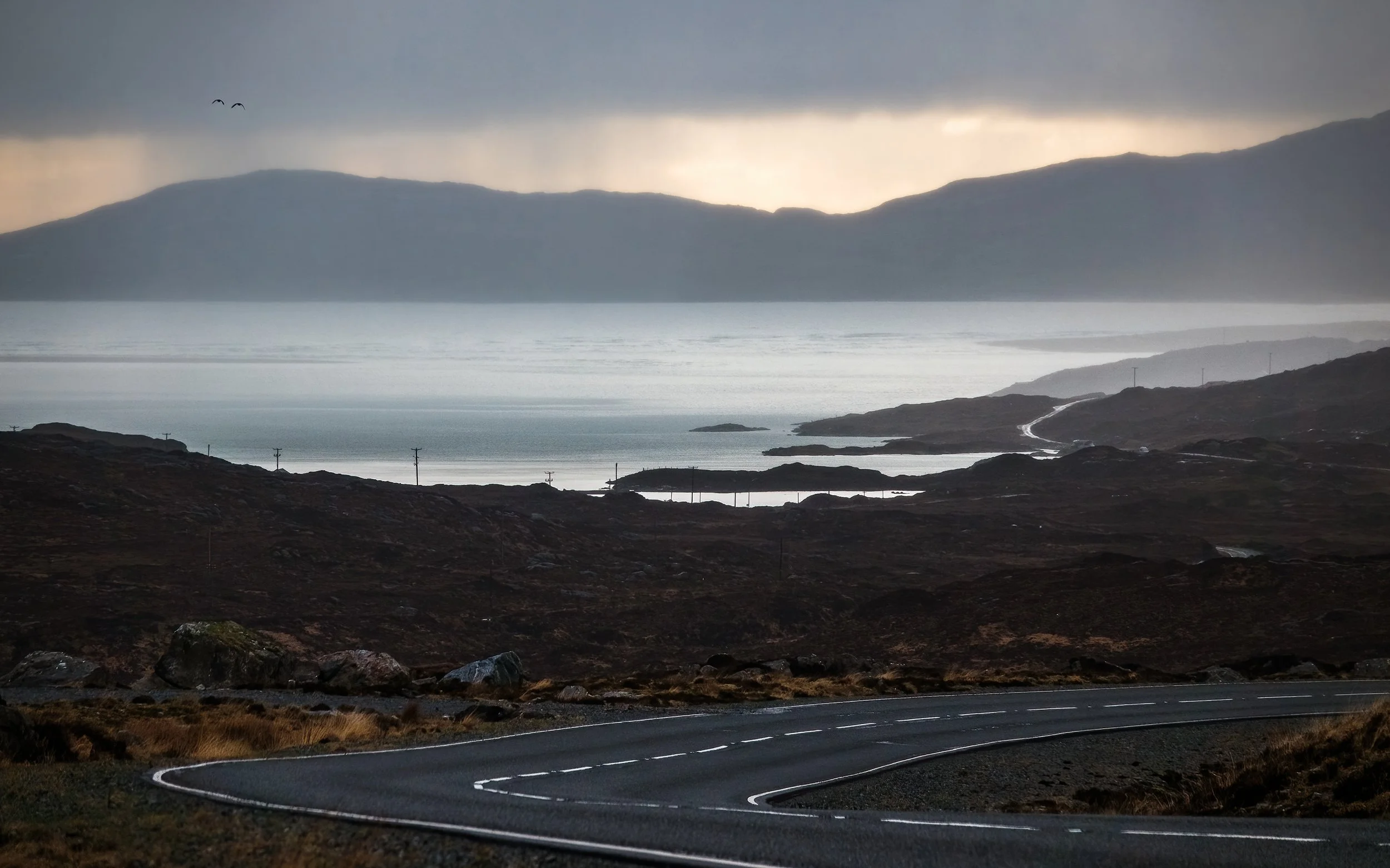
In the gloaming of pre-dawn, Loch Máraig looks like a gemstone glowing in the darkness from the highway above. I wind through the hills of North Harris, pass through the sleepy town of Tarbert, and climb cross the rocky spine of the main island. To the east, the colours of first light are beginning to appear over an expanse of rock and water that resembles a moonscape. It looks like something from the very creation of time, a primordial place, so much so that one is tempted to think of it as wild and uninhabited - but one would be wrong. Crofters have wrung lives out of this blasted, acidic soil for generations, especially since the Clearances of the 1800s. But that is a place for tomorrow. On this morning, I descend through a broad pass onto the west coast, and am greeted by the sweeping sands and lush green machair of Luskentyre (Lósgantair). Though my dawn destination is at the very southern tip of Harris, I cannot help but stop the every few miles to photograph the blue hour as it develops over the sands of Seilebost, the braided salt marsh besides Northton (Taob Tuath), and the hilly pass descending into Rodel (Roghadal).
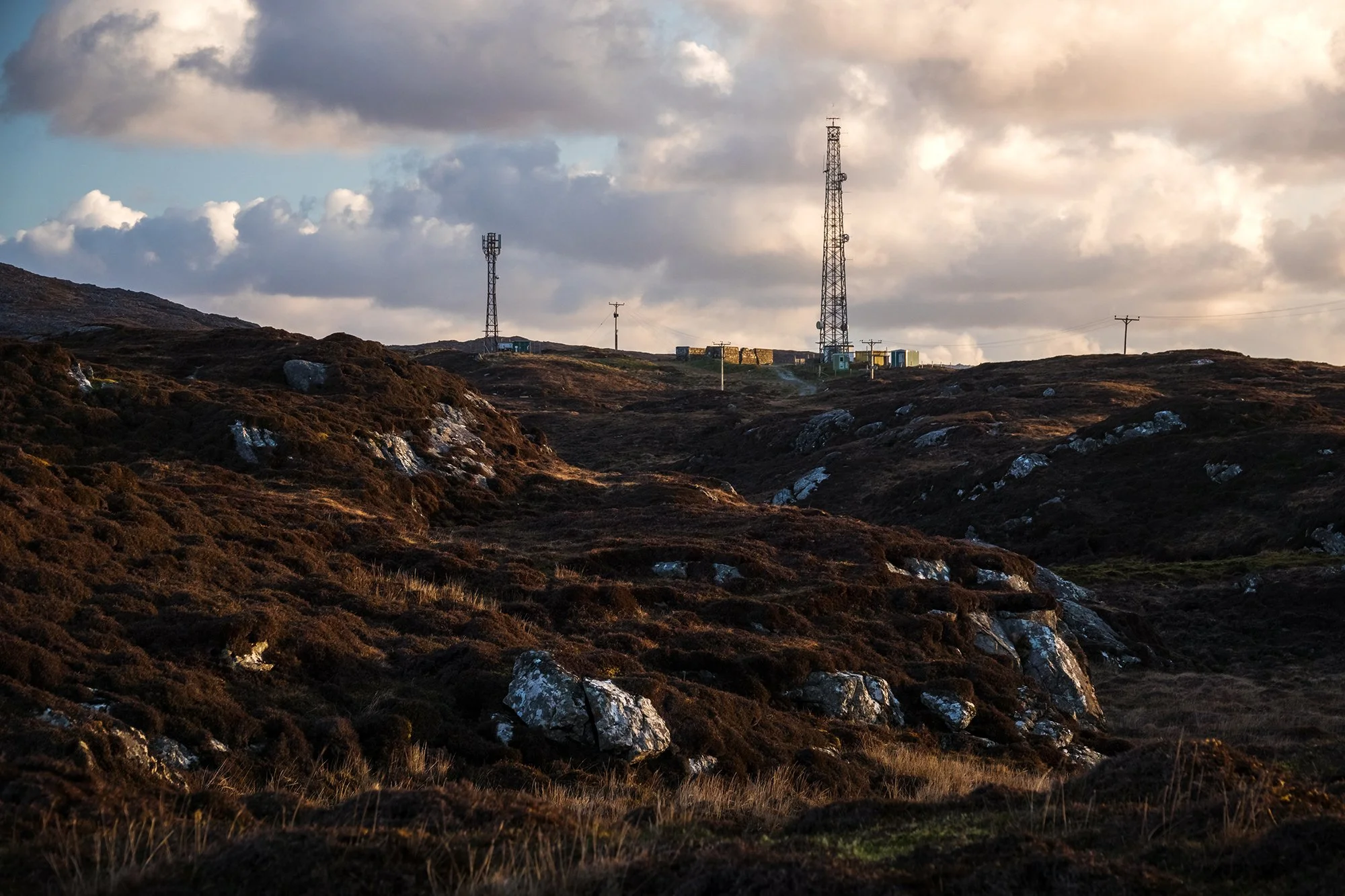
In Rodel, I park the car beside St. Clement’s Church, which was constructed in 1528 as the sanctified burial ground for Clan MacLeod, the finest remaining example of medieval architecture and stonework in the Western Isles. To get a better view of the area, I follow a sheep path off the road and clamber up a hillside, briefly crossing into a deep, squishing peat bog to do so. From above, I photograph as first light falls on the church’s stone tower, and wander around the upper moorland. To the north, the mast of a radio tower looms over the treeless expanse, and to the south, colourful bands of clouds are developing over the Minch, and the hills of northern Skye are visible in the distance. After sunrise, I eventually descend back to the village. I stop in examine the graves around the church, and to see its austere interior. I am alone here; a pair of beautiful, moss-covered sycamore maples is growing over the church’s stone wall.


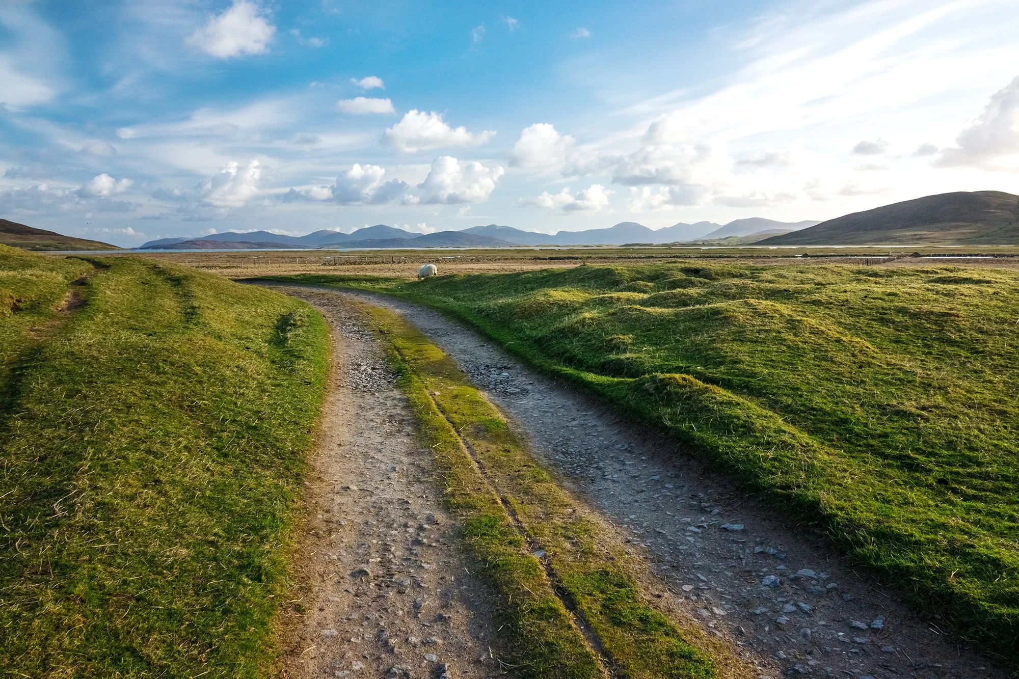
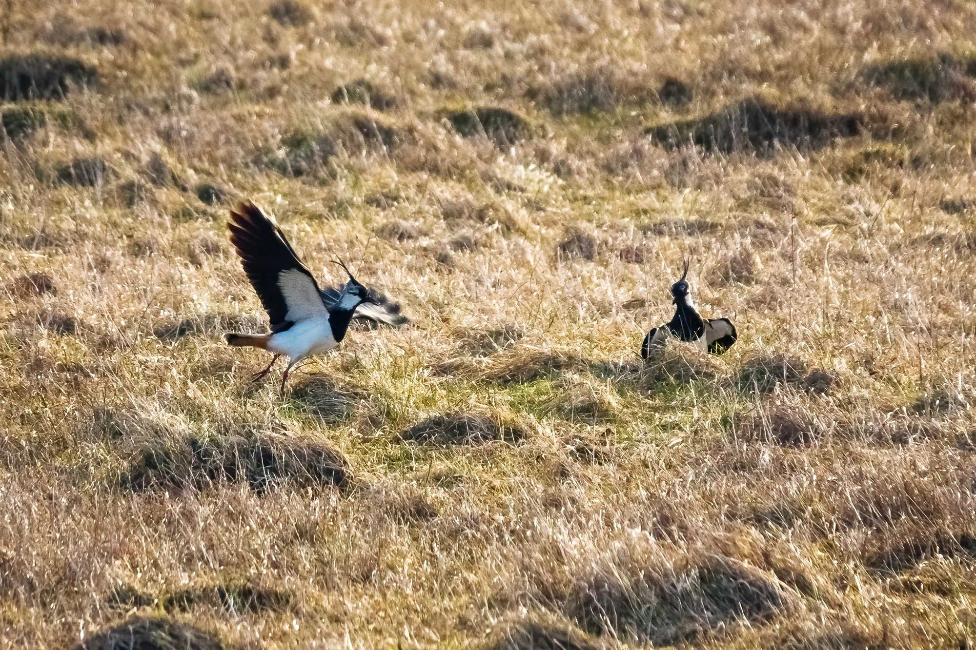
Back northward, this time stopping at Northton to take a long walk along the coast toward a ruined 16th century temple (Rubh An Teampaill) and to climb Ceaphabal (“Bow-shaped Hill” in Norse). Heading out from town, I pass through a sheep pasture and cross onto a beautiful expanse of machair. This fertile, grassy ground, which in the spring is covered with wildflowers and grazing sheep, is found only here in the Outer Hebrides. Its unique ecosystem is linked inextricably to the sea: marram grass growing on a bed of limestone sands blown by coastal winds onto the acidic soil; beaches to soften the impact of waves upon the dunes; kelp beds to provide nutrients to an intricate food web; a complex community of sandflies, passerines, waders, gulls, and all sorts of marine and migratory birds. The machair of the Outer Hebrides is in danger of being completely disappearing into the sea as anthropogenic climate change continues to take its toll. As I cross the grass, I watch a pair of breeding northern lapwings circle the sky to the north, silhouetted against the mountains of North Harris, the male making its dizzying, dancing flight and its characteristic cries. The pair swoop down to harass some oystercatchers in the marsh, who have probably inadvertently made their way too close to some unseen nest.
Toward and then beside ever-looming Ceapabhal, I make my way to the old temple on a headland overlooking the coastline, photographing the breaking surf, the oystercatchers prancing through the grass, and the distant isles of Shillay, Pabbay, and Berneray. Alone on the headland, I stop to rest inside the old temple’s stone walls and gaze out the window where the altar once stood. To the east, a stunning view of mountains and machair, and golden coastline. Then, it’s time to retrace my steps, turning northward onto the rocky flanks of the mountain, over a stile across barbed wire fence, and steeply, steeply upward. A golden eagle soars overhead, its wings catching the updraft off the mountain as I labor upwards, going over big granitic boulders and layers of gneiss and schist. It’s a grueling climb, but at the end, I am treated to sweeping views across the coast of Harris, and out to sea. A weather front moves in as a descend back to the car, bringing with it light flurries of rain. In the pasture, the sheep are awake and socializing loudly, and the spring lambs are suckling and playing in the rich, green grass.


Further north, I stop to photograph the church cemetery in Scarista, and after eating a picnic lunch in the car, I cross the sandy beach at Nisabost and climb the machair dunes to reach MacLeod’s Stone. I photograph an old couple wearing tweed coats and holding hands as they gingerly stroll down the beach; between this and all the mama sheep with their lambs, I think of Jane and miss her. It’s late morning now, and after further scouting adventures at Seilebost and Luskentyre (including the most picturesque burial ground I have ever seen), I decide I’ll return for sunset on the beach near the Seilebost schoolhouse, and make the long drive back to the hut to eat lunch and shower. Above the loch, Clisham (An Cliseam), the tallest peak in Harris, has finally revealed its stony face after being shrouded menacingly in cloud ever since my arrival - but it is destined to vanish again before the end of my afternoon nap. I sleep solidly through the bleating of the nearby flock and the pitter-patter of passing rain showers.


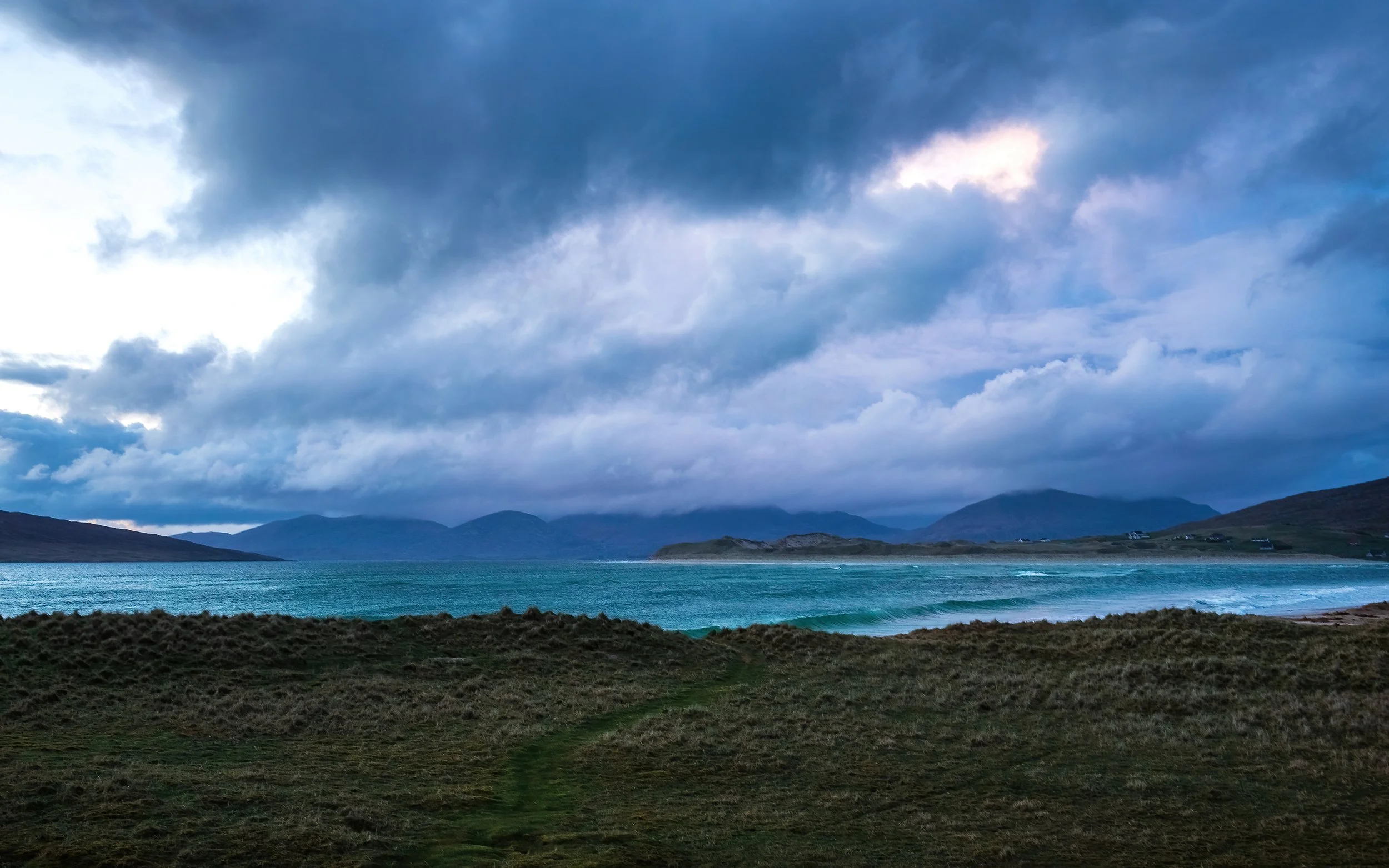
In the early evening, after dinner, I set out again to the west coast, stopping briefly for photos along the expansive moors above Tarbert. Parked again beside the Seilebost school, I visit the schoolhouse and photograph its playground before wandering down to the beach. The tide is in flood now, and the earlier gigantic expanse of golden sand has been transformed into a series of turquoise breakers which come one after another, slamming into the grassy dunes. I carefully set up well behind the edge of the grass, lest my camera gear and I become victims of coastal erosion along with the machair. Sunset is a somewhat muted affair, but I spend the next hour enjoyable photographing the wave action, and watching wisps of colour develop in the towering clouds over the mountains of North Harris. Then, it’s back in the car and back to my bothy to tuck in for the night.