Day 4: The Standing Stones

“They were godfearing people, those shepherds. There was no love in the relationship. Donnelly tells me that they had one Bible that was passed around in strict rotation. It was stolen by a visiting monk in 1776, two years before the island was abandoned altogether. In the interim, I wonder, did they assign chapter and verse to the stones and grasses, marking the geography with a superimposed significance - that they could actually walk the Bible and inhabit its contradictions?”
- Dan Pinchbeck
Dear Esther

“Fierce landscapes remind us that what we long for and what we fear most are both already within us.”
-
Belden Lane
The Solace of Fierce Landscapes

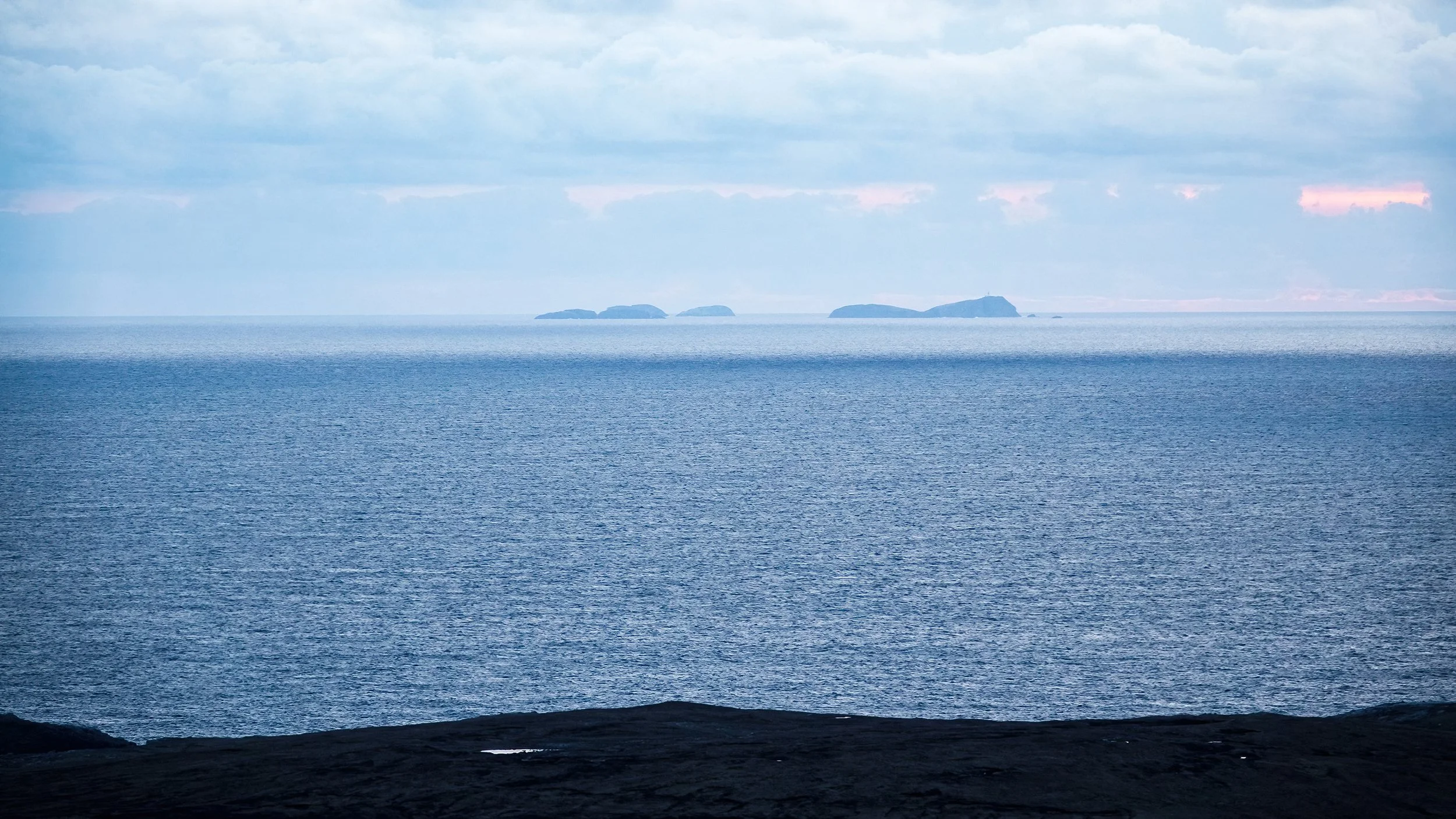
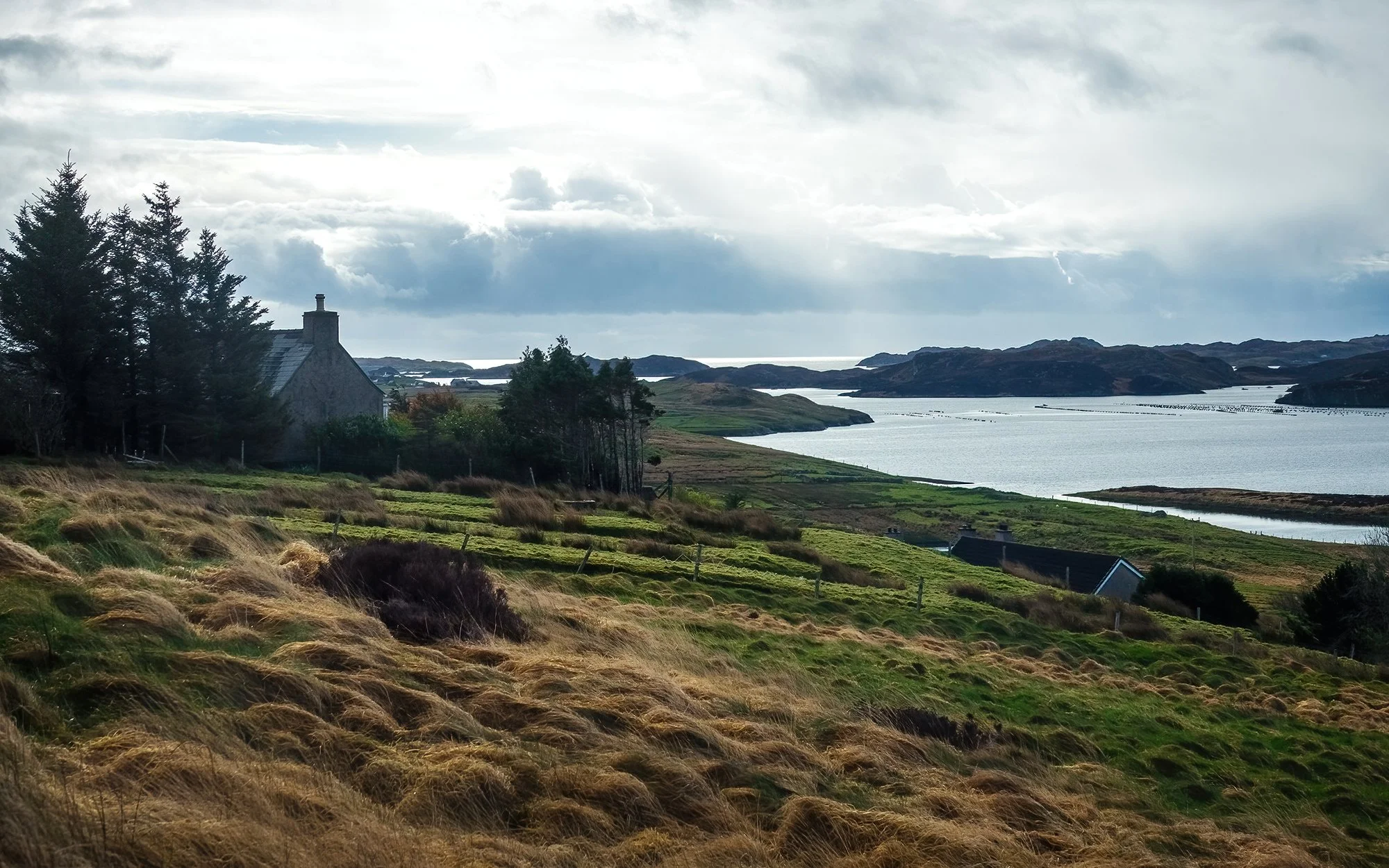
After cleaning up the hut and loading the car, I’m off northward again in the darkness of the early morning. My first destination is nearly an hour away in the Park (Pairc) district, where I’ll be paying a visit to the lonely crofting communities on Lewis’s eastern edge. Just before sunrise, I descend the road overlooking Lemreray (Lemrebhagh), a coastal finishing hamlet overlooking Eileqn Glas a’ Bhaigh, the Sound of Shiant, and its namesake islands. It’s an overcast morning, but the rapidly flowing clouds soon give way to breaks of light as I continue over a hill westward to the village of Orinsay. Here, I stretch my legs and take a walk behind the community center, where there is a fabulous view outward to the Shiants. I take photos of the distant hills, the sea view, and the local ewes and lambs, who look a little more surprised than usual to see a visitor in these remote parts.

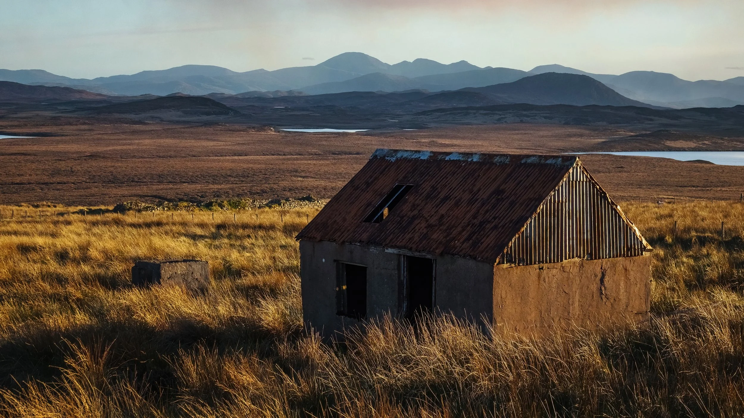
Back over the hill, I retrace my route northward, stopping to climb a local prominence with a radio mast; at the summit, there are sweeping views of the Pairc moorlands and lochs to the north and west. Back on the road after photographing the Free Church of Pairc in Gravir, I continue to the shores of Loch Eiresort. In the communities of Caversta and Garyvard, I take compositions of the loch’s eastern end. A flock of sheep at the end of the cul-de-sac in Caversta, perhaps mistaking me for their breakfast delivery, bleat excitedly as I look around with the camera. Now it’s time to return to the main thoroughfare, driving through a passing rainstorm between ample swaths of blue sky. In Ballahan, I park by the road to wait out the rain before photographing the derelict house once again - this time with frontal, morning light. The old truism about island weather (that if you don’t like it, you can wait a few minutes) proves very true indeed.

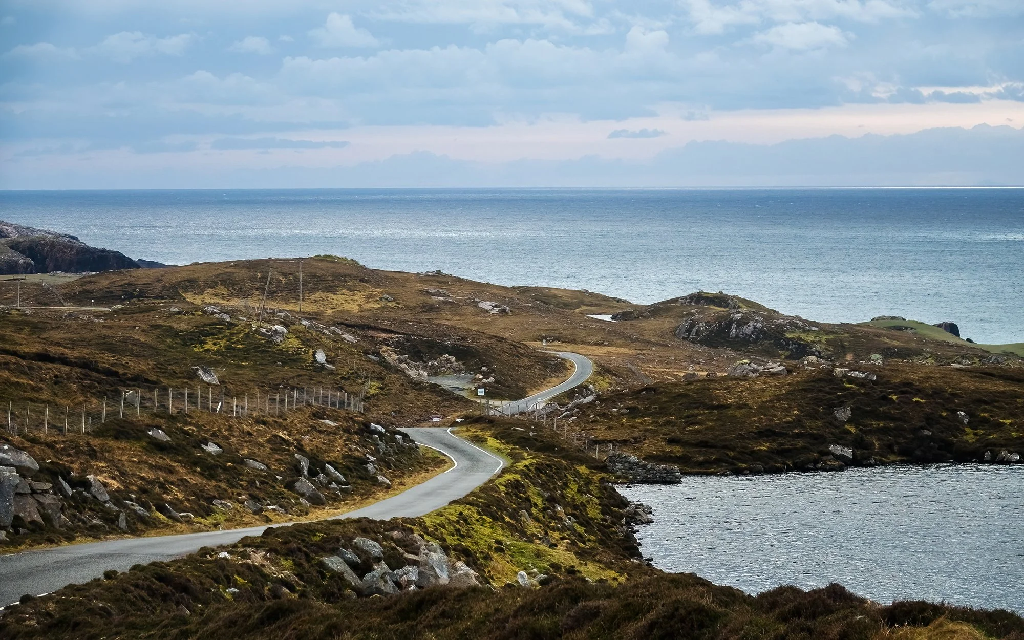
Continuing north now, I photograph the bothy beside Loch Bhaltois before turning eastward along Loch Liurboist. In the village of Leurbost, I scout out a few views of the loch from the residential side street on the hillside above. Then, it’s further on to Ranish, where I drive to the farm at road’s end and set off for a brief walk onto the grazing ground. After letting myself through a fence and dodging cowpies and sheep dung, I climb onto a nearby view to gain views of Loch Grimshader out to the sea. To the south across the sound, I can see the houses of the little settlement of Cromore, nearer to where I started the morning, and to the north, I can see faraway sea stacks and islets near the coast of Stornoway. The early morning’s clouds have cleared, and it’s an impressively bluebird day (for now) on the Isle of Lewis. I take some images with my long lens before heading back to the car.

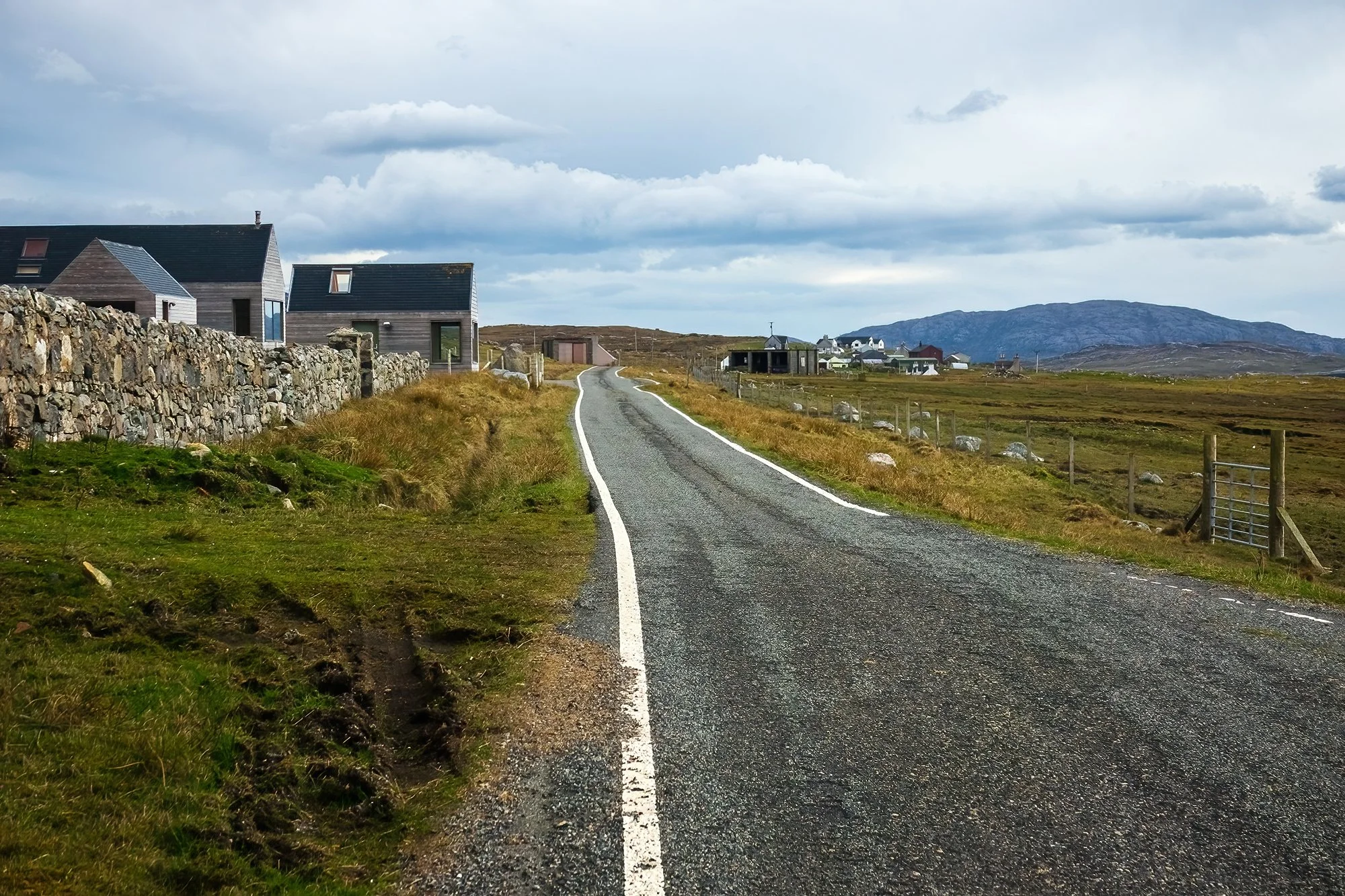
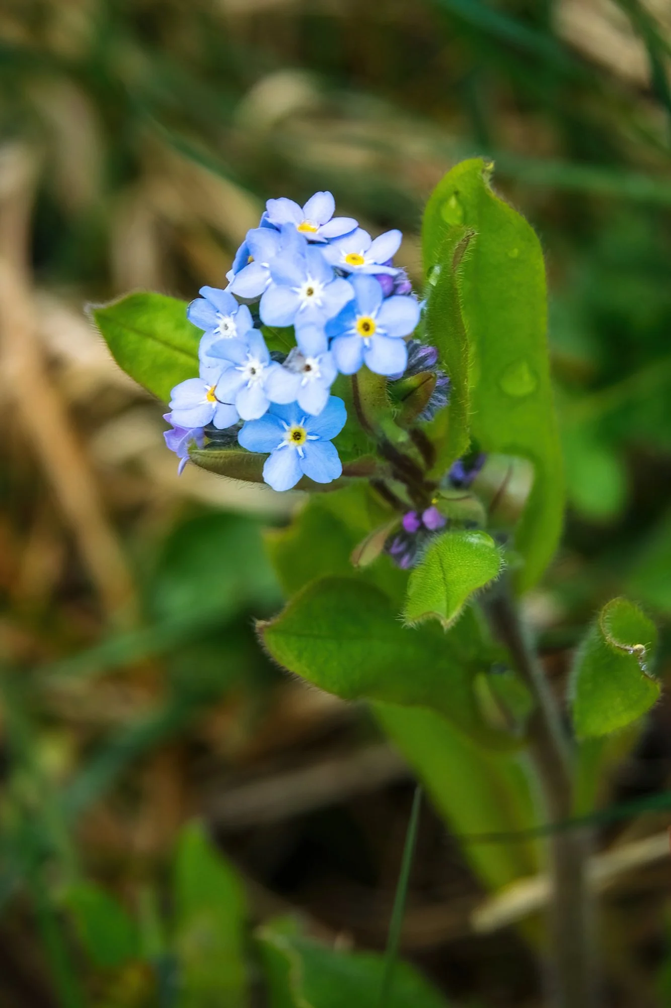
Heading back through Crossbost, I stop by The Weaving Shed to pick up additional gifts for my parents (who I conveniently forgot would be visiting Boston in the next two weeks - roughly timed for my dad’s birthday and for an early Mother’s Day celebration). The shop owner, who learned to weave as a child and produced all the arts and fabrics on display (as in, from raising the sheep to the final product) shows me around and lets me take a photo of her loom and her beautiful garden of native flowers. I purchase a tweed cap for my dad and a neck warmer for my mom. After a brief visit to the local church and cemetery, I return to the highway and head west now, across the moors.

It’s around noon now, and my goal is to cross the island and check-in punctually to my hotel room at 2 PM so that I can take a nap. After scouting a few locations in Achmore, I drive the Pentland Road between Achmore and Breasclete. It’s an impressively lonely stretch of road, but what would otherwise be a desolate and moody landscape is brightened by the sunniest day I have had thus far on the trip. To the south, the mountains of Pairc recede ever further away, across an interminable, treeless expanse of heather crisscrossed by streams, bogs, and lochs. I stop midway in a pullout to stretch my legs and eat lunch while leaning against my car. Although I am ever watchful for oncoming traffic, there is not another soul in sight this afternoon. In Breasclete, I park on the hillside and take a brief stroll through the residential street (photographing flower beds, derelict yards, and a very sociable, excitable border collie) before continuing onward a few miles to the Doune Braes Hotel, my home for two nights. At check-in the hotel proprietor sees my camera, and after asking my plans for the night, mentions that there is a chance of aurora in the forecast… Oh. Oh no. Oh boy.

Yes, it’s going to be one of those nights. Before we get there, a small digression on spontaneity. I have been told by some (read: everyone I’ve ever traveled with) that I am somewhat of an over-planner, at least when it comes to photography. That I should learn to let loose and go off-piste once in awhile. And yes, it’s true that the experience of a new location is quite different when you’ve Google street-viewed the whole place, compared to when you haven’t. For me, though, the magic of showing up with reams of marked GPS coordinates, weather apps, written notes, and additional readings (!) is that it lets me connect with my surroundings in a way that is a bit more meaningful than an average vacation. And that, when an opportunity arises or an unexpected situation develops, I have all the tools at my disposal to be as spontaneous and free-form as I want. This trip has already proven this in spades: instead of shooting single locations for sunrise and sunset (a necessity when shooting timelapse, which I am intentionally eschewing this trip in order to focus more wholly on still photography), I’ve been spending golden hour in multiple locations, quickly hopping from point to point in order to capitalize on the slower sunrises and sunsets in the north.

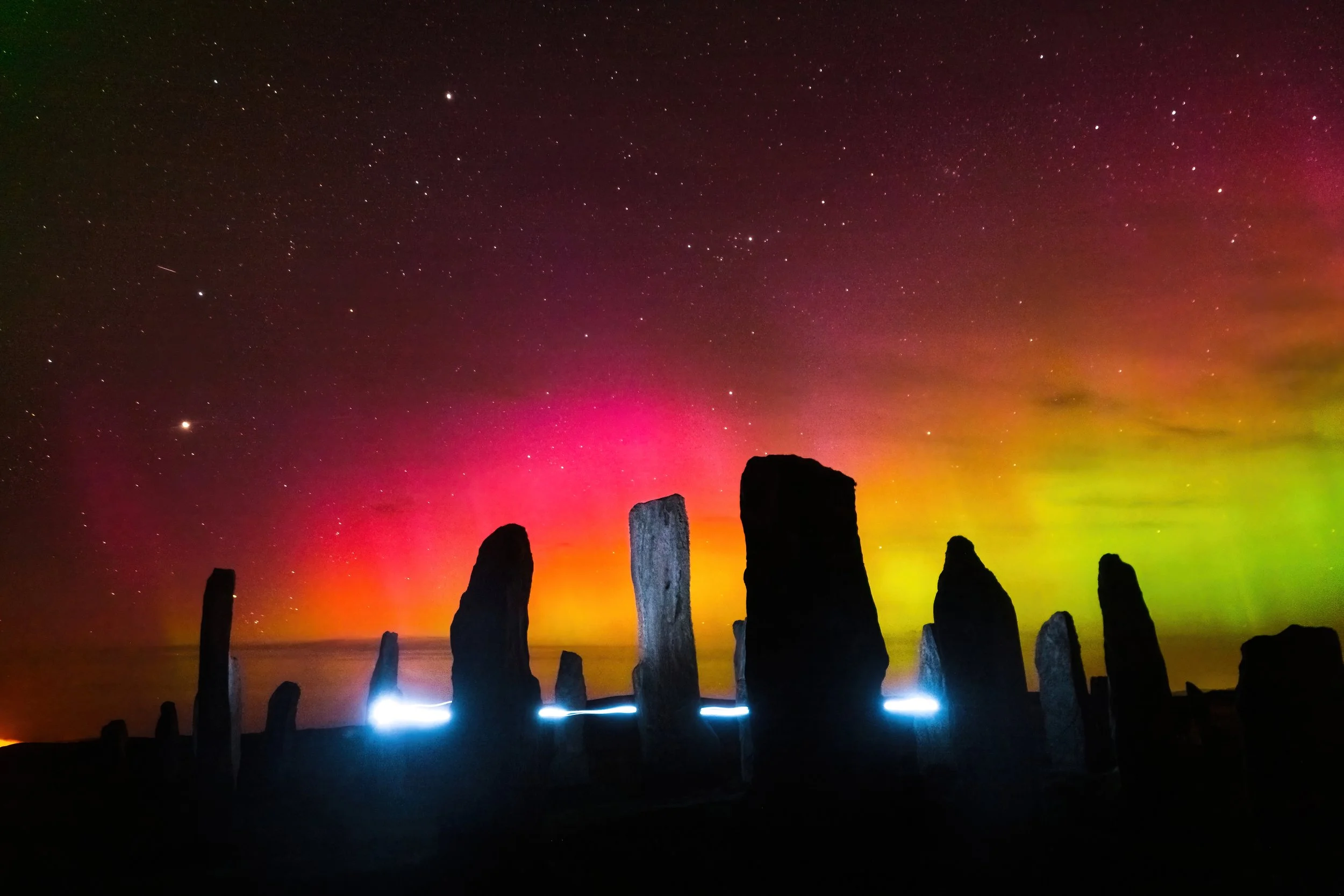
Which is why, when given a serendipitous heads-up about the aurora by the kindly hotel clerk, I immediately reconfigured my golden hour plans. I would use the evening and its clear skies (horrid for sunset, potentially great for astrophotography…) to scout out the world-famous Callanish Standing Stones, a few miles away. From my pre-planning, I knew that the main cluster of stones is laid out in a cross-like configuration on a hilltop - so it shouldn’t be hard to find a north-facing composition with an interesting foreground. After a brief break at the hotel, I head out to thoroughly explore the Callanish main circle, as well as nearby sites (Callanish II and III) that formed a wider sacred landscape for these Neolithic peoples as well as their Celtic successors. At the main site, I use my phone to take reference images so I have some idea of where to set up when it’s pitch dark and I can only see silhouettes. To the west, on the island of Great Bernera, there is some sort of peat fire burning, sending trails of hazy smoke across the water and several miles inland. Preparation complete (and local forecasts looking promising for both aurora and cloud cover), I finish the daylight hours off with another visit to the roadside bothy in Achmore (a few miles eastward on the highway), followed by a quick swing through the village of Tolsta Chaolais to photograph its charming houses at sunset. Here, as elsewhere throughout the Hebrides, landscape and history are remarkably entwined; everywhere, I have been seeing ruined houses - often blackhouse ruins (drystone walls dating back between 150 to several hundred years, formerly with thatched roofs and earthen floors) beside derelict whitehouses (subsequent, more “modern” two-story houses built with concrete and stone, often by cannibalized the abandoned blackhouse beside them). Tolsta Chaolais has a remarkable example of these ruins side-by-side; I take my time photographing the derelict house through the ruins of its adjoining blackhouse, carefully using the stone walls to the frame the shot with the colourful sunset behind. Afer this, I stop back at the Dounes Braes to eat dinner and shower, in anticipation of getting to bed quite late.

At 9:30 PM, with darkness having begun to set in earnest, I head back south to Callanish. At the standing stones, I am alone, and the experience of walking onto the ancient ritual ground, making my way toward jagged monoliths that suddenly appear out of the darkness in the ghastly light of my headlamp, is more than a bit eerie. To the west, Venus shines brightly above the horizon, glowing pale and ochre; below it, the peat fire on the nearby island is continuing to burn, the flames now glowing visibly red and orange in the night. In the last light of twilight, I take some west-facing compositions of the central monolith and burial chamber before shifting around the circle to look north.

After an hour of making subtle adjustments and nailing down focus (non-trivial in total darkness, even making use of headlamp and starlight), the the last light fades, the street lamps in the nearby village begin to flicker off, and I finally see it: the telltale colour in the sky. To the naked eye, it appears like bands of turquoise or teal discoloration in an otherwise black night; for a moment, I mistake it for the earlier smoke clouds from the peat fire, coming as they are from a similar direction. But the next camera exposure leaves no room for doubt: I am seeing my fourth lifetime aurora borealis, completely through serendipity and dumb luck, and in one of the most sacred and special places I could have possibly imagined. I spend the next few hours shooting the Standing Stones with the northern lights dancing in the skies above; I also run what must be over a hundred laps inside the stone circle, gradually mastering a fifteen-second route (and head motions) with my headlamp that allow me to adequately highlight the foreground, “paint” the main central monolith, and create an interesting light trail that circles the burial chamber like an floating spirit orb or will-o’-the-wisp. It does feel somewhat sacrilegious, maniacally sprinting circles around the stone circle, bobbing and weaving my head wildly - but then again, what could be more pagan than creating art while celebrating the night sky? I pause to wonder and imagine how Neolithic peoples may have used this ground - as a ceremonial site, as is widely hypothesized? As a space for gathering and community, much like the tourist families with their kids laughing and playing patty-cake earlier in the afternoon? Or as an enduring symbol of their love of their natural world and landscape - much as I’m doing? Part of me thinks: if their ghosts could see me frolicking around their sacred stones beneath a springtime aurora, perhaps they would wholeheartedly approve. Past midnight, I return to the hotel, happy to have just concluded one of the most exciting, technically challenging, and stupendously productive photography outings of my entire life.

Day 5: From Sea to Mount

“Dear Esther, I have found myself to be as featureless as this ocean, as shallow and unoccupied as this bay, a listless wreck without identification. My rocks are these bones and a careful fence to keep the precipice at bay. Shot through me caves, my forehead a mount, this aerial will transmit into me so. All over exposed, the nervous system, where Donnelly’s boots and yours and mine still trample. I will carry a torch for you; I will leave it at the foot of my headstone. You will need it for the tunnels that carry me under.”
- Dan Pinchbeck
Dear Esther

“‘Come on,’ she said, and led me down a narrow path through the heather to where the remains of an old ruined cottage looked out across the sands, and we picked our way through the stones to its grassy interior. She promptly sat herself down in the grass and patted a place beside her. I sat down, immediately aware of her warmth, the soft sighing of the sea, the vast firmament overhead, the sky black now and crusted with stars. I was breathless now as she turned those eyes on me, and I felt her fingertips on my face like tiny electric shocks.”
- Peter May
The Lewis Man

I wake up a couple of hours later feeling like I’ve been hit by a truck, run over, and then run over in reverse again. Nabbing sunrise and sunset several days in a row (and eating like I normally do on these trips - random shit at random times) have taken their toll. I’m somehow both swollen and dehydrated. I need some skin cream or something. My nail cuticles are profoundly suffering. I’m sleep-deprived and one entire side of my head hurts. I’m also happy as hell, this week already having shaped up to be a (the?) trip-of-a-lifetime in terms of memorable experiences, connection to and affinity with the landscape, and discovery and creation of fantastic images. Such is the photographer’s life. Despite ten years (albeit not continuously or obsessively) of planning and mental hype, the Outer Hebrides somehow have not disappointed.

The prior night’s astrophotography outing means that I show myself a little compassion and scuttle my original plans for sunrise, and make new plans to have a more relaxed morning exploring my immediate locale. I’ll leave the more extensive afternoon open to do a westward power-tour of Great Bernera and the Atlantic side of Lewis, encompassing the expansive sands, dramatic cliffs, and rugged mountains of the Uig district. I wake at the rather humane hour of 7 AM (sunrise looked to be a bust anyway - this I tell myself as I throw open my east-facing curtains to check the cloud cover, which moved in overnight). I head downstairs to enjoy a delicious full Scottish breakfast (bacon, eggs, sausage, scone, black pudding, and grilled tomatoes and mushrooms - together with toast, coffee, juice, and yogurt), my first proper hot meal in days. After relaxing and reading for a bit, I gear up and head out to walk the footpath from Carloway to the hamlet of Tolsta Chaolais (Gaelic, “farm by the strait”) which I quickly drove through as the sun was setting the day prior. The path I trod runs south from the front door of my hotel along Loch an Dùnain, over rolling moorland, and down into the valley where the village is nestled. Called the Scholar’s Path (one of many such-named trails here in the Hebrides), the just-under-a-mile grass path through the moors was built so that the village children could attend school, as legally required of all British subjects beginning in the 19th century. The schoolhouse closed in 1964, and was re-opened as my hotel (Doune Braes) in 1966.

My plan for the morning, to give myself a break from the driver’s seat, is to thoroughly explore Tolsta Chaolais by foot, as I know there are several crofts and scenic views that will be fun to photograph, and being a pied will allow me to take my time, savor the overcast but comfortable weather, and really immerse myself in the countryside. In any case, after several days of it, I’ve gotten sick of diving into lay-bys, throwing the parking break on, and either quickly snapping a roadside shot without stopping the engine, or turning the car off only to be berated by La Pasionaria’s over-tuned and frankly annoying-as-hell safety features the next time I start the engine. The entire trip, I never figure out how to save new default settings, so each time I start the Kia (upwards of twenty times a day), I have to manually turn off its aggressive lane correction, speed warnings (seriously, I shit you not, an audible alarm each second you are driving one mile-per-hour over any speed limit), and an extremely loud and startling “Consider taking a break!” alarm (with coffee icon) that aurally assaults you every fifteen minutes you drive over thirty minutes. I presume this last item is a safety feature, ironic given how effective it is at nearly causing me to swerve off the road and die throughout the week.

Anyways, it is lovely to spend some extended time walking. The grass path, a little boggy beside the loch, quickly evens out into a lovely walk through heatherlands and rolling hills. I stop to photograph the vegetation, so unique to this ecosystem - mosses and lichens, and early flower buds on the heather. The path descends onto a residential road at the village’s north end, and I walk all the streets to their dead ends, photographing the local fauna (all the ewes paired with their spring lambs, and a showy rooster with his pair of hens in a front yard). In the distance, I can see the peat fire on Great Bernera still smouldering. I take a picture of a perfectly cozy little house with daffodils blooming in its garden - to show Jane. Further south, the road descends to a crossroads beside Loch a’ Bhaile, a pretty little lake with a tiny pine-covered islet in its middle. Here, beside a bench memorializing a Royal Navyman killed in the HMY Iolaire disaster near Stornoway Harbour in 1919 (and the nearby colorful decorative rocks), I take a panorama of the village beside its lake. There are waterfowl (ring-necked ducks and pink-footed geese) floating on the water. I turn now down the road on the loch’s west side, a pretty line of houses. The sheep are grazing in the outfields, and I see a pair of sheep-dogs at work corralling down. Further along, I make friends with a floppy-eared English Spaniel who, bored with his owner’s yardwork, saunters down the road with me and lets me give her belly rubs. I stop at the ruined blackhouse and whitehouse (insert Gaelic and explanation) to photograph them in morning light, before proceeding down to the little white house by Loch Ròg, which was the setting of Katie Morag’s house (a famous children’s book character here in Scotland, turned into a TV program by the BBC). Outside the house, I see a funny scene play out when three lambs approach an old ewe, apparently wanting a drink of convenience amidst their breakfast grazing. The ewe butts away two of them; the interlopers scurry off up the hillside to find their respective, appropriate mothers. No communal suckling - a civilized rule for a civilized society. Next, I explore behind the Morag house, where a grass path continues along the slope above the loch. After poking around the shore and up a hillside overlooking the village, I make the long but breezy walk out of the valley and back to the hotel - a total of just over six miles covered on foot this morning.

After a shower and nap, I head back out in the afternoon. What was formerly going to be my morning’s itinerary is going to be compressed into the hours between mid-afternoon and sunset; I’m going to skip the long hike up the summit of Mealisbhal (Lewis’ highest mountain), which I feel quite at peace with. I make the drive westward from Callanish, first turning off a side road to cross the bridge to Great Bernera. At the island’s northern tip, I visit the beach at Bosta, which affords marvelous views out to sea and to the rocky islets of Floday, Bearasay, and Old Hill. I photograph the cemetery here and take a walk around the hills overlooking the beach to visit a restored Iron Age house, part of an archeological settlement that was unearthed from beneath the shifting sands during a severe storm in 1993.

Back on the road, I drive past another group of standing stones (Callanish VIII) at the northern end of the Bernera road bridge, marveling at the extent and ingenuity of these ancient people in their ritual landscape. The westward highway winds through a region of streams, hills, and lochs, turning into a single track as it curves around the shore of Loch Ròg’s southernmost arm. I follow the road past Miavaig and out to the coast, with the mountain crags of the Uig district looming ever larger to my west. In Uig, I first detour down the dramatic glen that runs to the head of Loch Suianebhal, taking photos of the mountain corrie at the loch’s far end, the nearby fishing bothy, and the braiding flow of the nearby stream as it winds toward the Uig sands and the far-off radar tower, looming dramatically over the region from a peak to the north. I continue out west and south past the dramatic sea cliffs at Mangersta, to the foot of Mealisbhal, where the road finally terminates at Mealasta (“the UK’s longest and most scenic cul-de-sac,” one guidebook joked). Although I don’t have time to hike in this area (there being only two hours now until sunset), on my return route, I stop in pullouts to photograph the beautiful sea cliffs and crashing waves; the distant islands of St. Kilda, which hover like mirages on the western horizon on this fine clear day, and the dramatic forms of Mealisbhal and the mountains to my east, made all the more stark by the dark clouds brooding above them. I am glad to have decided not to even attempt a summit. In exchange for a night of aurora, it seems like more than a fine trade.

Back down the cliffs now, to the expansive shimmering beach known as the Uig Sands. This marvelous place, like Seilebost in Harris from the second day of my trip, boasts a massive tidal inlet. I’ve come near low tide, so the entire expansive is uncovered from the caravan camp at Ardroil all the way across to the settlement of Timsgarry. Deciding not to chance a crossing on foot (indeed, the tide is rising and the ocean will have stranded me before the end of sunset), I step out onto the sands briefly before driving the car around to the Baile na Cille church, on a high hillside overlooking the area. Here, I walk down to the nearby guesthouse and cross a gate onto a footpath that circles the house, to a ruined old cemetery overlooking the beach. Although I thought the Luskentyre cemetery had a view “to die for,” this spot exceeds it,. Between the expansive sands, the tidal braids, and the ring of mountains encircling Uig to the south and west, all tinted by the faintest light of a cloudy sunset, this may just be the most beautiful final resting place anywhere in the world. After taking panoramas and portrait photos of the weathered old tombstones, I reluctantly trudge my way back uphill to my parked car at the church, looking behind me all the while to watch the developing light and swelling tide on the beach below.

My final stop of the evening is just a few minutes away: the radar mast that has been beckoning me from the mountaintop ever since I arrived in this region. I drive through an unlocked gate (shutting it behind me) and proceed steeply up to the tower at the summit. Climbing the concrete steps that lead up to the tower (and around to the back of the installation, where I find the summit cairn), I gaze out at the coast of Lewis. The summit affords perfect, 360-degree views: the rugged, island-clad shores to the north, the loch-studded moors of Bernera and the main island to the east, the mountain walls and shadowy glens to the south, and out to the Atlantic (and St. Kilda, clearly silhouetted now by the falling sun) to the west. It feels like a terrifically wild and windswept and lonely place - a climax of sorts for this adventurous week, and for all the planning and yearning that went into it. After taking a few landscape shots and panoramas (the sunset light, to be honest, is quite subdued thanks to the marine layer of clouds), I take some selfies at the summit, to commemorate my visit. Then it’s a long drive, in fading light, back to the hotel. At the hotel, I find myself locked out of the front door (an honest mistake - they thought all the guests had returned for the evening). After calling the proprietor, I sit in the back seat and have a bite of bread and fruit (surprisingly, the first I’ve eaten since that enormous breakfast) before being let back in through the old schoolhouse’s back door, kitchen, and dining room. Then, eventually, off to sleep.

Day 6: Sea Room

“The sea’s a bit wild out there in the wind, breaking white all around those rock stacks. I can even feel a hint of spray on my face. Light, like the touch of a feather. Wind’s blown all the clouds away now. There were days out on the moor I’d have killed for a piece of blue sky like that.”
- Peter May
The Blackhouse

Another relaxed morning, another gigantic full Scottish breakfast to start the day. Today, I’ll be driving up the west coast of Lewis, mostly sightseeing rather than doing any serious exploration of photography. It feels like the trip has reached a denouement of sorts. I bid farewell to the friendly proprietors at the Doune Braes hotel and head up the road. My first stop is in Carloway to visit the ruins of an Iron Age broch (fortified tower-dwelling). Jane and I visited two brochs during our 2015 trip - one in Glenelg, and one in Skye - but this is the first one I’ve been able to climb up to the second floor using a set of restored stone steps. Before leaving, I visit the small nearby visitor center which has dioramas depicting life in the ancient times. Next, I stop in Carloway to photograph the village and its church, followed by a visit to Na Gearannan’s traditional blackhouse village. The village’s thatched huts appear much as they did in centuries past, and were lived in until the 1970s. Nowadays, several of them have modernized interiors and are mostly rented by holiday-goers seeking an idyllic escape by the oceanside. I climb up onto the sea cliffs behind the village, gaining an impressive view from above of the nearby beach and cove.

Throughout the morning, I continue making my way up the west coast, stopping at various beaches and doing small portions of Lewis’ coastal walk, a long waymarked trail that connects many of the townships and beaches that dot the island’s coastline. At Dail Mor and Dail Beag beaches, I shoot the waves crashing upon impressive basaltic cliffs. I see another photographer with full long-exposure setup (tripod and ND filter) shooting the outgoing tide as it washes away from the rocks at Dail Beag, but frankly I am too tired (and it is mid-day) to be doing any serious photography. Mostly I stroll about with my shades, windbreaker, and camera in hand, enjoying the good weather and shooting whatever I see.

In the afternoon, some brief roadside stops at points of interest in the coastal villages: the ruined Norse mill at Shawbost (its thatched roof looking quite worse for the wear after storms in the past year), a massive whale jawbone in Bragar (erected into the front gate of a roadside house), historic houses and ruins in Arnol, and a small shieling (summertime bothy used by crofting families when moving their herds between seasonal grazing grounds) in Brue. The shieling, especially, I love. It is much cozier on the inside than I expected; on the wall is posted a list of Gaelic sayings, and outside, a place map highlighting the Gaelic names for features across the landscape within a few square miles - it seems that every stream, loch, hill, crag, and rock has a name and special significance. Here in the Outer Hebrides, modernization has come quickly in recent decades. But amidst the cars, roads, and conveniences of globalized life (flights and ferries on Sundays - although most businesses still observe the Sabbath), the traditional ways still have a strong place in island life. By the roadside, I still see many crofters tending to their sheep, working the land, and cutting peat for fuel in neat banks.

After refueling the car and buying some petrol-station lunch (sandwiches and an ice cream bar), I eat in one of the ubiquitous church parking lots - for every village, no matter how closely spaced they may seem in the age of asphalt highways, has a church - usually spare, simple, and unadorned, in line with the strong Protestant culture here on Lewis. Then, it’s further up the island to the community of Galson, where I check into my little croft for the last two nights of the trip. It’s a cute little retreat, just up the road from the local beach and cemetery, and I share a wall with the sheep in the farmhouse stable. There are occasional bleats and baa’s throughout my nap in the afternoon, but my new wooly friends are surprisingly quiet at night.

For my evening outing, I retrace my route back to Shawbost, where I plan to hike out to the coast to photograph Stac a’ Phris, a massive sea arch not unlike Drangarnir in the Faroes. It’s taken me a lot of research and map study to work out how to walk out to the arch, from the road, without hitting too much bog, but I think I have a good route that lets me connect up with the Lewis coastal walk fairly quickly. After following the green-tipped waymakers for less than a mile, I see the unmistakable slanted top of the arch, and cut down to the cliff’s edge for a closer look. Making my way down carefully on the rocks (slippery with lichen and guano), I set up my tripod and play around for the next two hours with a variety of compositions and shutter speeds. Ultimately, I decide to use exposure blending to control the high dynamic range of the scene (shooting almost directly into the sun) and combine features from multiple images (fast shutter speeds for wave action, soaring birds, and skies; slow shutter speeds for rock detail and a smoother ocean surface). As the sun sinks into the marine layer, I pack up and head back across the peat, stopping to take some final images of the incoming weather, and a nearby sheep. Before dark, I make it back to the outfields of Shawbost, and the warm incandescent streetlights of the island villages are just flickering on as I return to Galson for a well-deserved rest.